4 Days in Yosemite National Park | USA
Towering mountains of stone, tumbling waterfalls dancing with rainbows, endless crystal lakes and giant, ancient sequoia trees. Yosemite might just be a little slice of paradise! One of the earliest National Parks in the USA, thanks in part to Scotsman John Muir who loved the place dearly, Yosemite is nestled in the mountains of northeast California. I journeyed here from Las Vegas, on the second half of a small group tour. The first half was spent in Utah, and I explained in my first post what exactly small group travel entails, especially on a camping trip. We swapped leader and a few passengers in Vegas, before continuing our journey west, to spend 4 days in Yosemite National Park.
The Journey from Vegas
Area 51
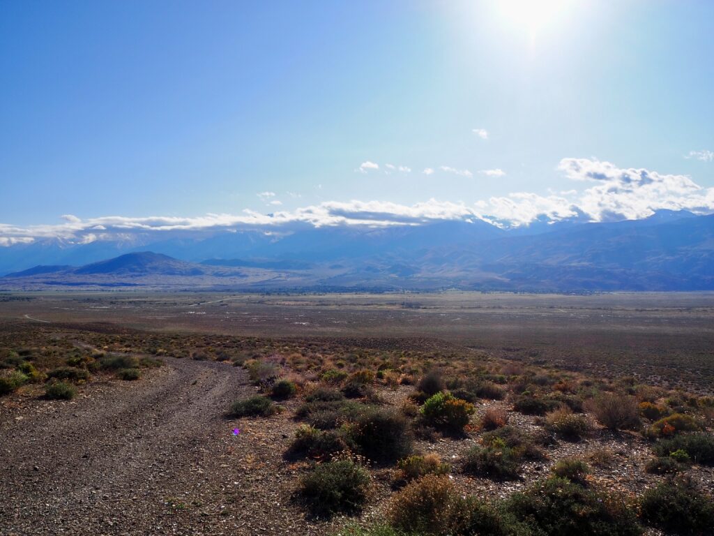
After wrapping up our journey through Utah, and a couple of nights back in Las Vegas, we departed in our trusty van through the morning traffic once more. Vegas to Yosemite is too far to journey in one day, so we were stopping to camp overnight in Bishop, Nevada, before crossing into California. And in true USA road trip style, we made a few unusual sightseeing stops along the way!
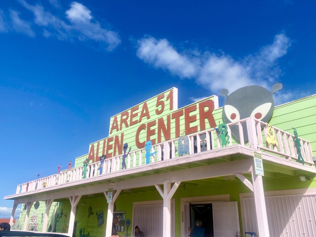
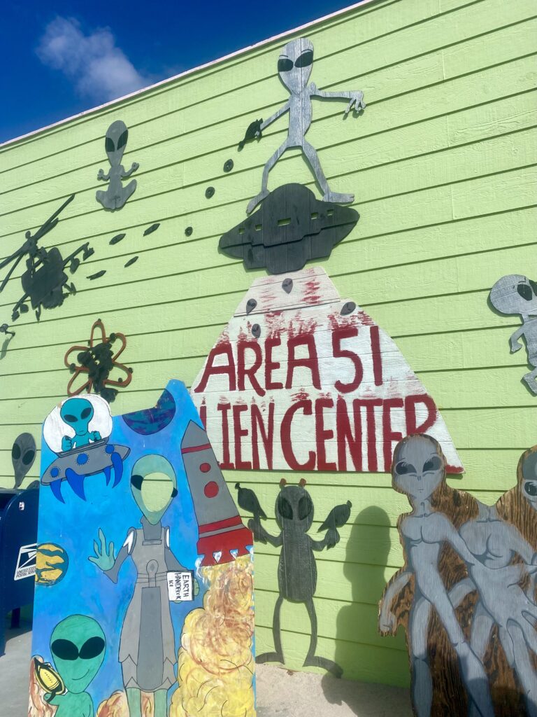
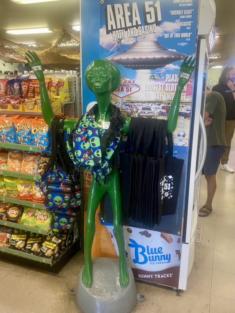
The vast, empty deserts of Nevada are the perfect place to hide your secret air force base. And the Area 51 base has long been rumoured to house aliens, or at least, alien artefacts brought from Roswell, New Mexico. The truth of what happens inside Area 51 is top secret, so who knows if they’re researching aliens or not, but the lore persists. Obviously, a van of tourists can’t stop by for a visit. But there are plenty of roadside attractions nearby, and we stopped at a small gift shop brimming with alien souvenirs. Whether you believe conspiracy theories or not is up to you, but it’s a pretty funny and quirky little place to check out on the way past!
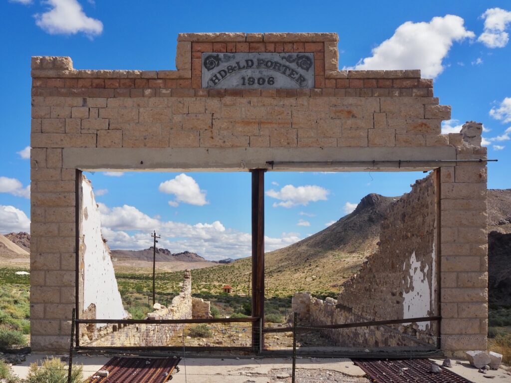
Rhyolite Ghost Town
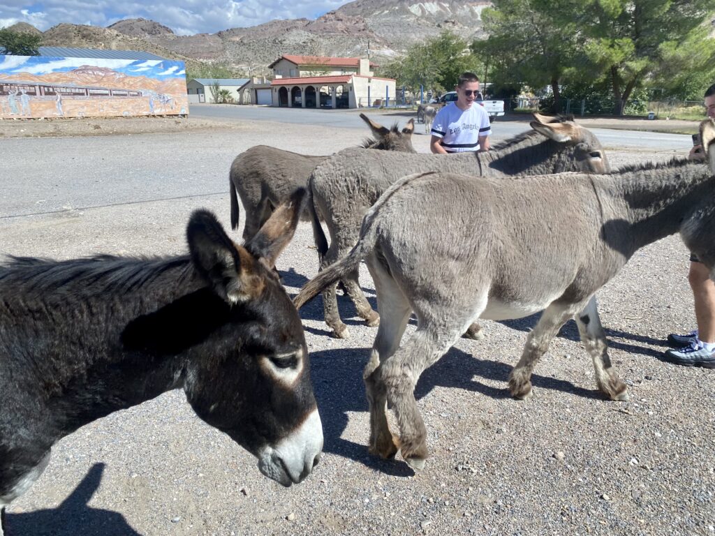
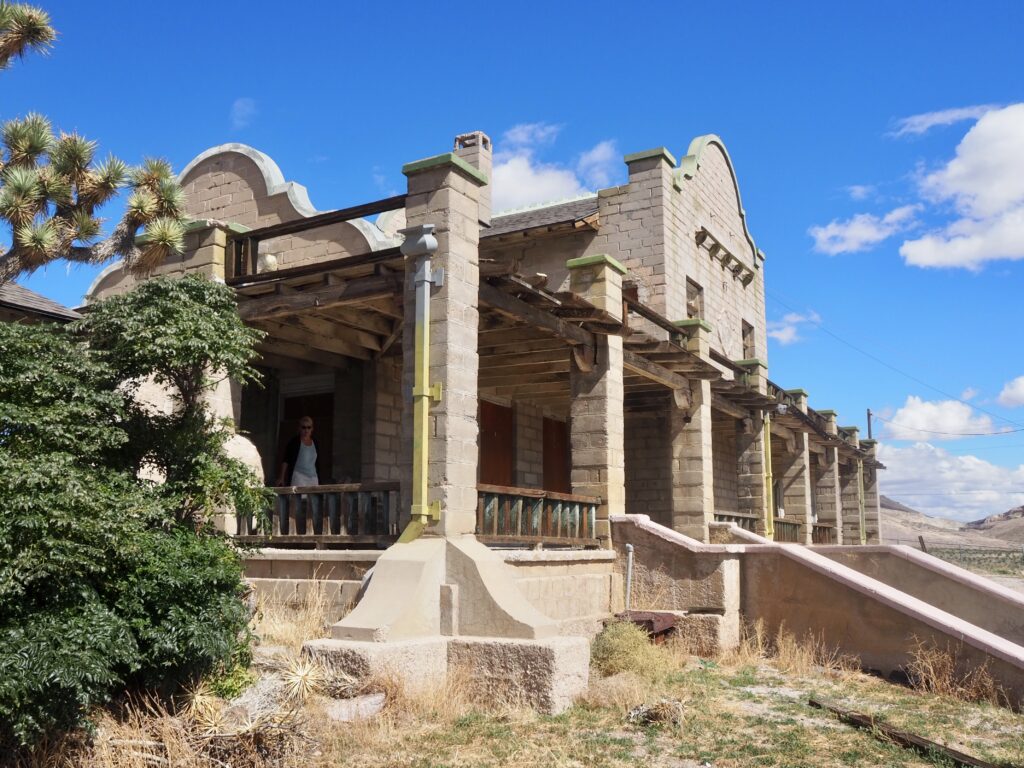
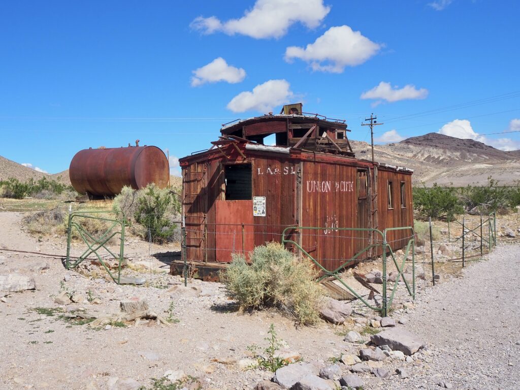
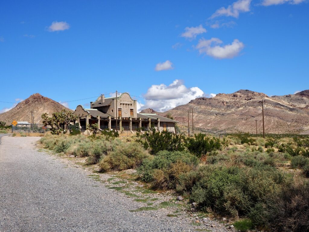
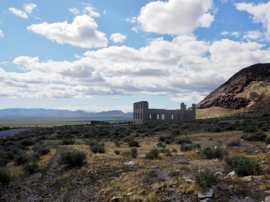
After a quick lunch stop and to see the donkeys in Beatty, Nevada, we continued on to Rhyolite. Lurking on the edge of Death Valley – the hottest recorded place on earth, which we got some views of but didn’t actually visit – it’s hard to believe people tried to live in this remote, desert town. It sprung up in the early 1900s as a new mining town during the gold rush, complete with a railway line. The population swelled to around 5,000 but then declined just as rapidly once the ore was exhausted. By 1920, the people had abandoned the town entirely!
The ruins are now protected as a historic site for visitors to explore. Of course, you can’t go inside most of them for safety, but you can roam the streets of the little town. We gazed at the crumbling buildings, walking circles around them and reading the information boards about the town history. Ghost towns are something I’ve only ever known from American movies, so seeing an abandoned Western frontier-style town was a little surreal.
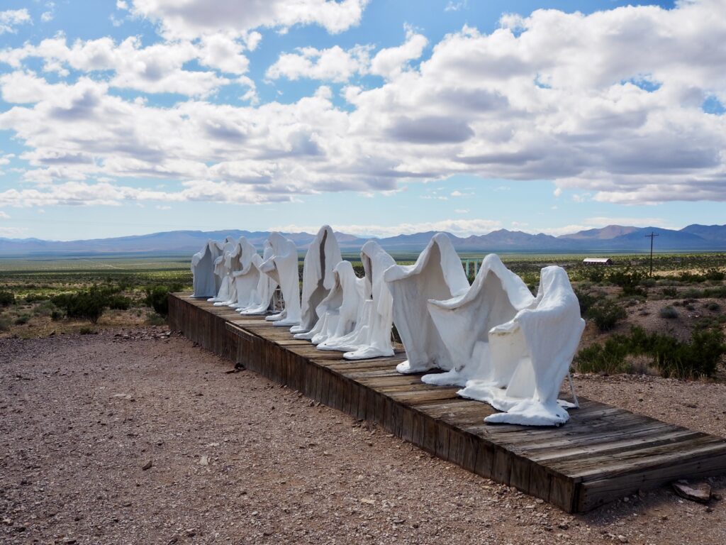
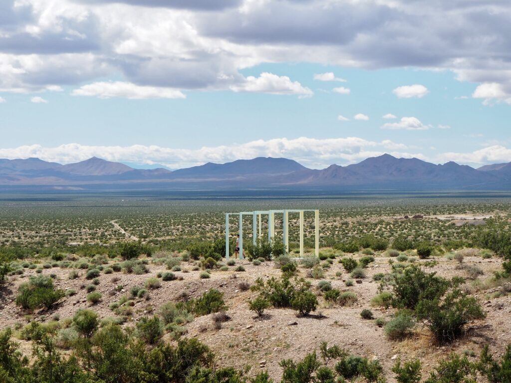
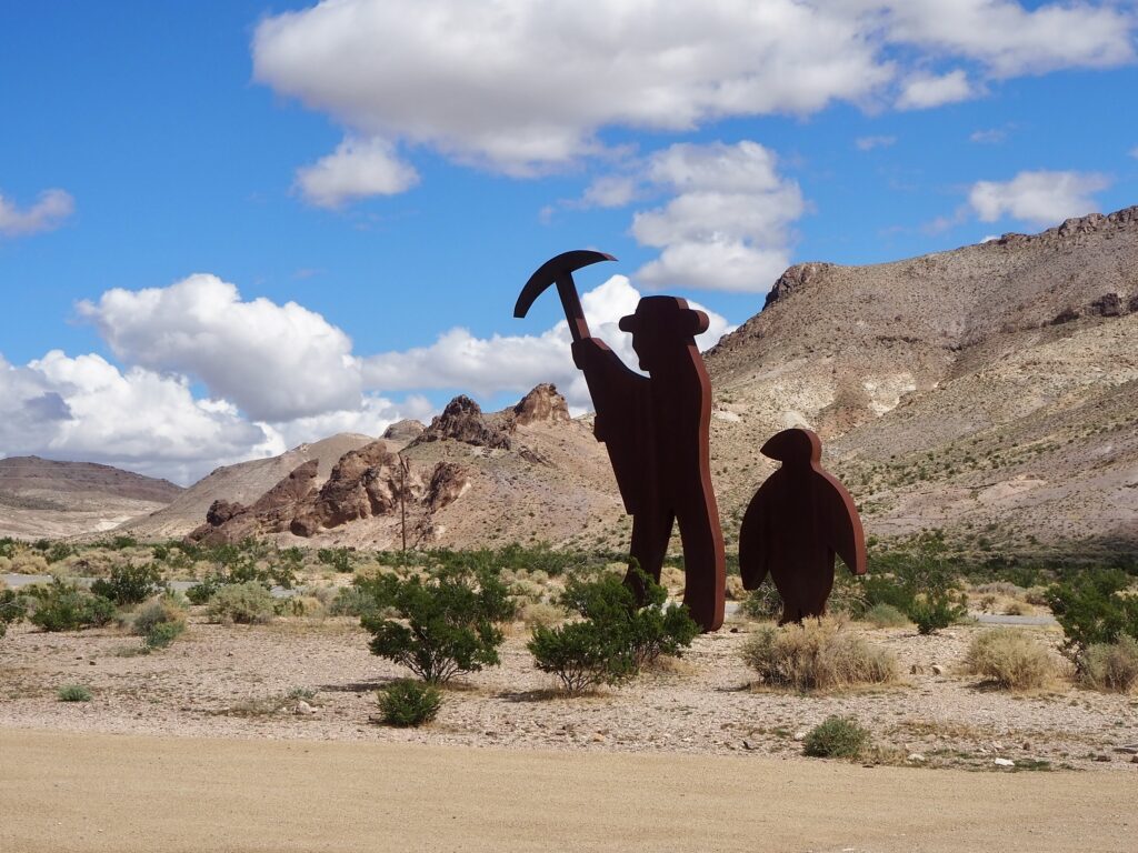
We also visited Goldwell, an open-air art museum just down the hill. Several sculptures decorate the hilltop, with a sweeping vista of Death Valley as their backdrop. They’re pretty weird, wonderful and eclectic in style, which makes for a rather odd roadside attraction in such a remote location. The spectral figures are pretty eerie in particular, and you can climb inside their cloaks which made for a very unique group photo!
Keough Hot Springs & Bishop
We arrived in Bishop, our stopover for the night, in the late afternoon. It’s a fairly small town, but a convenient halfway point from Vegas to Yosemite. After setting up camp and going on a grocery run, we tucked into dinner together. Then, for those who wanted to, we headed out for a late-night dip in Keough hot springs. Now, this isn’t like the hot springs in Banff, built into a chlorinated swimming pool (though the Keough Hot Springs Resort has those, if you prefer). No, we went to the all-natural option. You literally drive up a dirt track and get into a stream!
The site is untouched, save for a couple of small signs, and I don’t know how you’d tell it was here if you’d never been before. Stripping to our swimwear, we hopped in the warm water and sat on the silt riverbed underneath the stars. The full moon had been just a few days prior, so it was still big and bright, meaning we could manage without head torches while in the stream at least. It perhaps wasn’t the most scenic or memorable hot springs I’ve been to (Guatemala holds that title still), but it was a unique way to spend an evening!
We couldn’t relax entirely though… There’s a super fun parasite in the water which is harmless for the most part, unless you get water in your nose or ears. Then, if it gets inside you through these channels, it can burrow into your brain and cause permanent damage! Not concerning at all. So no splashing or dunking under the water here… Luckily, we all survived intact. The worst part was getting out the water and dressed again, because the Nevada desert is freezing cold at night in early October!
Day One
Mono Lake
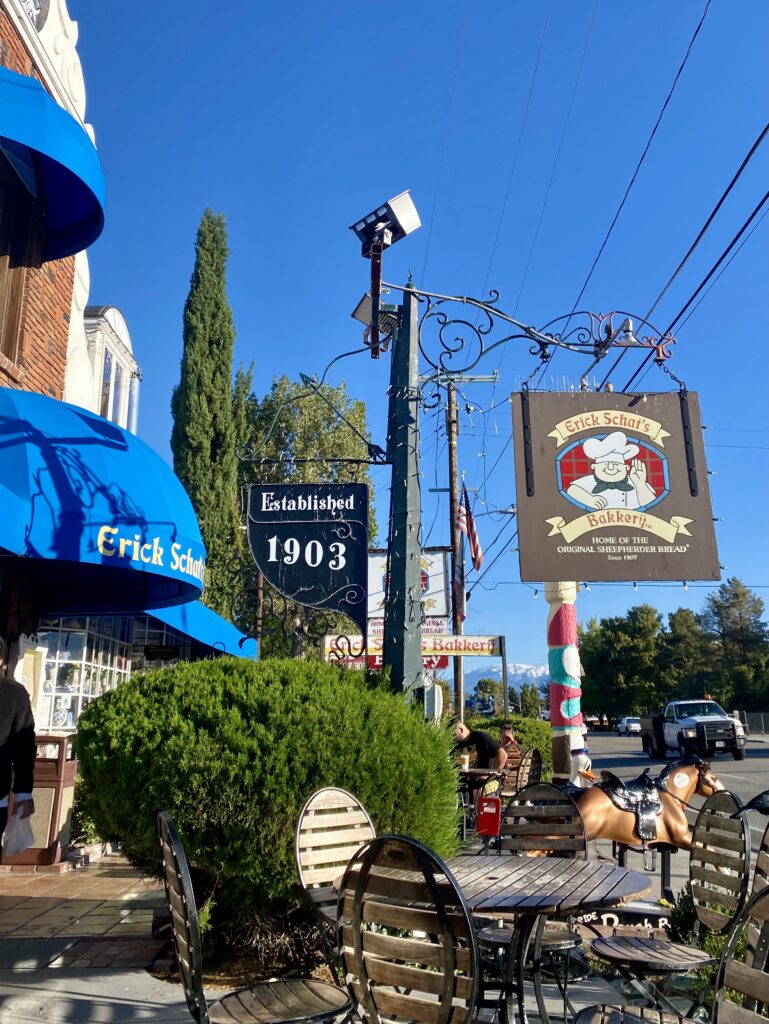
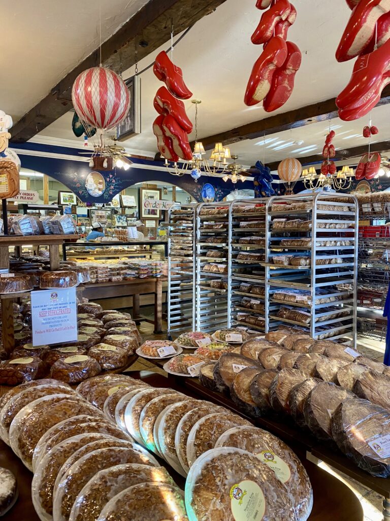
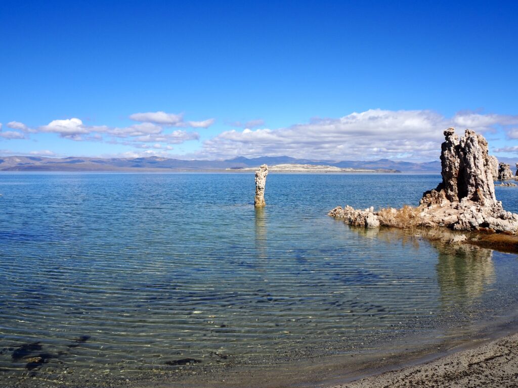
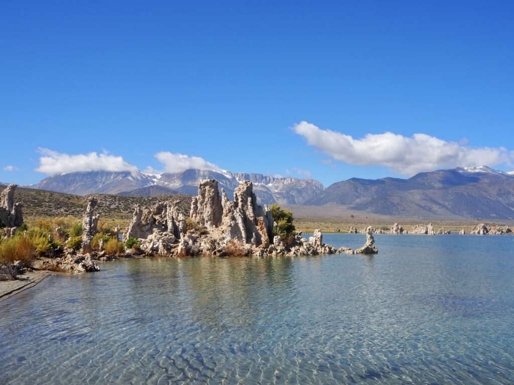
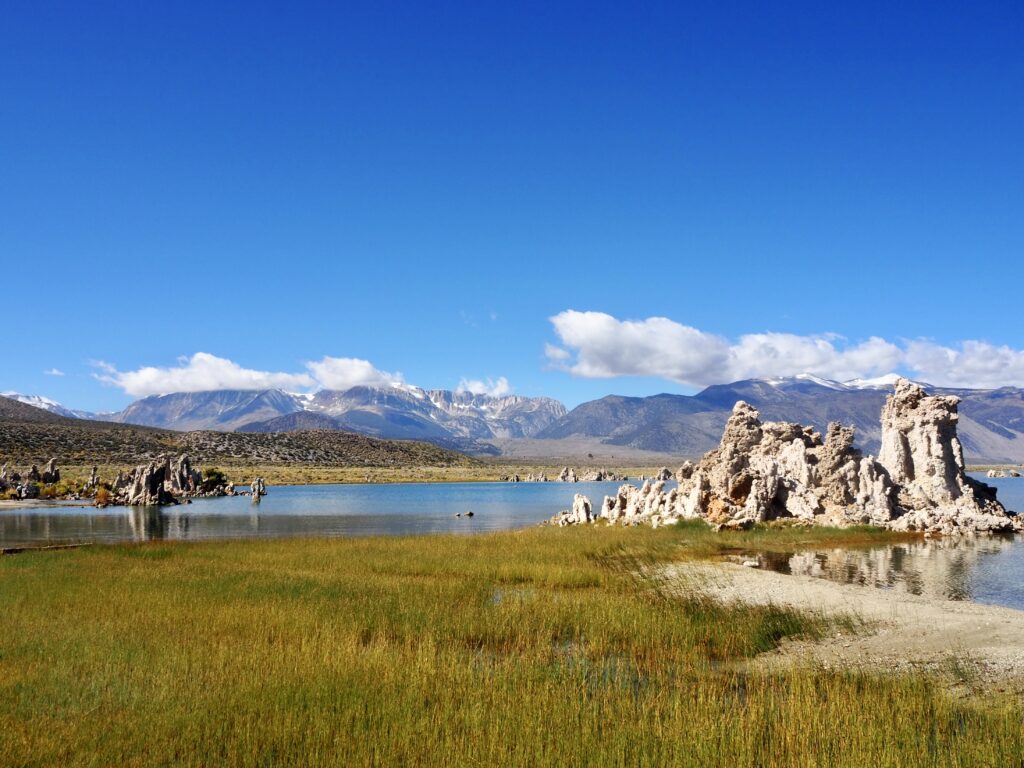
The next morning, we stopped in Bishop again for breakfast at the Dutch bakery, which has more baked goods than you could imagine for such a small place! Sugar and caffeine are a great start to the morning. After a couple more hours driving west, our 4 days in Yosemite began with one more stop outside the park boundaries at Mono Lake.
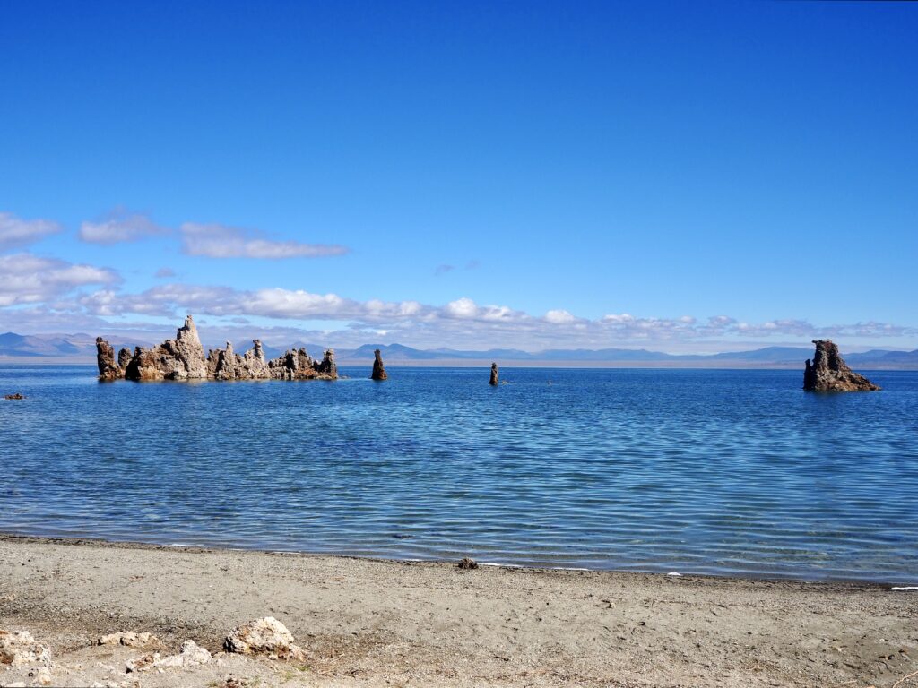
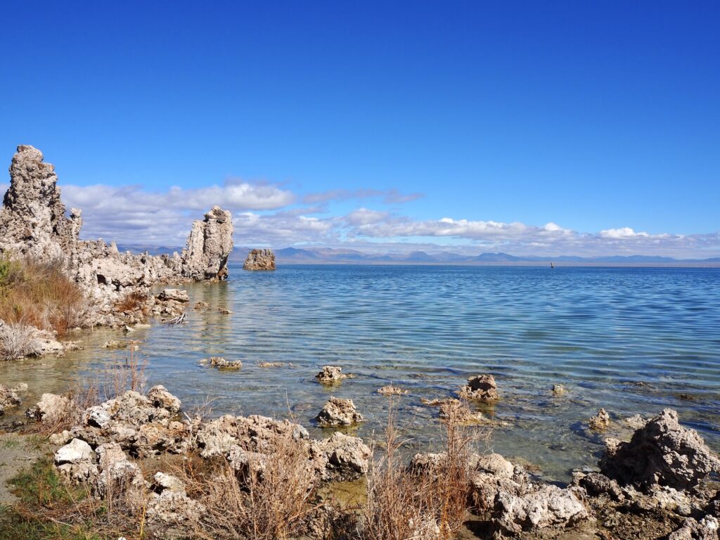
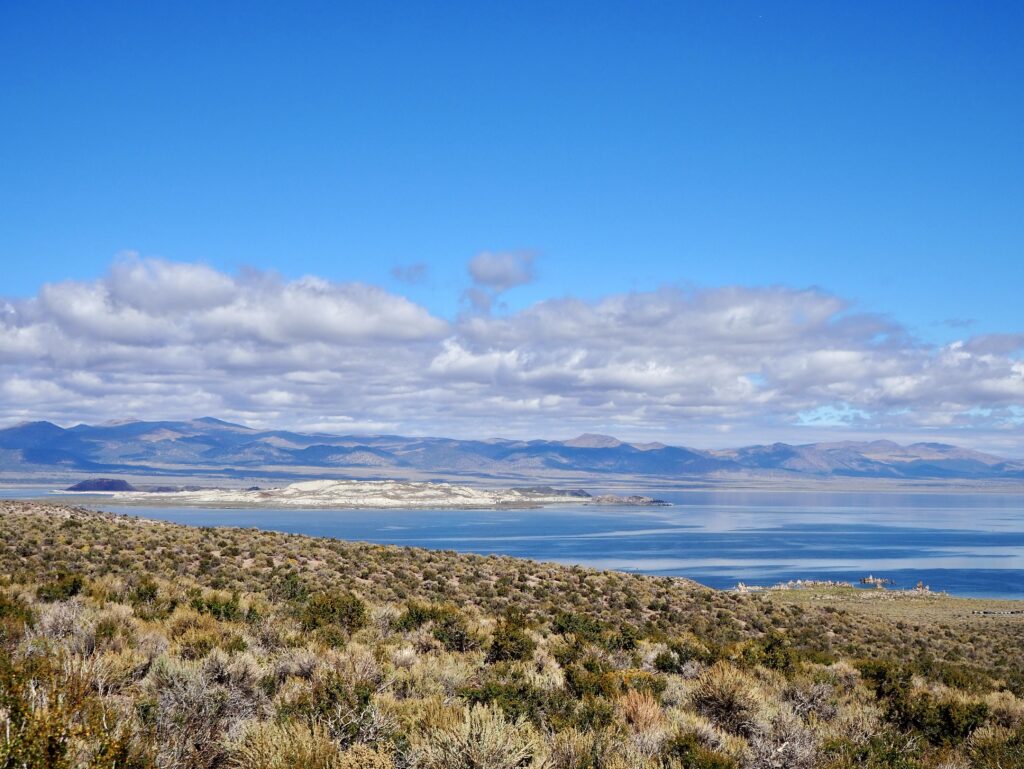
The mountains steadily rose around us as we crossed into California, a reminder that this state isn’t just beaches and coastline! Although as we rose in altitude, we dropped in temperature, cool outside ven in the sun since it was October. And then the mountains dropped away to reveal Mono Lake’s basin, shining bright blue under the sun. It’s actually a salt water lake, which makes for a unique ecosystem. We took a stroll along the shores, dotted with information signs. The water was also dotted with tufas – unique geological formations, limestone towers that grow from the lake’s floor. The are a result of calcium freshwater springs seeping up into the carbonate-rich lake water and creating a chemical reaction. Usually they remain underwater, but Mono Lake’s water level dropped due to water diversions. The tufa are now slowly eroding above the surface.
After our lakeside stroll, we headed to a nearby overlook with a small shop to have our picnic lunch outside. Then it was on the road again, climbing the mountains higher and higher as we approached the park entrance.
Tioga Pass & Lake
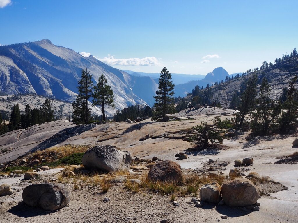
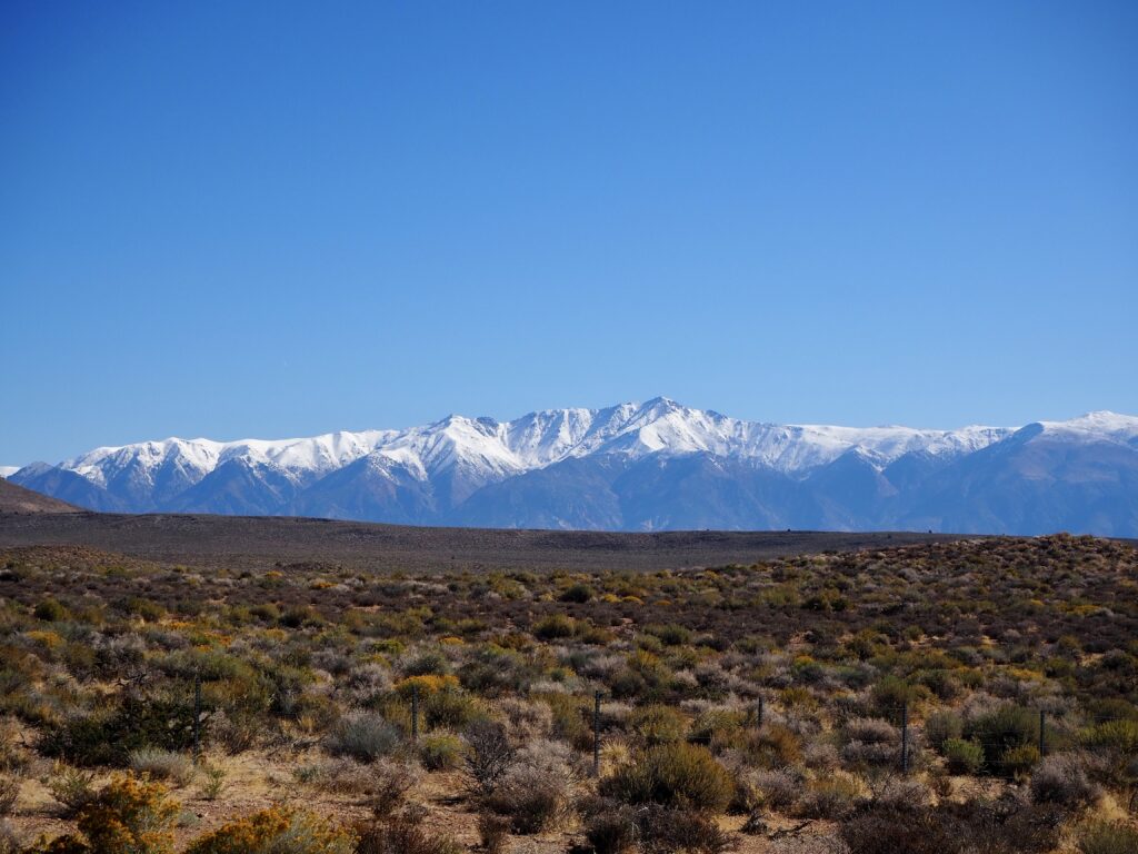
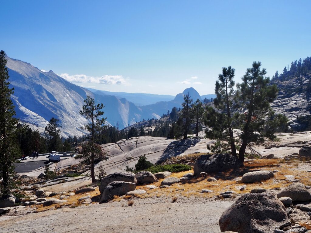
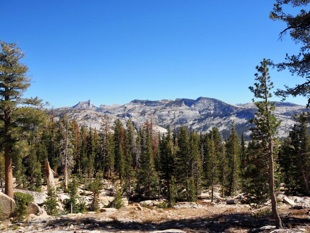
We were lucky that it hadn’t yet snowed enough in Yosemite to close our route into the park, since it was the tail-end of the season. It takes a long time to clear it every April after winter, too! Tioga Pass is the highest highway pass in California, clocking in at over 3,000m in elevation. My ears could certainly tell! We stopped at a viewpoint shortly before the park entrance, to look down at the rock-strewn mountain sides dropping away beneath our feet, sprinkled with evergreen trees. While it was impressive enough, it was a mere taster of what was to come.
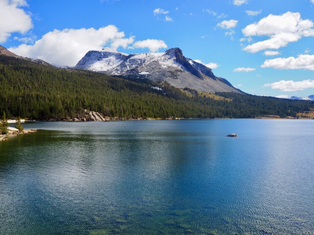
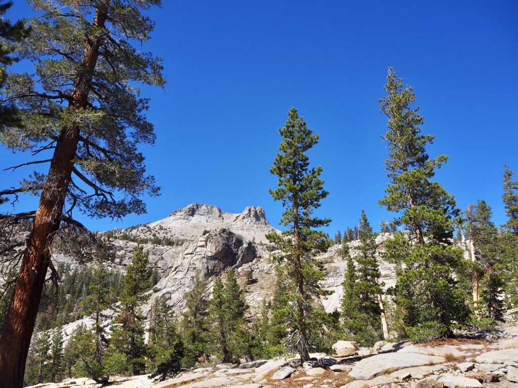
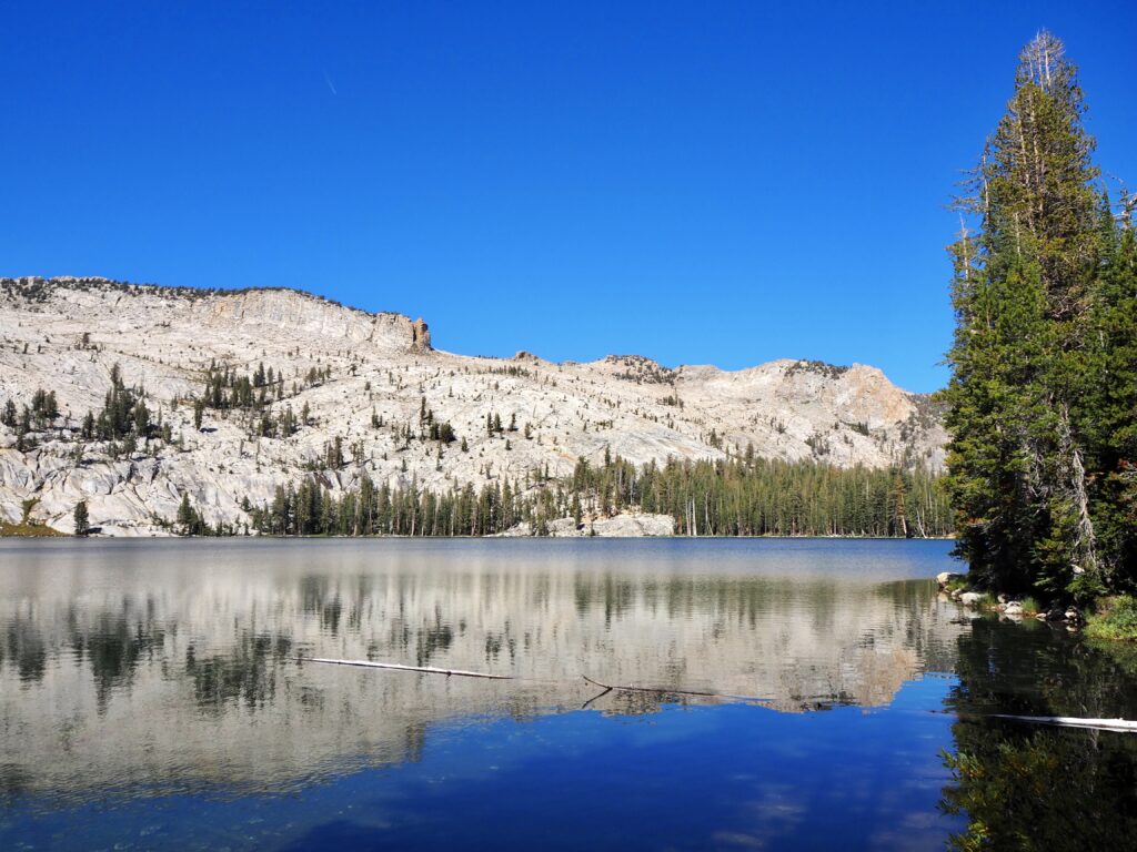
Entering the park gates, we soon arrived at Tioga Lake, the first of dozens of sparkling, turquoise lakes around Yosemite, fed by glaciers. This is the nice thing about entering Yosemite from the east, was we had the afternoon to drive all the way across the park, stopping at a few places on this quieter road (not in the valley) along the way. We’d be heading west when we left the park, so it was great to see it from end to end! We pulled over next to Tioga Lake and embarked on a short hike up the rocks behind us to enjoy the view looking out to the lake. More mountains were visible in the distance. It was all a bit of a departure from the red rocks and flat desert-scapes of Utah, being surrounded by so much green and blue and grey again!
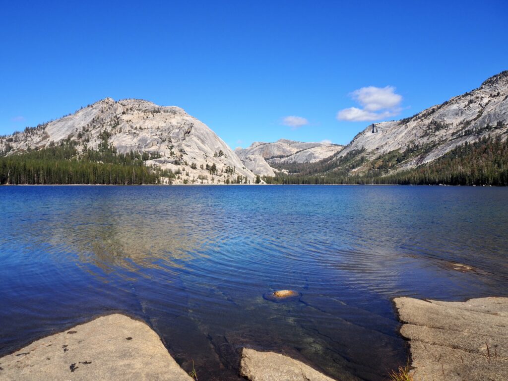
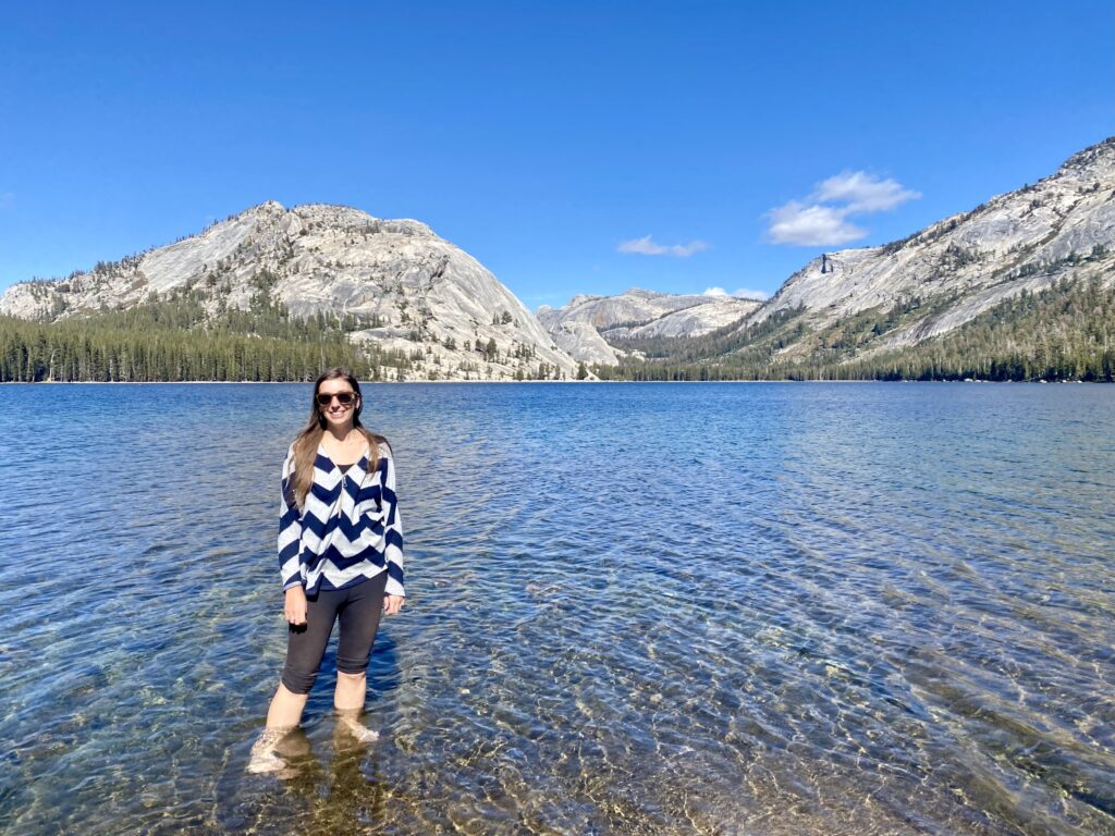
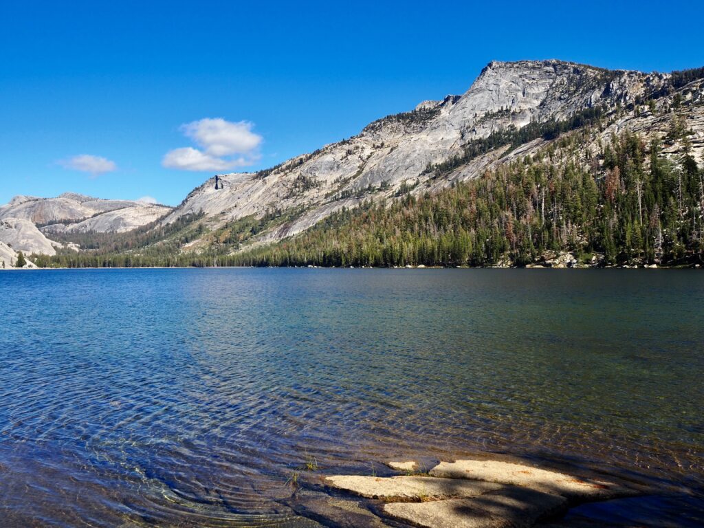
Tenaya Lake
We stopped at a second lake, Tenaya, a little further along the road. It was a short walk from the roadside, but nothing I’d class as a hike this time. We walked out onto a rock face sloping into the water to take in the views. Crystal clear blue water, surrounded by lush forest and mountains towering on all sides. The water looked too inviting, so several of us stripped off our socks and shoes for a paddle. Between the sunshine and the blue lake, it looks very summery! But this is a glacial lake, remember? That water was pretty cold! Though it then became somewhat of a game of who could stay in the longest. After numerous glacial lake paddles back in Banff, I didn’t find it too bad!
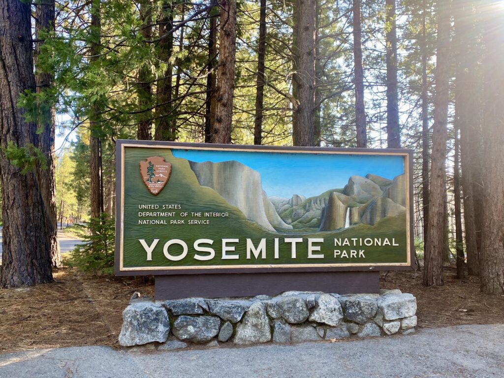
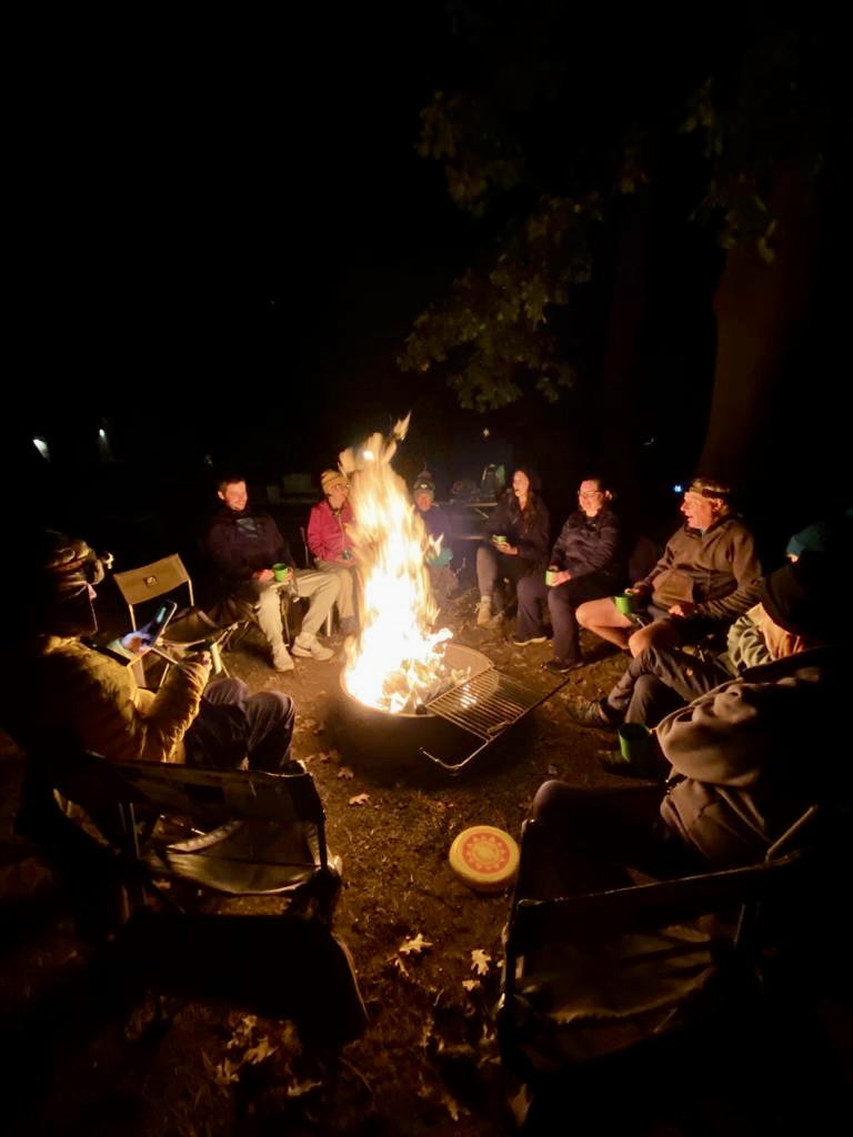
Our drive continued west across the park, with one more quick stop for a group photo at the Yosemite sign. Then we headed out the west entrance to our campsite for the next 3 nights. It was nice to know we didn’t have to pitch the tents and tear them down again every couple of days now! We prepared dinner, gathered around our campfire for a few hours, before slowly retiring for the night.

Day Two
Mirror Lake Trail
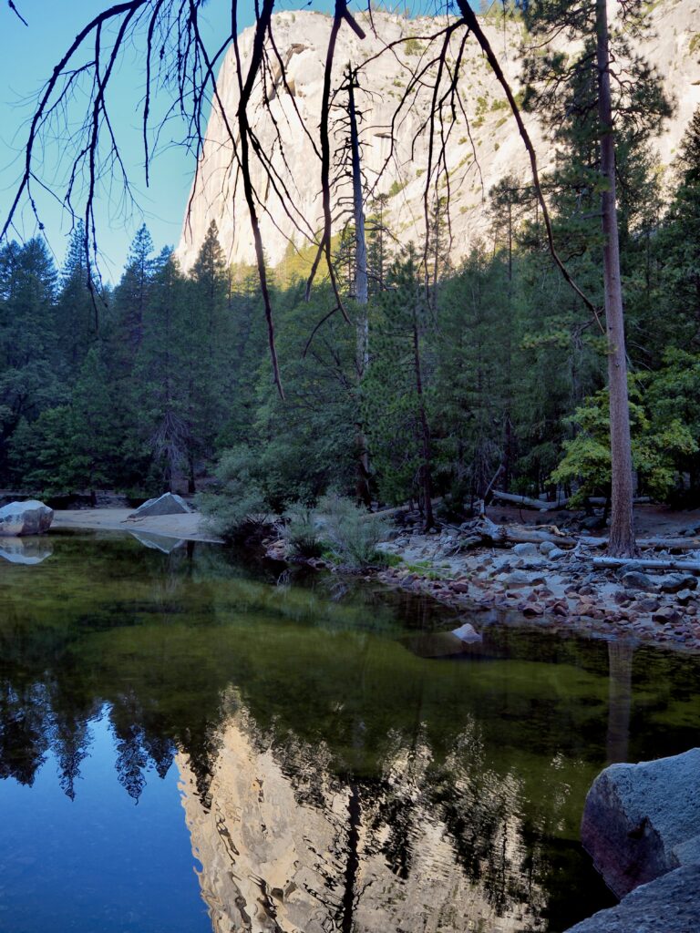
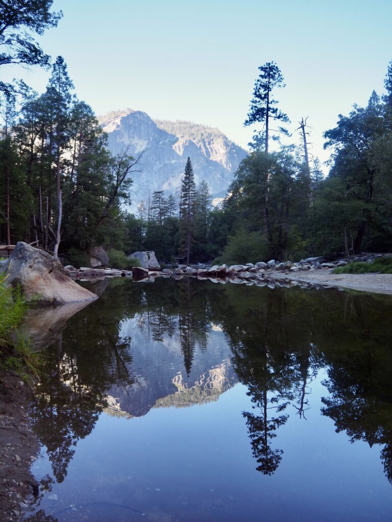
Our second day in the park was focussed on Yosemite Valley, which is the most popular area for visitors. A free shuttle bus loops through the valley, which gave our group the flexibility to do our own things. Some people opted for big, full day hikes, but I was keen to explore a few different locations. Our leader dropped us all off at Curry Village, which was also our meeting point at the end of the day. A few of us decided to start with the Mirror Lake Trail, a low-lying loop that only takes an hour or so. It’s best done in the morning when the water is still!
Now, an important note for the rest of this Yosemite post – the water levels were low. This is inevitable at this time of year. The waterfalls are at their peak in spring, when the glaciers start to melt and release all the water again. All glacial-fed lakes are the same, their levels higher in spring and summer. As it was October and despite still being sunny and green and not too cold, the glaciers are starting to freeze on-high, pulling away water from the lakes and falls.
The trail to Mirror Lake was a fairly easy walk through the forest, stepping over the odd rock or tree root, and following the green river water alongside. When we arrived at the lake, it was indeed looking pretty shallow. Fortunately, the mirror effect still worked though, and we could admire the mountains and trees reflected on its surface. It was still early enough in the day that the sun was low too, as strong, sharp shadows would have made it harder to see the reflections! It was a relaxed, easy walk and a gentle start to the day.
Yosemite Falls
Back at Curry Village, most of the people I’d hiked with opted for a bigger hike to take up the rest of their day, heading to Nevada Falls. Instead, my plan was to jump on the shuttle bus for a quick tour of some of the park’s most iconic locations before joining the shorter version of their hike. I caught the bus to Yosemite Village, wandering past the shop to pick up my customary magnet and the visitor centre. I’d hoped to visit the museum but it was closed.
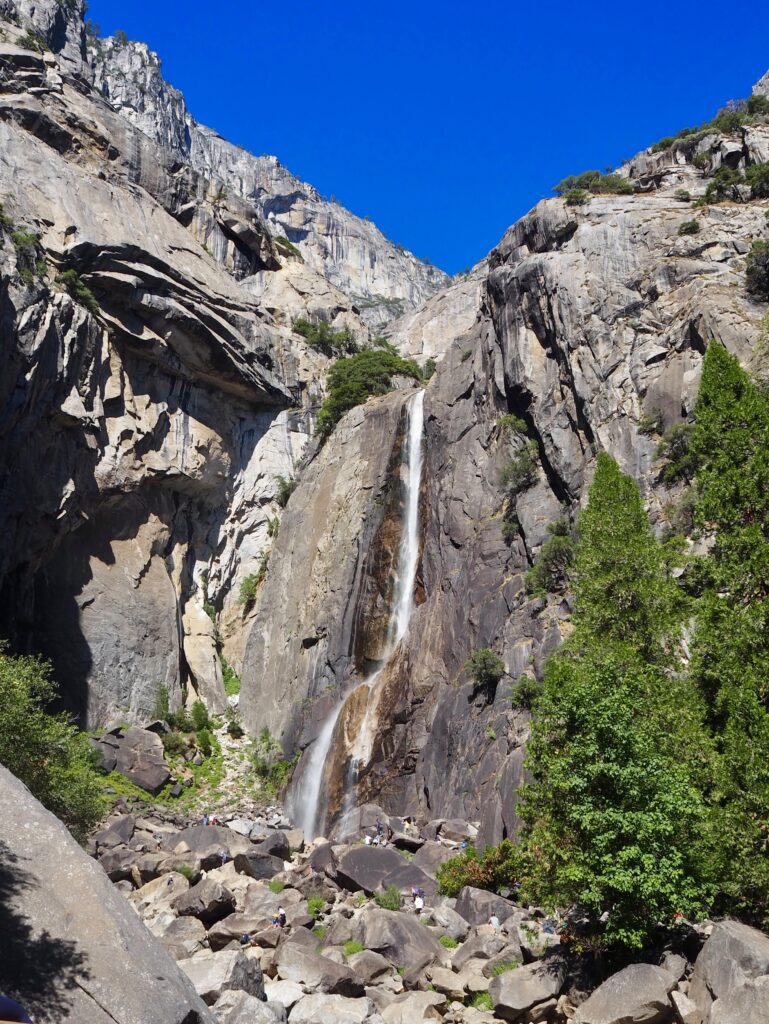
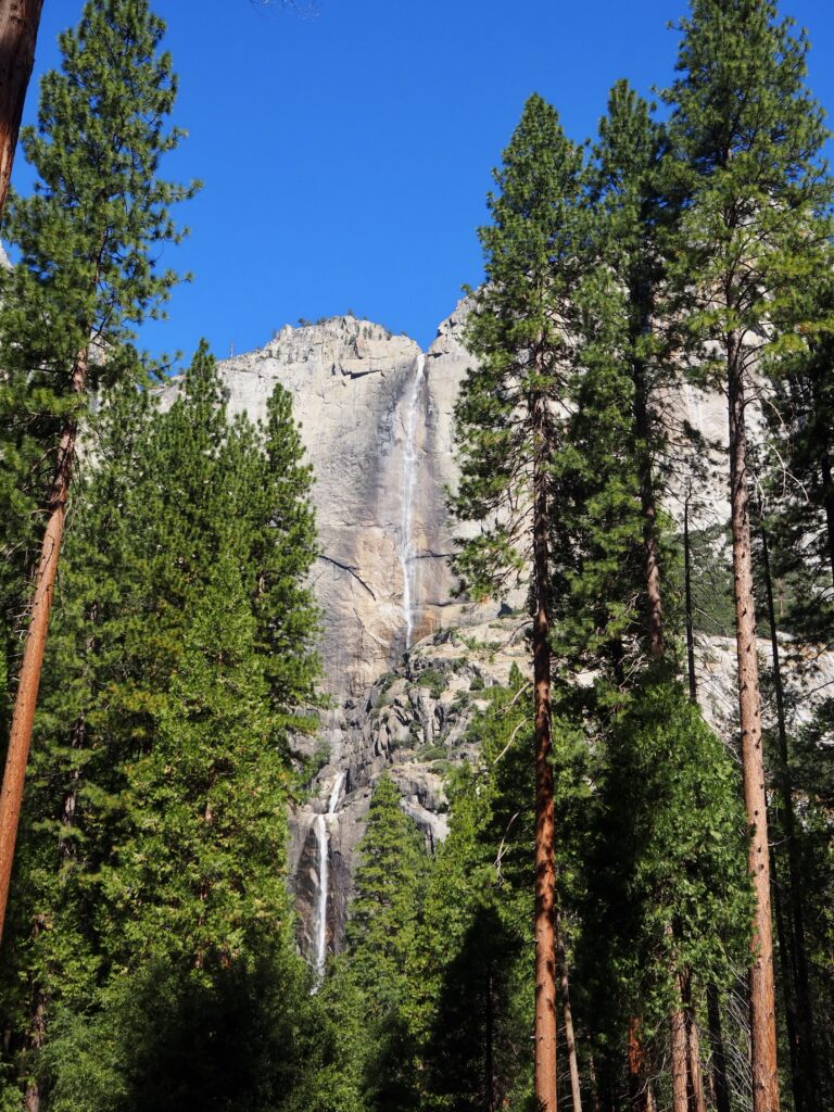
So, I carried on, following the road to Yosemite Falls. You can hike to the top of the Upper Falls, but that takes a few hours. The Lower Falls trail makes a small loop just off the road, taking you to the base of the falls and then back to the bus stop. You can see both falls from below here, so it’s a pretty impressive view! It’s all pretty level and takes about half an hour to complete. As mentioned, the waterfalls didn’t have a huge flow of water but there was still plenty tumbling down. And the sheer height of the Upper Falls plays a big part in the “wow” factor. The sun was out more fully now too, and walking under the shade of leafy green trees just made for a very pleasant stroll. I was quickly starting to see why this park is so beloved!
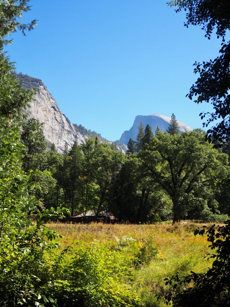
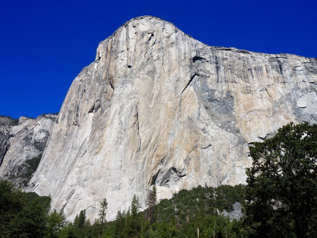
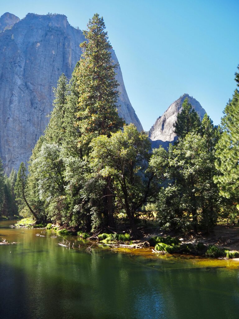
El Capitan
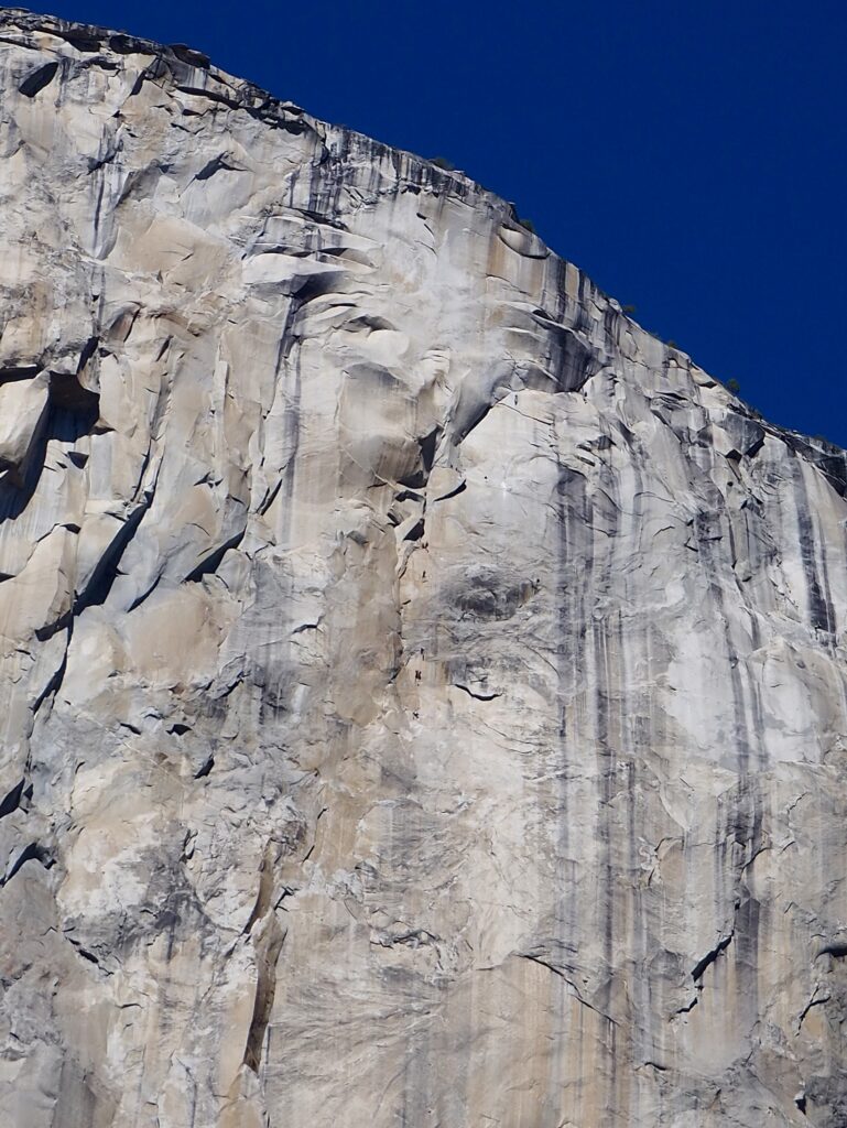
Hopping back on the bus, I zoomed to the other end of the valley to eat my picnic lunch beneath El Capitan. We had seen it that morning on our way into the valley, in the early mist, but I wanted another look. While I’m far too scared of heights for rock climbing, my best friend loves it and she’s the reason I know about El Cap (no, I haven’t watched Free Solo but I know about it!). El Cap is a really popular rock face to ascend, but it takes several days to do so. Meaning people literally camp on the rock face overnight!
It’s a hugely impressive mountain, towering over the valley with this sheer, flat face on the front. A majestic sight on its own, even without spotting the climbers! Sitting in the meadow beneath it while I ate, I trained my eyes on it carefully to look for them. Binoculars would have been handy! It didn’t take me long to find 3 or 4 groups at various stages of their ascents. Seeing just how tiny they are puts it all into perspective! Definitely not something I would ever attempt, but it was incredible to just watch them for a little while.
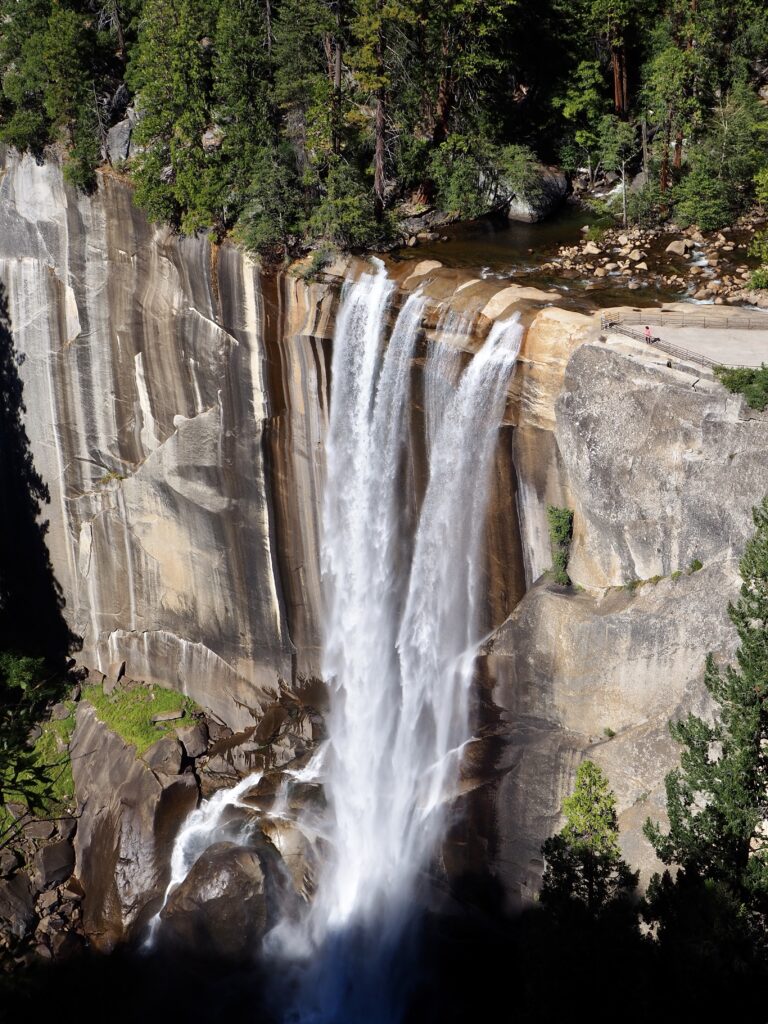
Vernal Falls Trail
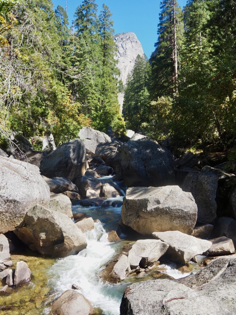
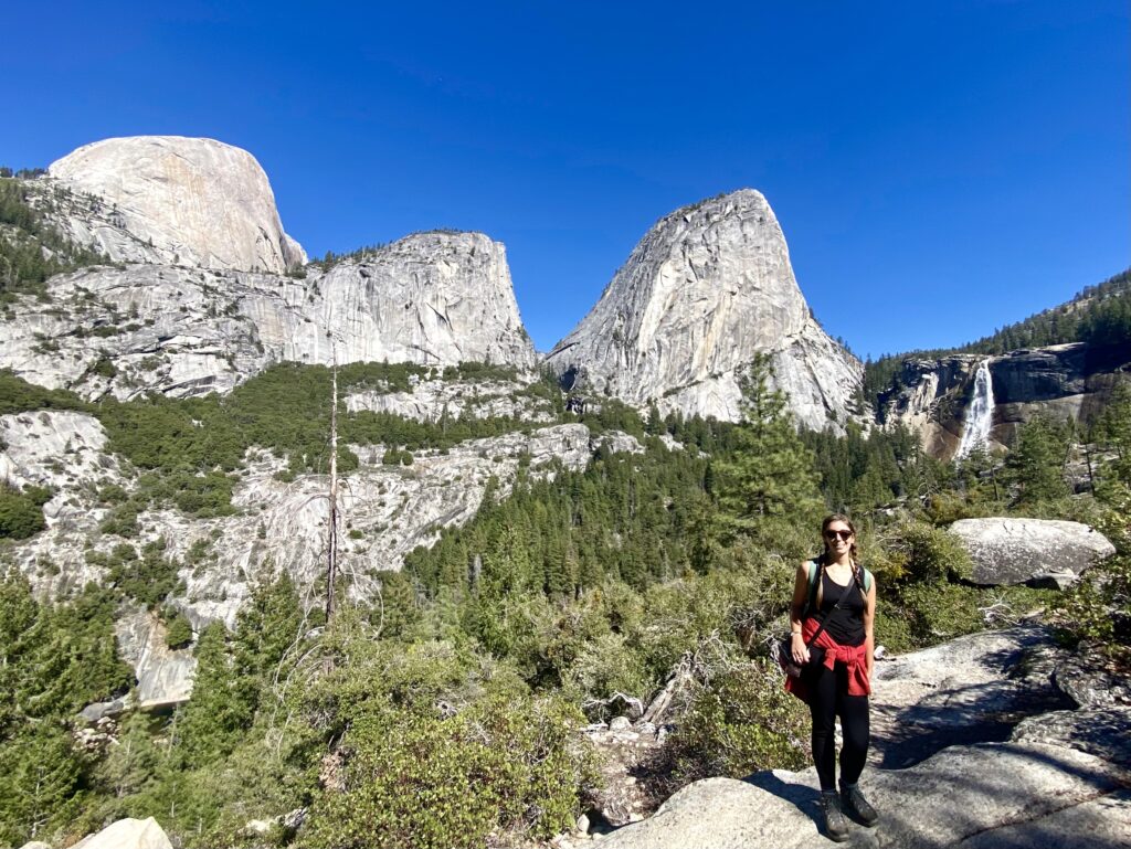
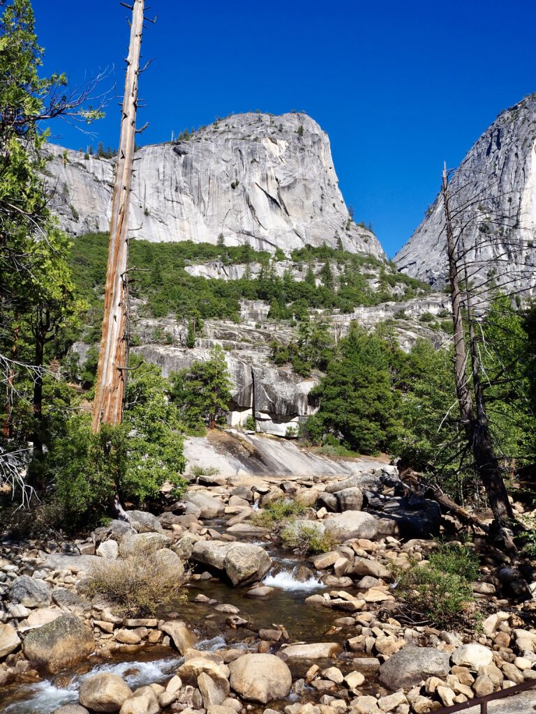
The shuttle bus whisked me back to Curry Village to set out on my afternoon hike. The Vernal Falls trail follows the same start and end as Nevada Falls, going up the John Muir Trail and down the Mist Trail. I just cut across at Clark Point to half the loop instead, and it only took me a couple of hours. The first part of the hike was an easy amble through the forest, crossing the river by a small bridge. Once the ascent began though, it was another story The John Muir Trail is a series of steep switchbacks, climbing up the rocky mountainside. There was some relief in it being all under tree cover, keeping me cool from the sun. A few breaks in the trees offered views into the steep valley.
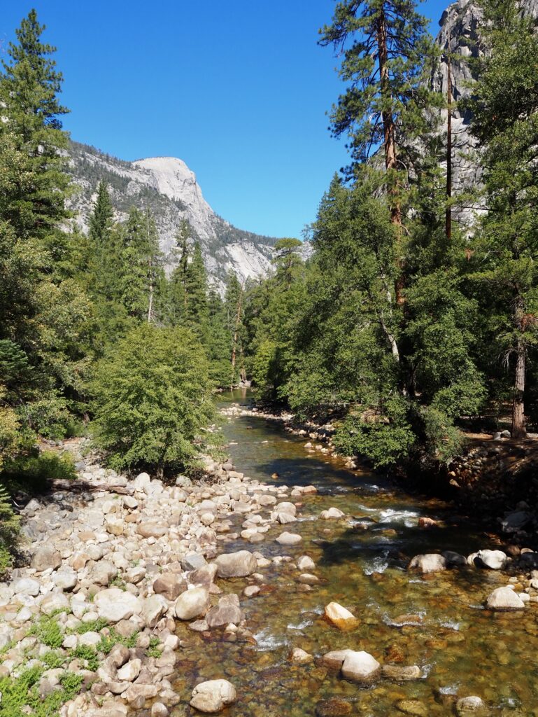
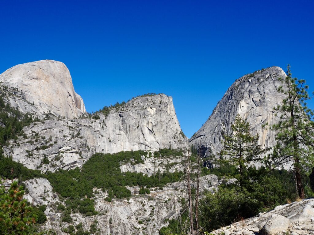
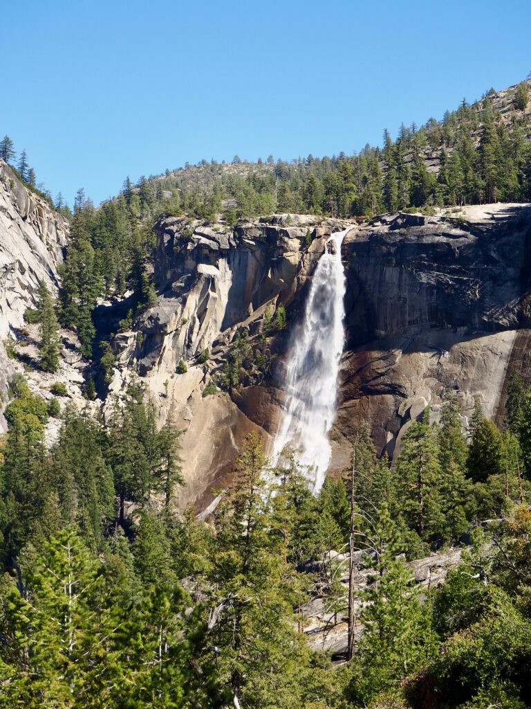
The switchbacks seemed to be never-ending, until I suddenly emerged above the tree line at Clark Point. It wasn’t long before Nevada Falls appeared. I didn’t mind that I wasn’t hiking to its head, since this was a pretty impressive viewpoint! Next to it, the iconic curve of Half Dome was also visible, alongside various other peaks. Such dramatic scenery is very typical of Yosemite! My route began to descend over large rocks, when Vernal Falls appeared below me, dropping steeply over a cliff edge into the valley. Once I reached the river and the top of the falls, it was a slightly daunting view over the cliff edge!
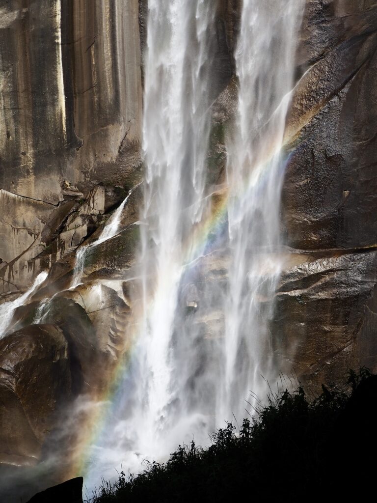
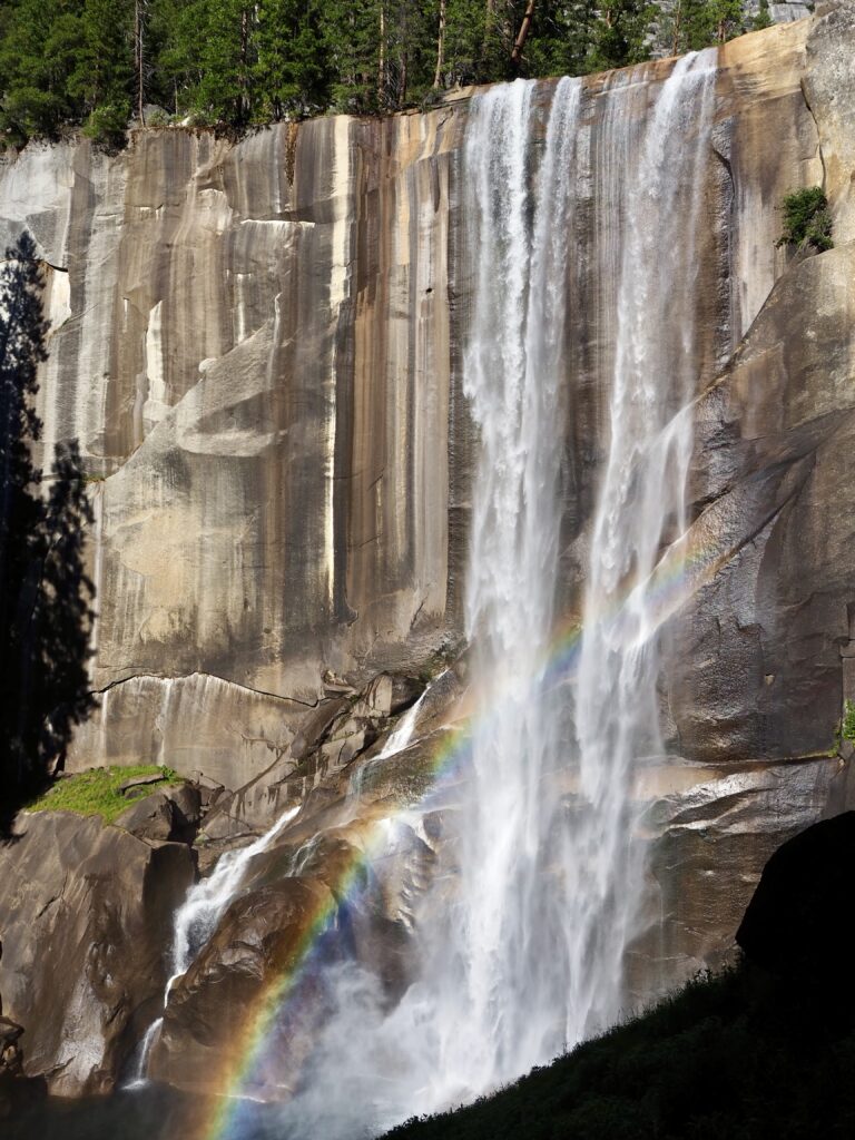
Mist Trail
I sat on the flat rocks in the sun for a while, before beginning the descent down the Mist Trail. The trail is named for obvious reasons, as you’re walking close enough to feel the mist from the falls. The sun was also casting rainbows into the spray, dancing their way down the falls. The rocks can be slippy from the spray though, and they’re steep! The trail then joins back up with its start, over the bridge and through the forest again.
Back at Curry Village, we were more than ready for a cold beer at Bar 1899, before the group all came together for a pizza dinner at Pizza Deck. Finally, to complete our exciting day, we stopped at El Capitan again on the drive back. In the dark, the rock face twinkled with stars – which are, in fact, the lights of the climbers! It was impressive enough seeing them earlier that day, but the reality of them spending multiple nights halfway up the rock face was something else. It was scary but also magical!
Day Three
Tuolumne Sequoia Grove
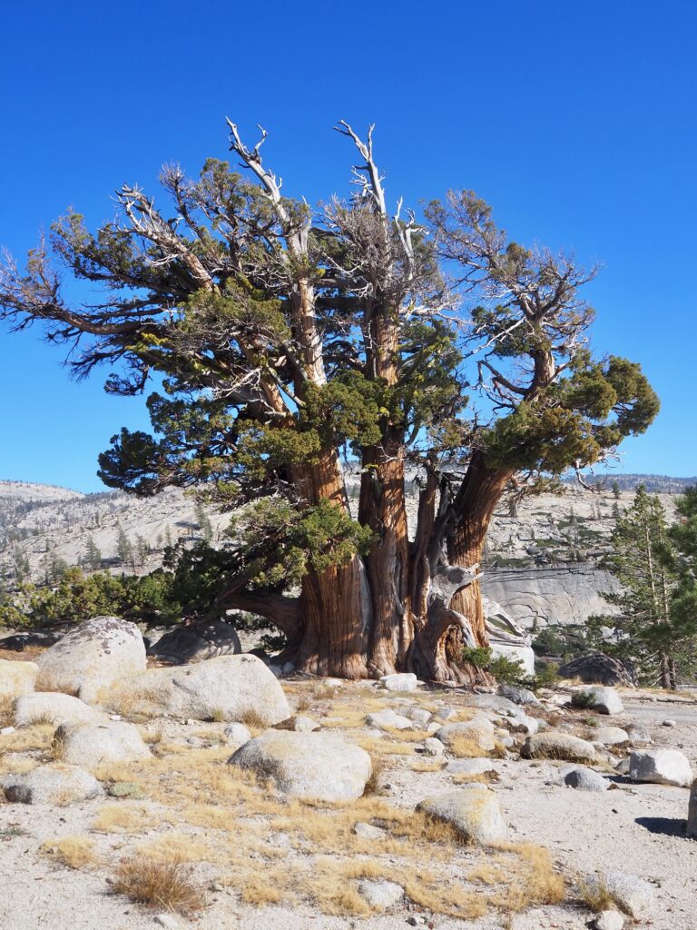
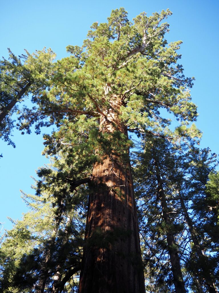
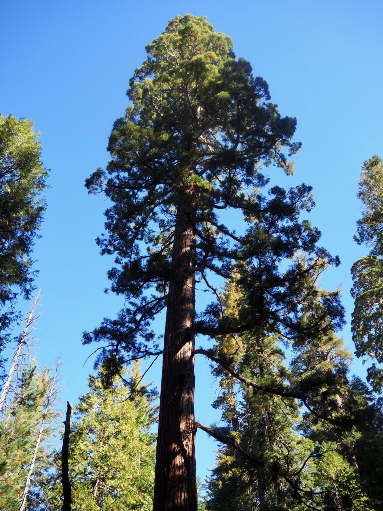
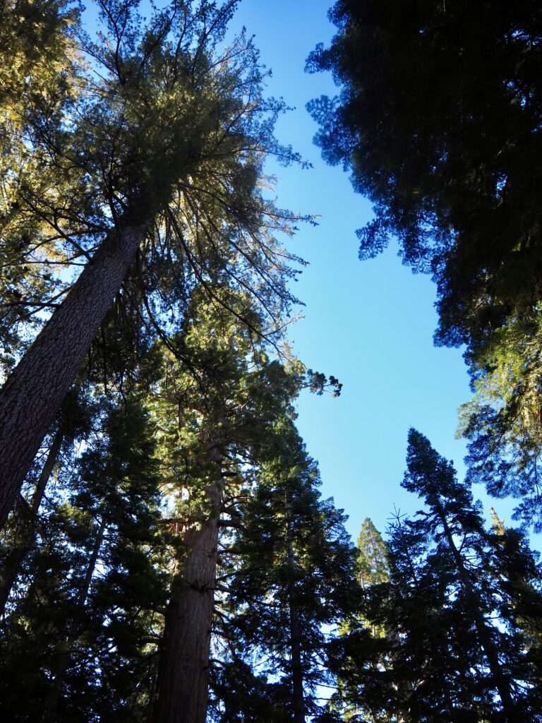
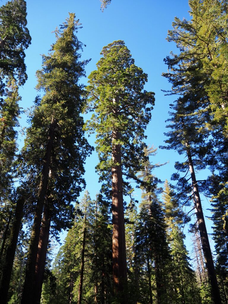
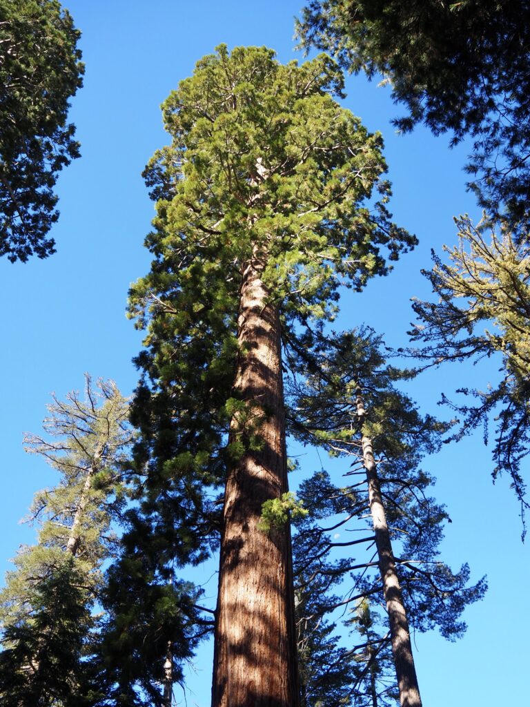
For our third of four days in Yosemite, we headed away from the valley again, to quieter parts of the park. Several people had asked about seeing the sequoia trees, so we bundled into the van to drive to Tuolumne Grove. We completed a short hike through the grove, which was actually downhill first and uphill on the way back. It’s an easy enough path for the whole group’s fitness level though. The forest is mainly composed of conifer trees with only about two dozen sequoias. You have to hike for a little while before spotting the first one. But it’s so worth it once you do!
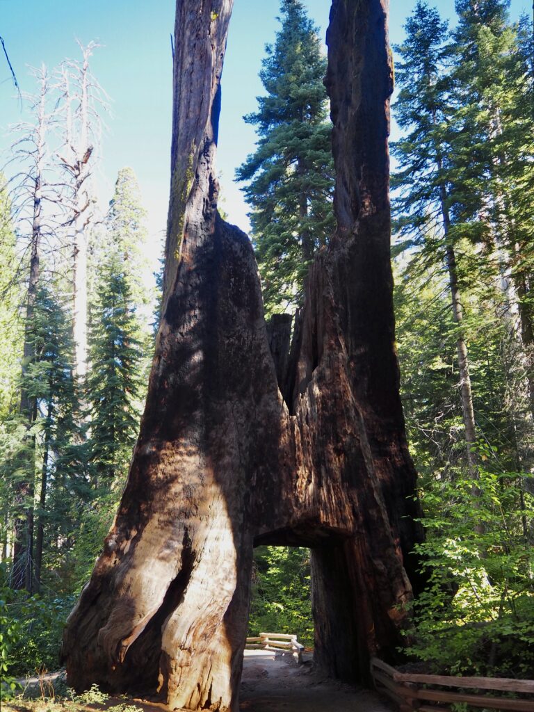
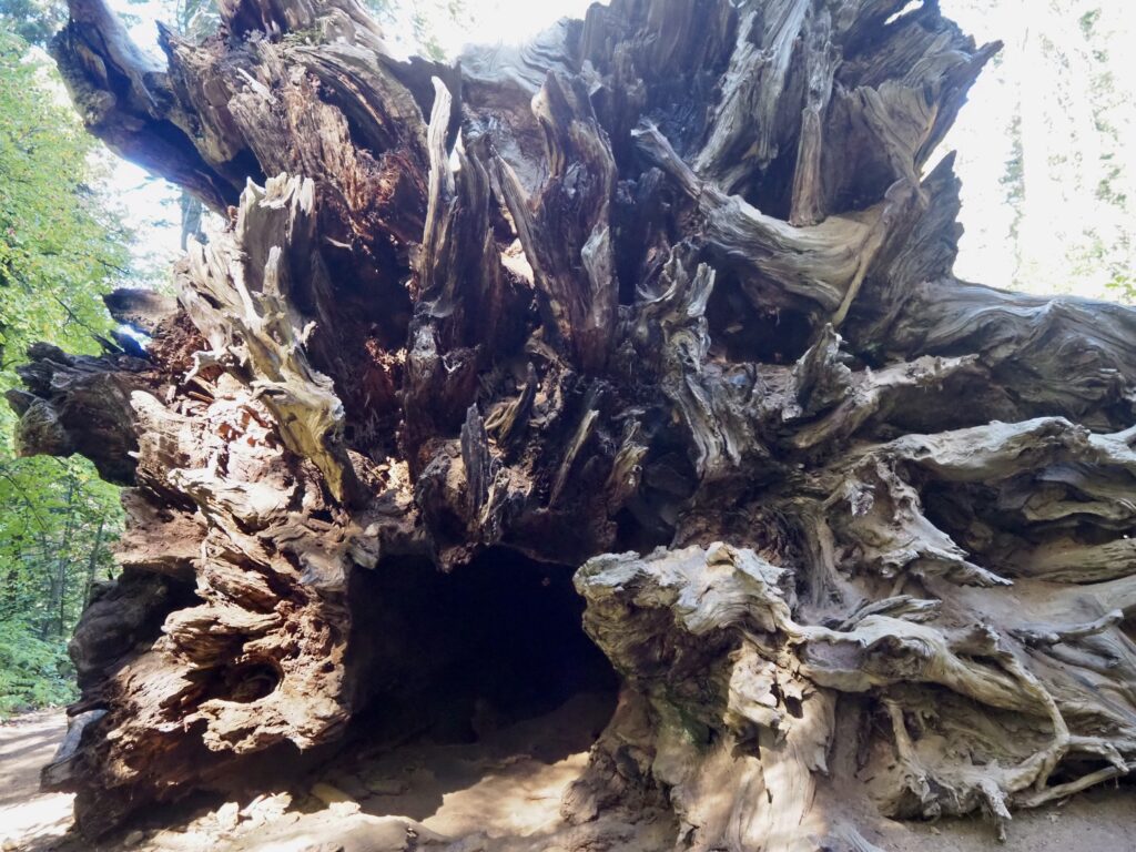
These magnificent, giant trees are amongst the largest tree species on earth, taking hundreds of years to reach their massive size. Craning my neck skywards at each one, I was just in awe of nature’s majesty yet again. It was a quiet grove as well (Mariposa Grove is usually busier), with only a couple of people besides us around, which allowed us to take in the quiet and serenity of the first. There are a few dead trees along the trail, which was sad to see, but part of nature. One was hit by lightning, but you can actually walk under an arch where the path cuts through its trunk. Another lays on its side, the trunk hollowed it, so you can walk all the way along it. Though it was a narrow squeeze in places! The whole grove was such a beautiful place to spend a couple of hours.
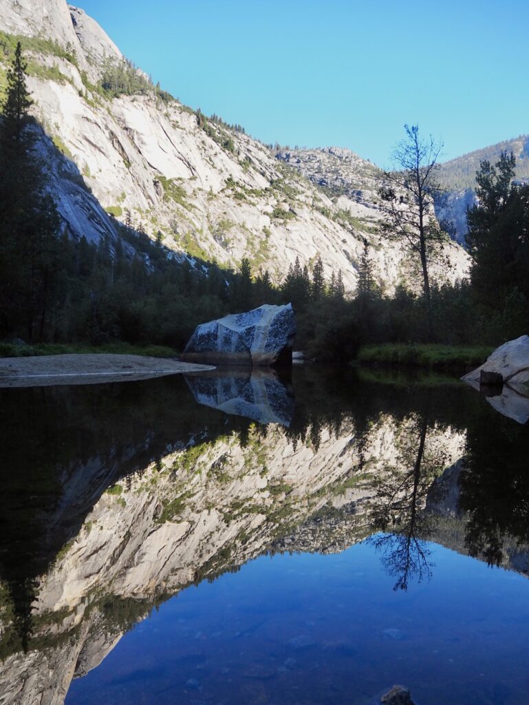
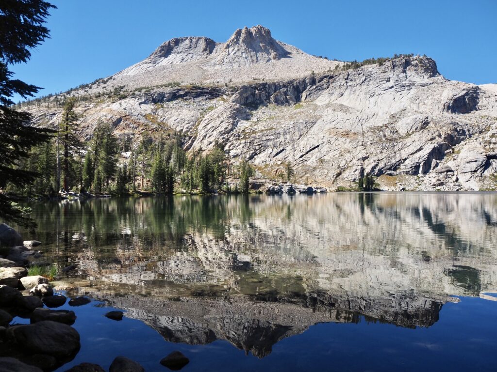
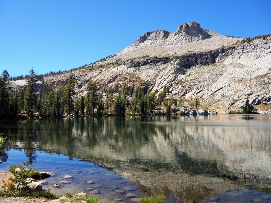
May Lake Trail
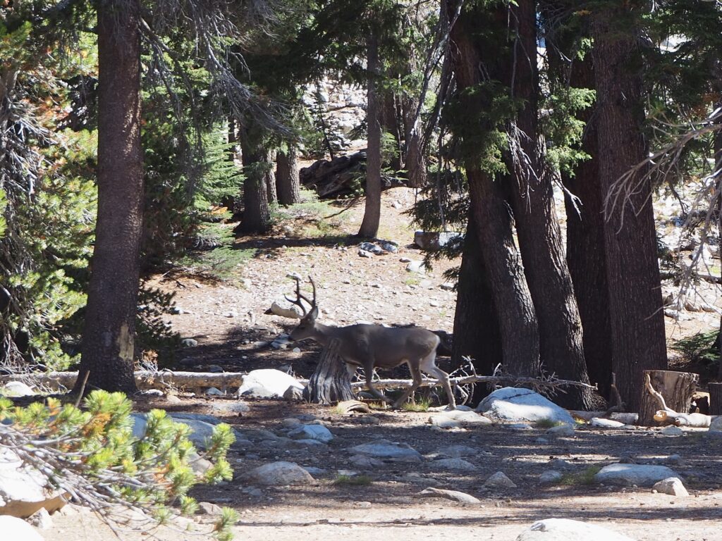
There was some group discussion and negotiation after leaving the grove, of where to spend the afternoon, since we all had to agree in the same van. Our leader gave us a couple of choices and “lake” won out, specifically the May Lake Trail. This is another much quieter area of Yosemite, with only a few other people around. From the car park, the trail is a rocky path, climbing gently up a small mountainside. Nothing too steep or any more strenuous than yesterday! At the top, we emerged on the shores of a serene, blue lake. It was so peaceful, we even spotted a deer strolling through the forest!
We sat on rocks and logs by the shore to tuck into our picnic lunches while enjoying the view. It was a bright, sunny day and with little wind to disrupt the water’s surface, it acted as a perfect mirror of the mountain behind. A beautiful spot to enjoy lunch! A couple of group members went for a swim, but most of us opted for a paddle instead, stripping off socks and shoes and rolling up our trousers. It was a little slippy on the rocks – as one person discovered when he toppled over entirely and got soaked! The rest of us managed to stay dry above the knees, luckily. Some of the group also hiked halfway around the lake and back, but I opted to just relax and enjoy the view a bit longer, before we returned the way we’d come again.
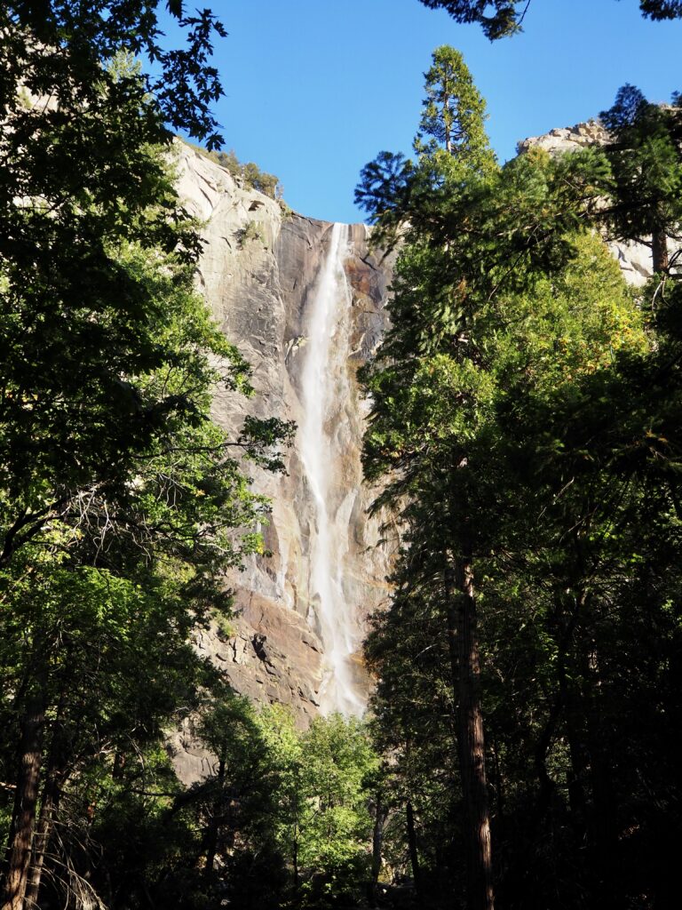
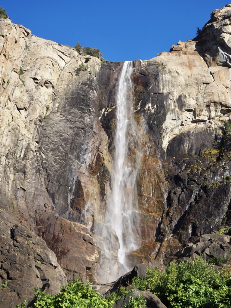
Bridalveil Fall
We headed back towards Yosemite Valley for the evening, as our tour leader had a special spot for sunset. But we arrived with time to spare, so we made a quick stop at Bridalveil Fall. As mentioned, none of the falls were running at full force at this time of year, but it was still a very pretty view. We walked the short trail from the road to the foot of the falls and admired them while sitting on the rocks below. We saw a few people climbing up over the rocks to get even closer but with all the spray, this seemed dangerously slippy! Not that we had enough time anyways, as we were racing the sun.
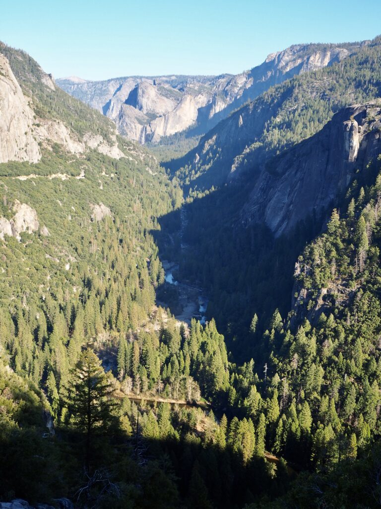
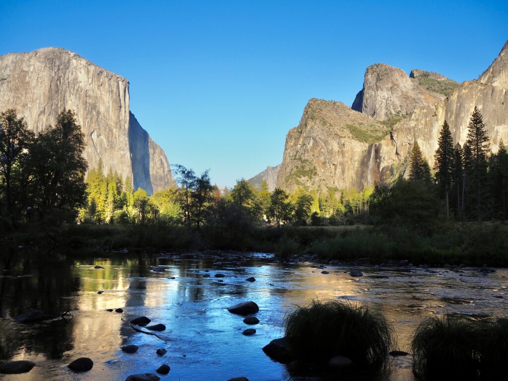
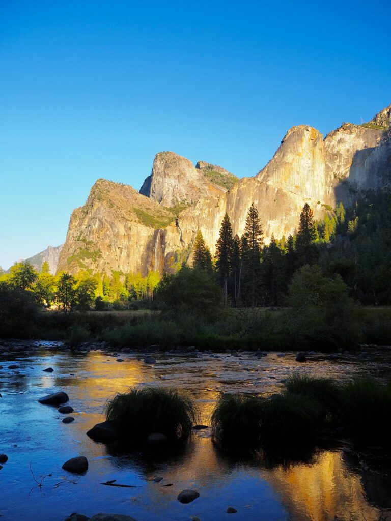
However, there was just enough time on our drive to stop at Yosemite Valley View. This small lay-by on the banks of the Merced River offers a stunning view back into the valley, with El Capitan and Bridalveil on either side. Having the river in the forefront made it even prettier too!
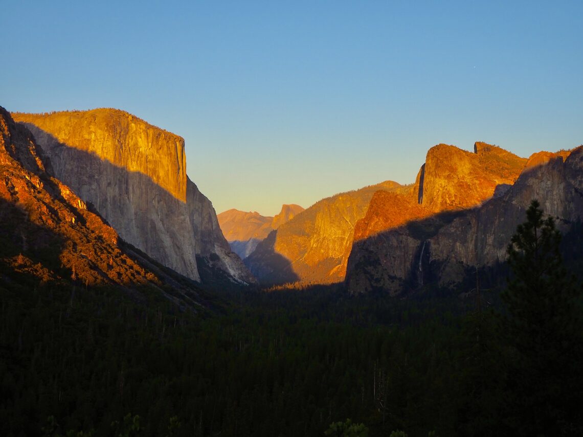
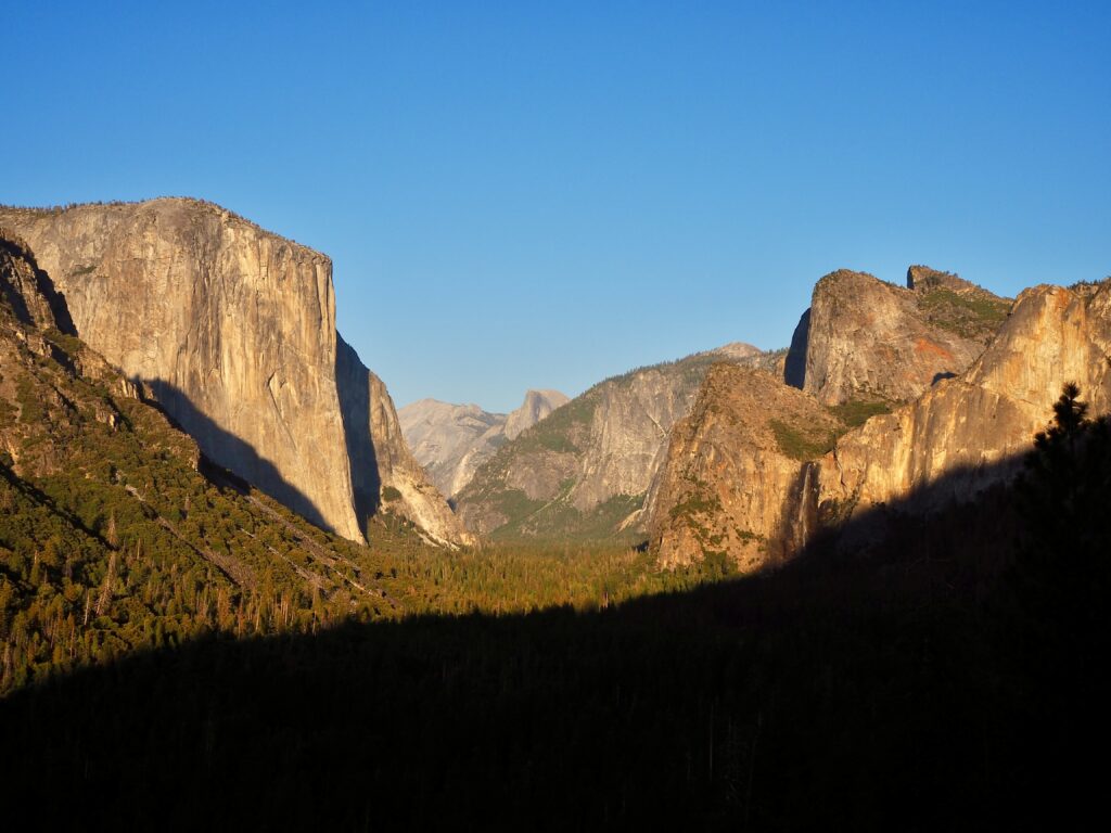
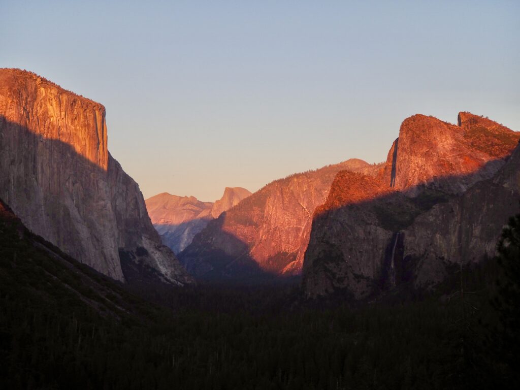
Tunnel View
Our sunset spot was Tunnel View, and if you don’t recognise the name, you’ll recognise the scene. This is probably the most famous view of Yosemite Valley, the image used on every calendar, magnet and marketing materials. El Capitan to the left, Bridalview to the right, and Half Dome in the back. It’s a truly breathtaking view, and as the sun set to our backs, the valley was cast in the golden hour glow, changing from green to orange to pink before our eyes. We snapped our photos of course, and just stood atop the steep banking soaking in the majesty before us. If Yosemite hadn’t wow-ed you until now, you’d be hard pressed to not be amazed by this view.
We headed back into the valley for dinner again, before driving back to camp in the dark. There, we had enough time for one last campfire gathering beneath the trees and stars.
Day Four
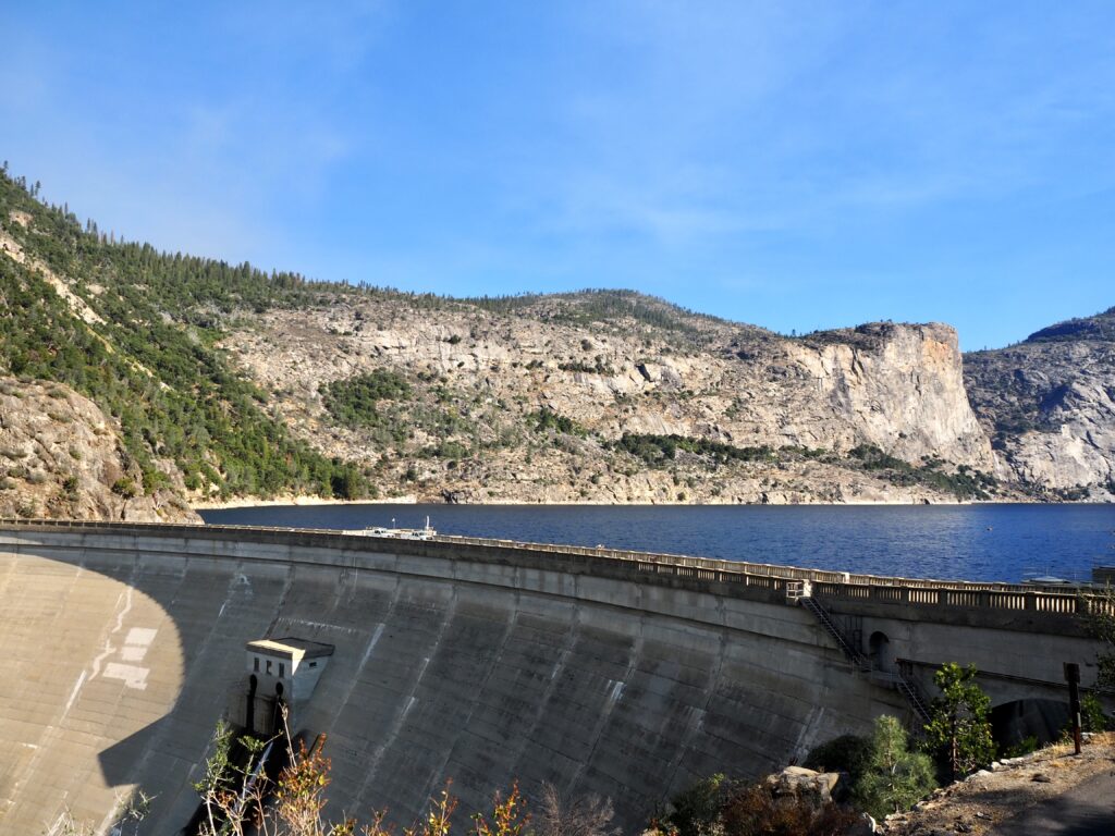
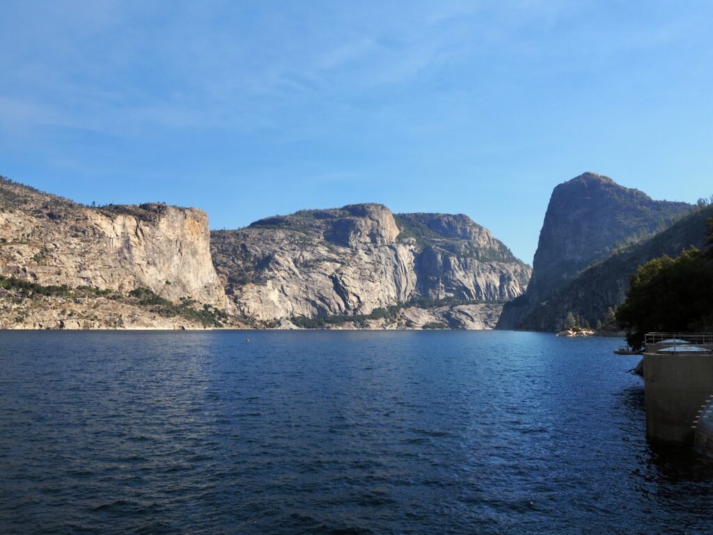
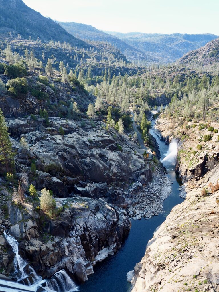
Hetch Hetchy Dam & Reservoir
The last of our 4 days in Yosemite was really just a morning I guess. We were leaving the area behind to travel west, but we had enough time for one more stop. Hetch Hetchy was actually meant to be yesterday’s destination, but since its main draw is the waterfalls, which are almost gone this late in the season, we’d voted for sequoias instead. But our leader offered to drive us out there still, with the option to sleep in and hang back at camp for those less interested. I tagged along though, relaxing in the van on the winding drive deep into the park.
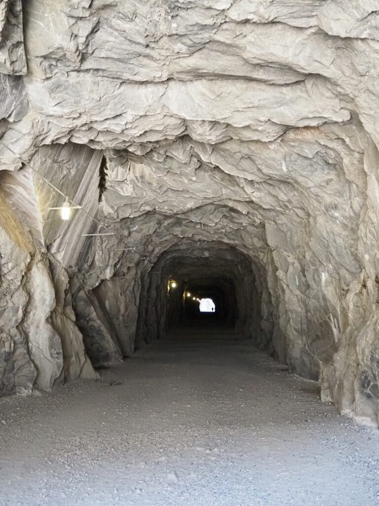
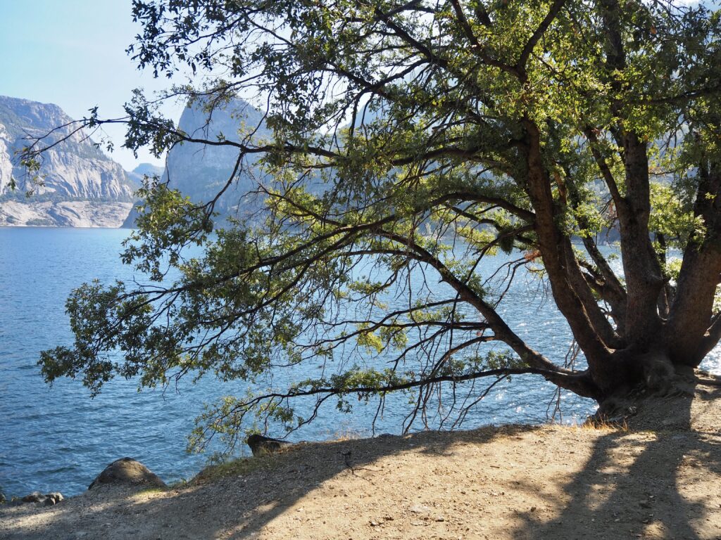
Hetch Hetchy was somewhat controversial back in the day, as it is a dam and a man-made reservoir, created to manage California’s water supply. Conservationists like John Muir objected to building this inside Yosemite, but ultimately, they lost out. We parked up near the dam and could walk across it, the reservoir to our right. We could see one of the falls still running, and the marks of where the others had been over the summer, but were now dry. There is a hiking trail up to them both, which is what we had skipped yesterday. Instead, we ambled across the dam, looking down into the valley below, and through the vast tunnel cut into the hillside, before doubling back on ourselves.
Then, it was time to leave Yosemite behind, bidding farewell to its incredible scenery. Our drive took us west across California, with San Francisco being the final destination for most of the group. Since I’ve already been, I had a different stop planned en route. So, the group dropped me off partway (in Modesto) to pick up my rental car and head north…
4 Days in Yosemite National Park
Yosemite is one of the most famous and popular national parks for good reason! Those magnificent, towering mountains coated in lush green forests are home to giant sequoias and abundant wildlife. The sparkling blue glacial lakes and waterfalls tumbling down the rock faces. It’s a beautiful corner of California and one that rightly deserves to be protected. Having 4 days in Yosemite National Park was a good amount of time to cover a lot of ground. Although I’m sure super keen hikers could stay even longer to tackle longer trails! While Yosemite Valley is stunning, I also really enjoyed getting out to quieter corners of the park, away from the crowds. A gorgeous penultimate stop on my USA trip!