Utah’s National Parks | Arches & Bryce Canyon
So, if you haven’t read Part 1 of my ‘Utah’s National Parks’ posts yet, featuring Zion and Monument Valley, I recommend doing so for the context of the small group tour I was on. It was a crazy week, though, crammed full of too many adventures to fit into one post. We’d already been wowed by valleys, mountains, mesas and buttes, but there were even more rocks to come. Our journey headed northeast to Moab for a couple of nights to explores Arches and Dead Horse State Park. Then it was through Capitol Reef and on to Bryce Canyon, before returning to Las Vegas to complete the loop around Utah.
Moab & Arches National Park
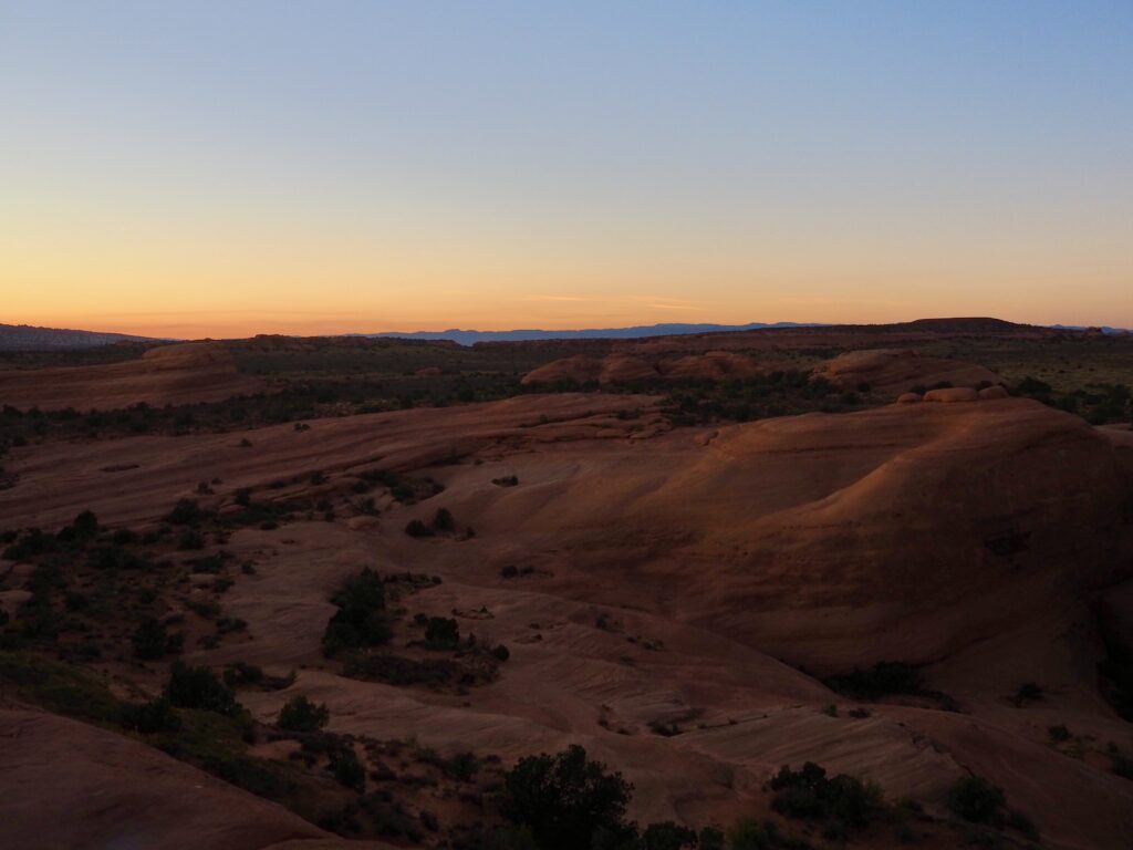
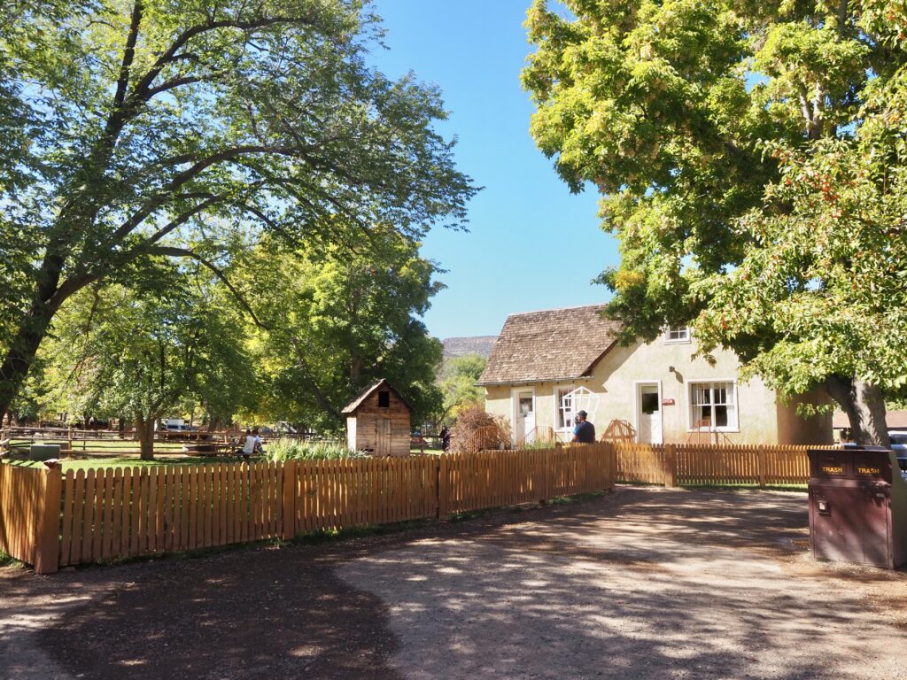
We rolled into Moab in the mid-afternoon, a small desert town that’s a hub for tourists visiting nearby Arches National Park. There’s also plenty of other activities available in the area, not inside the park. We had a few nights off from camping, staying in shared cabins instead, so there was no setting up required today. This gave us time to grab takeaway dinners in town, before driving into Arches to embark on a group hike. Arches is one of Utah’s National Parks on our itinerary that doesn’t have a shuttle bus service, so our group leader had to act as one.
Delicate Arch Sunset Hike
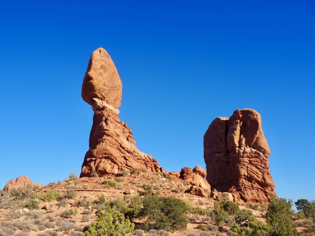
Anyways, as the name might suggest, Arches is full of rock formations shaped like… arches. But the first formation we actually stopped at was the Balancing Rock! It’s pretty cool to see it floating carefully on this narrow pinnacle.
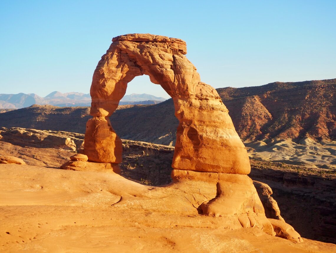
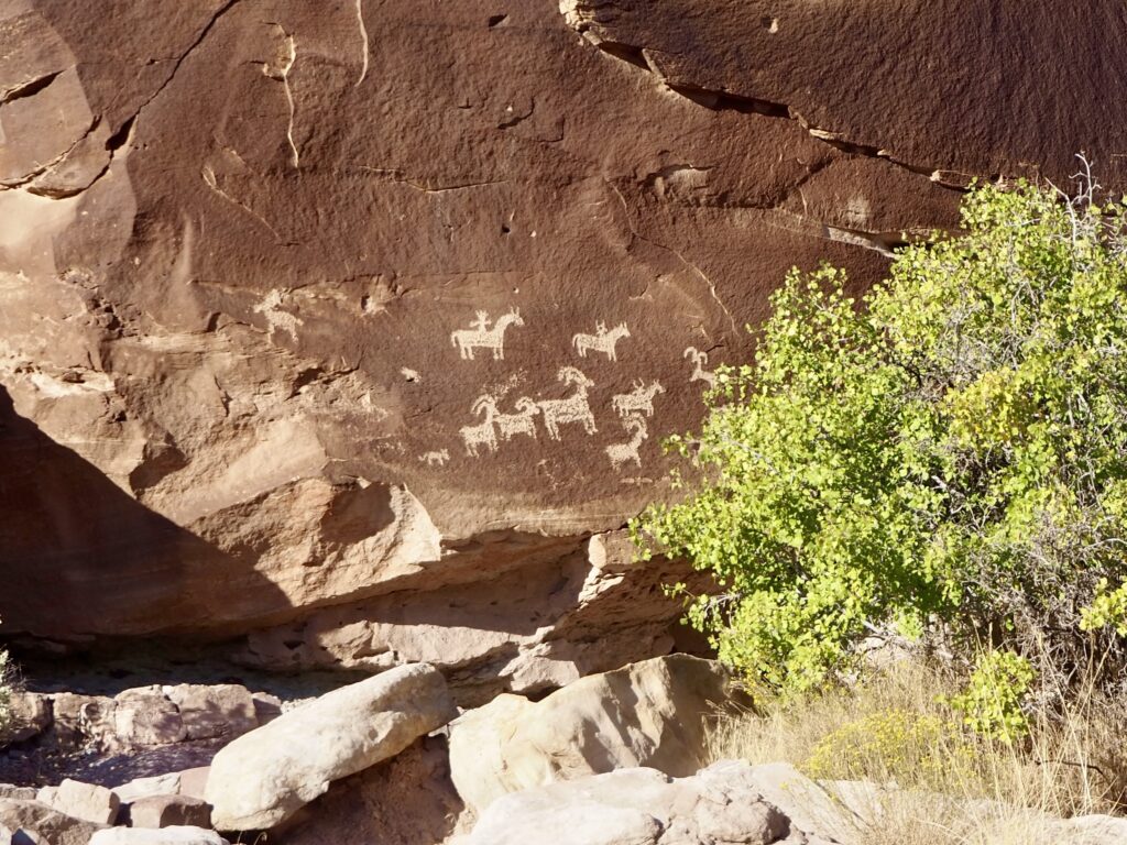
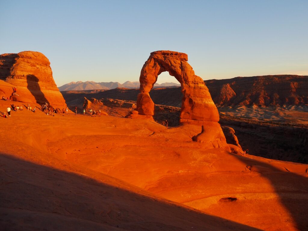
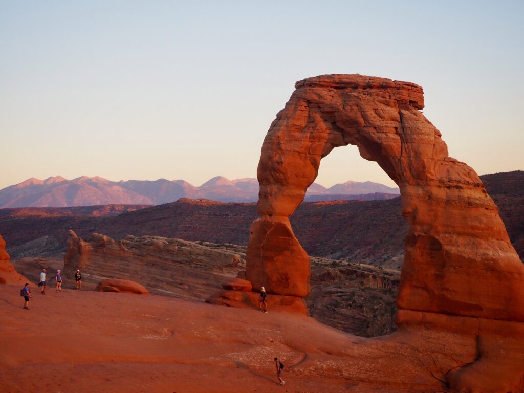
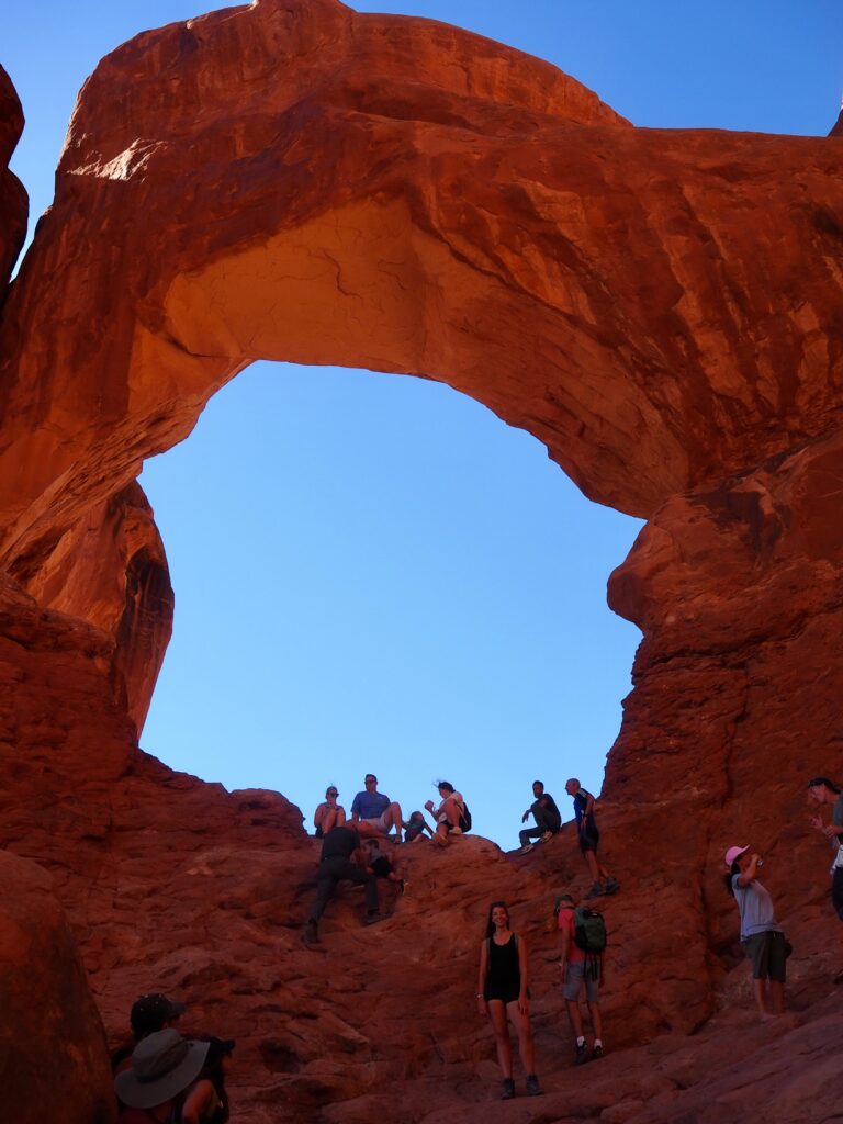
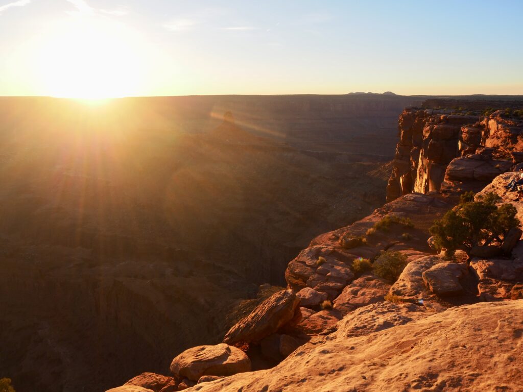
Delicate Arch is the most famous arch, precariously perched on a sloping mountain top. And, as I’d learned at the Grand Canyon and Monument Valley, sunset is a wonderful time to view the rocks, as they glow red and orange in the evening light. We got to the trailhead fairly early, allowing us to take our time meandering up the trail, stopping to check out a small building and some petroglyphs. The trail was a little tricky in places, with smooth, flat rocks creating a rather slippery surface. It was a little steep in places too, but nothing unmanageable.
Emerging atop the mountain, you round a corner and the arch is suddenly right there in front of you. It was pretty busy but the quicker hikers in our group had nabbed a spot for us all to squeeze in and sit opposite the arch. We were overlooking a sort of basin, and you could walk round the edge to get closer to the arch. I was a bit nervous about the drop though, so opted to skip waiting in line for a photo over there, and just enjoy the view from this side. We tucked into our dinners while watching the colours turn a deeper red as the sun sank lower and lower. It is remarkable how the arch has stayed standing for so long! We started our descent shortly after sunset, not wanting to let it get too dark. But the full moon was lighting our way overhead!
Colorado River Float
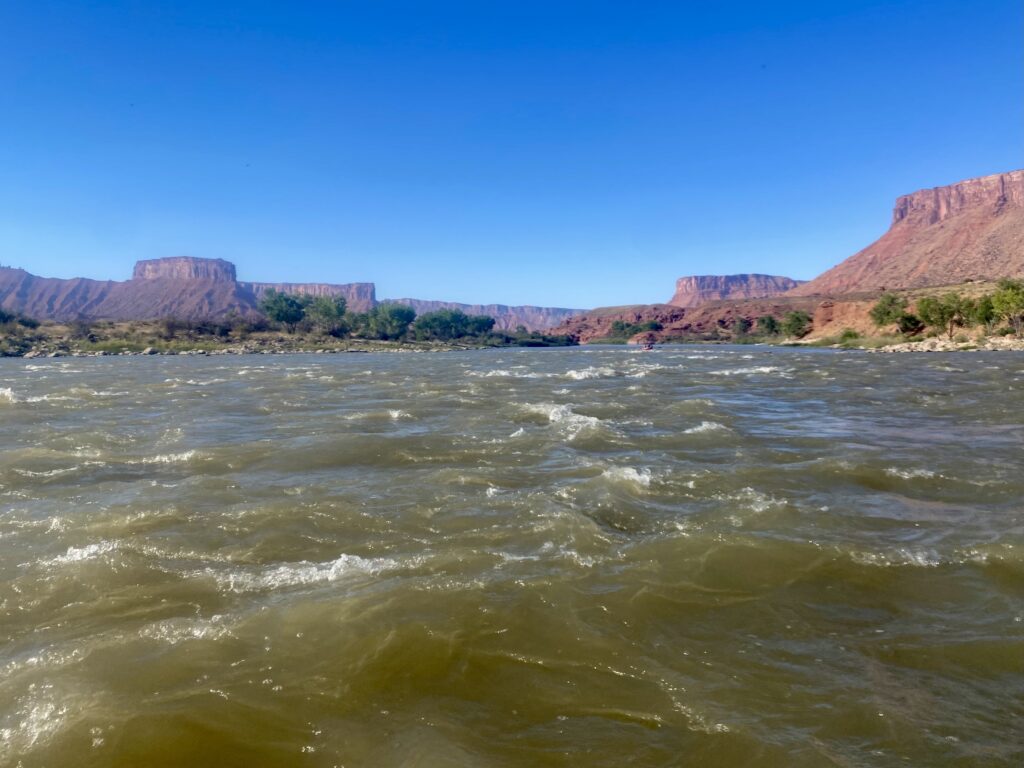
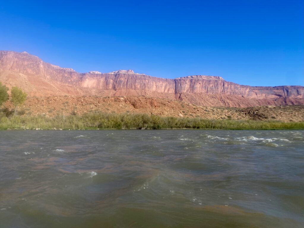
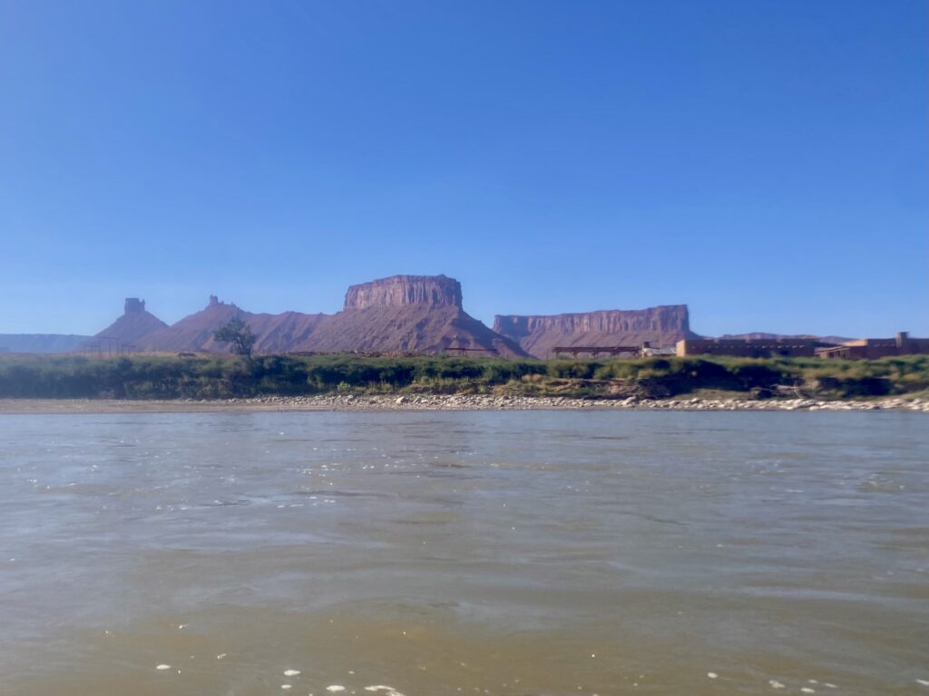
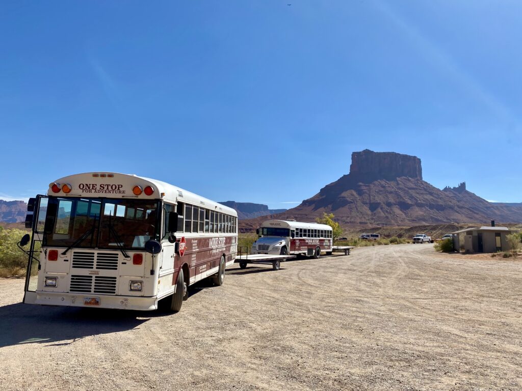
The next morning, most of the group were heading straight back into Arches, but myself and another had signed up for a different activity. While this was primarily a hiking-focused trip, I thought it would be nice to take a break from walking for a morning. We had chosen a rafting trip on the Colorado River instead. The water level was too low this late in the season (late September) to really call it white-water rafting, but we’d been warned of that when we booked. It was more of a ‘scenic float’, which honestly in the middle of a pretty packed trip, sounded quite relaxing!
The company picked us up from the cabin, kitted us out with life jackets (no wetsuits when it’s so hot!) and free water bottles, then transported us to the river. There were eight of us plus the guide in our raft, and she did most of the steering. For much of the route, we were able to just relax and only had to paddle at the occasional rapids. The river is a fairly brown colour, but that’s partly a testament to how long and powerful it is. The surrounding land was all towering mesas in shades of terracotta, dotted with greenery along the river bank. Our guide had plenty of stories about the area to share, and we chit chatted within the group too. It was just a pretty chilled couple of hours drifting downstream, enjoying the scenery.
Double Arch Trail
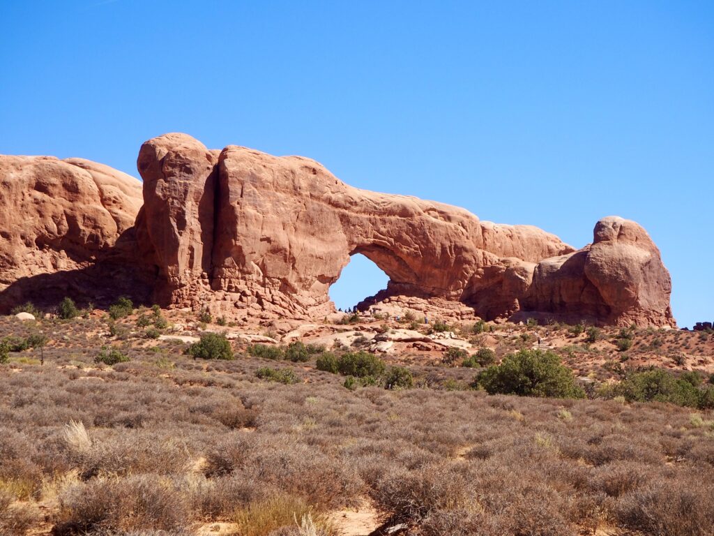
Our wonderful tour leader picked me up at the cabin to take me into Arches for the afternoon. She did such a good job coordinating the preferences of a dozen people with her acting as our shuttle bus! I knew I didn’t have time (nor energy to be honest) for a long hike, so she helped me pick a couple of shorter ones with intersting views and formations. My main priority was just getting to see a little more of the park besides Delicate Arch. Meeting up with a couple of other group members, we started off at the Windows car park where I could see one of the windows from a distance. These will slowly become arches over town, but aren’t quite as precarious yet!
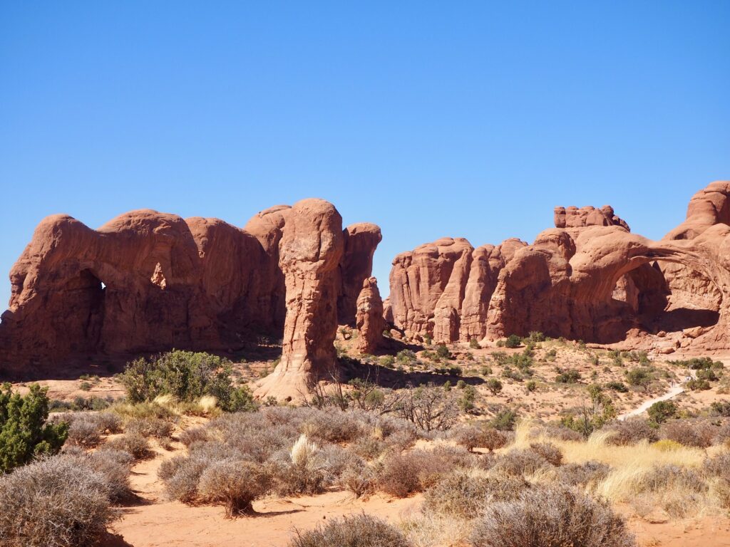
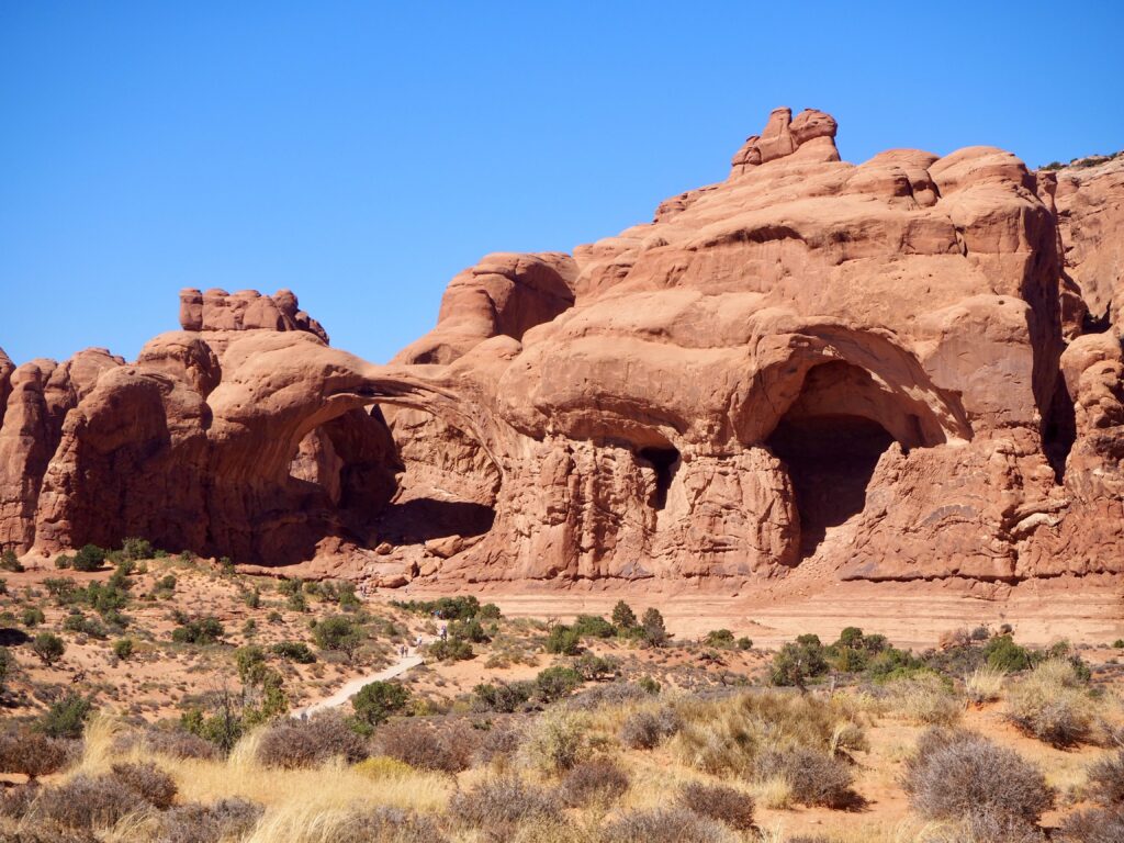
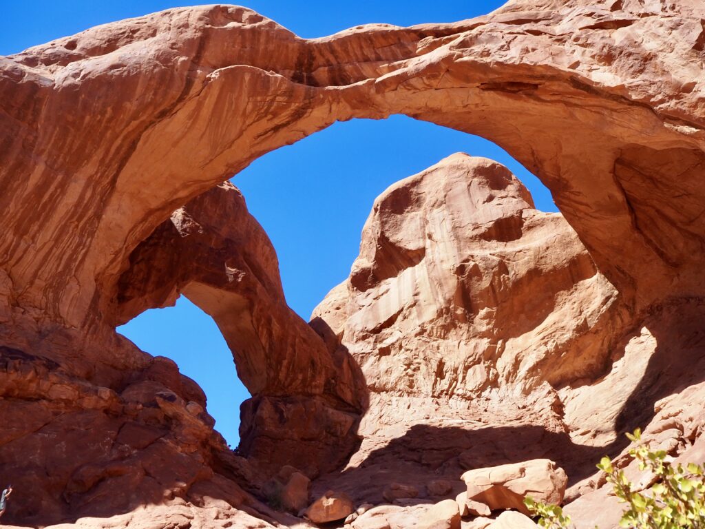
The car park is also the start of the Double Arch Trail, which only takes around 15 minutes to reach the rocks. It was an impressive formation from a distance too, studying all the towers and curves. The arches aren’t visible until you get up close, though, when they emerge against the sky behind. Viewing them from slighly different angles creates different shapes overhead, and there’s something really graceful about the way they curve and intersect overhead. Many people were climbing up to sit inside one of them, but you can’t really see the second to get the “double” from that angle. Plus, the others warned me there was a steep drop on the far side and my fear of heights kicked in again. I settled for a few pictures further down the slop instead!
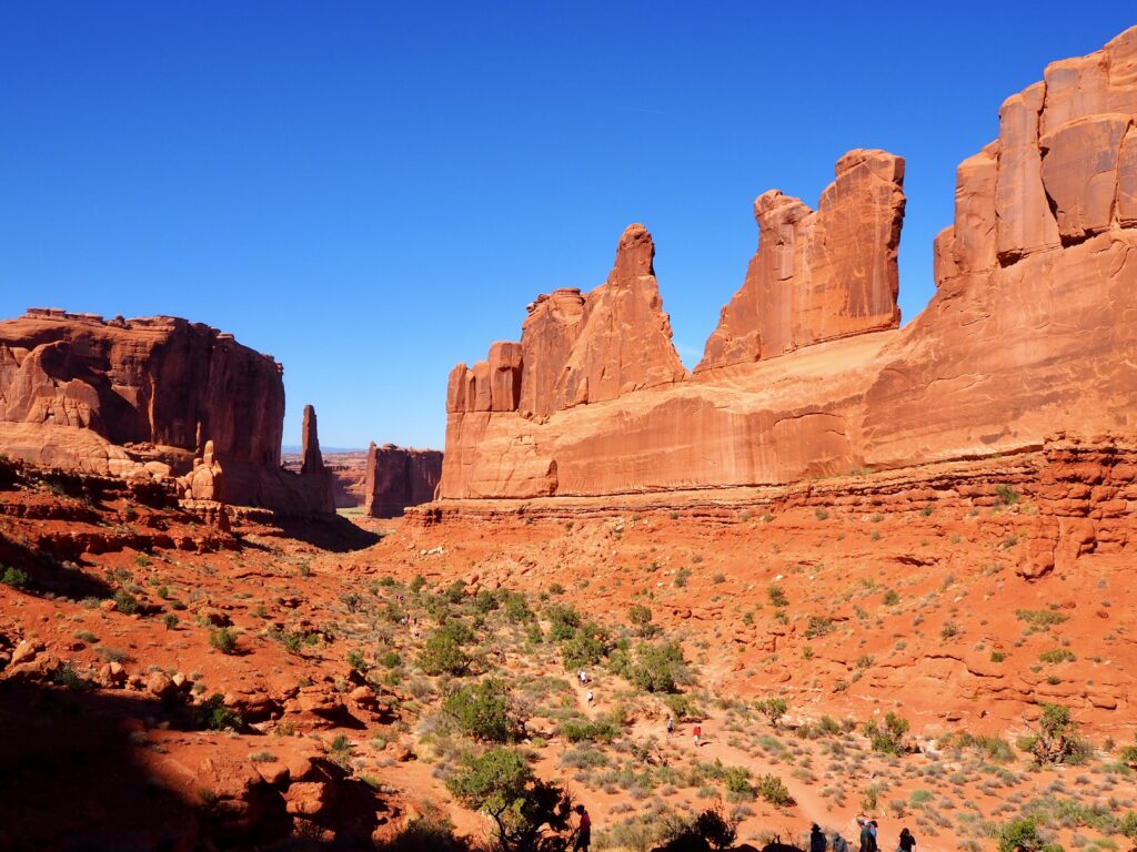
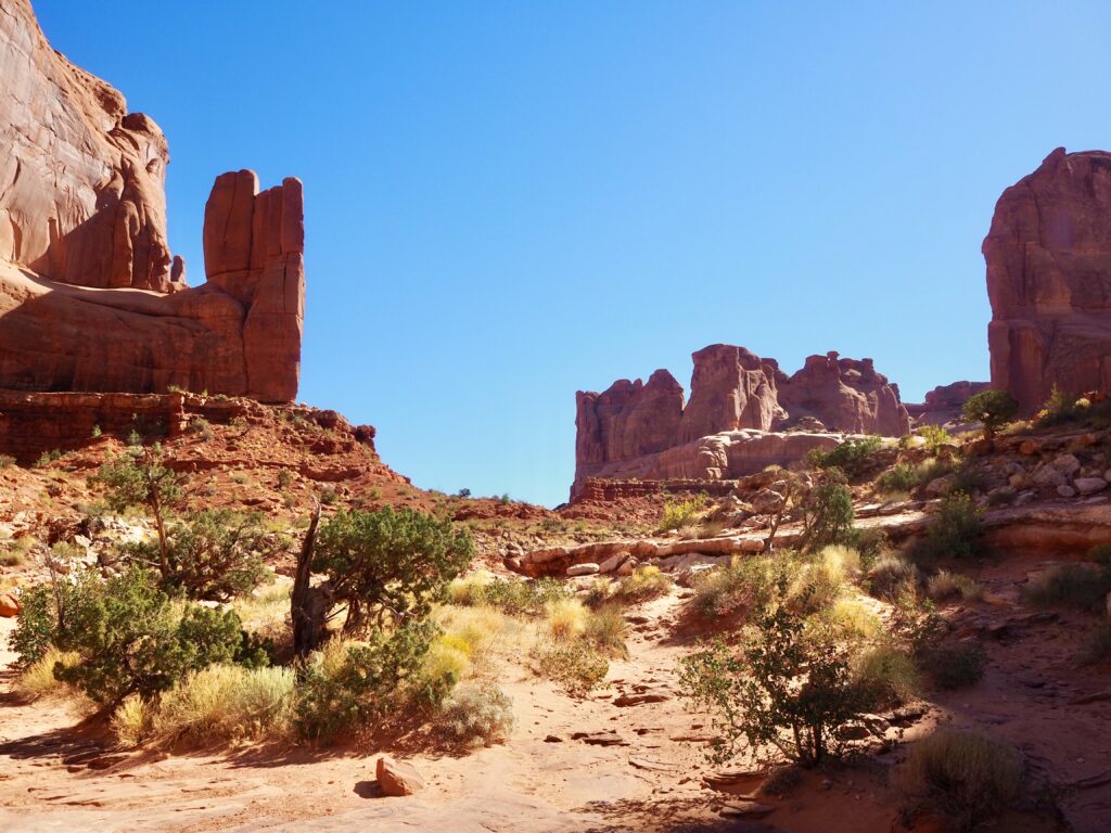
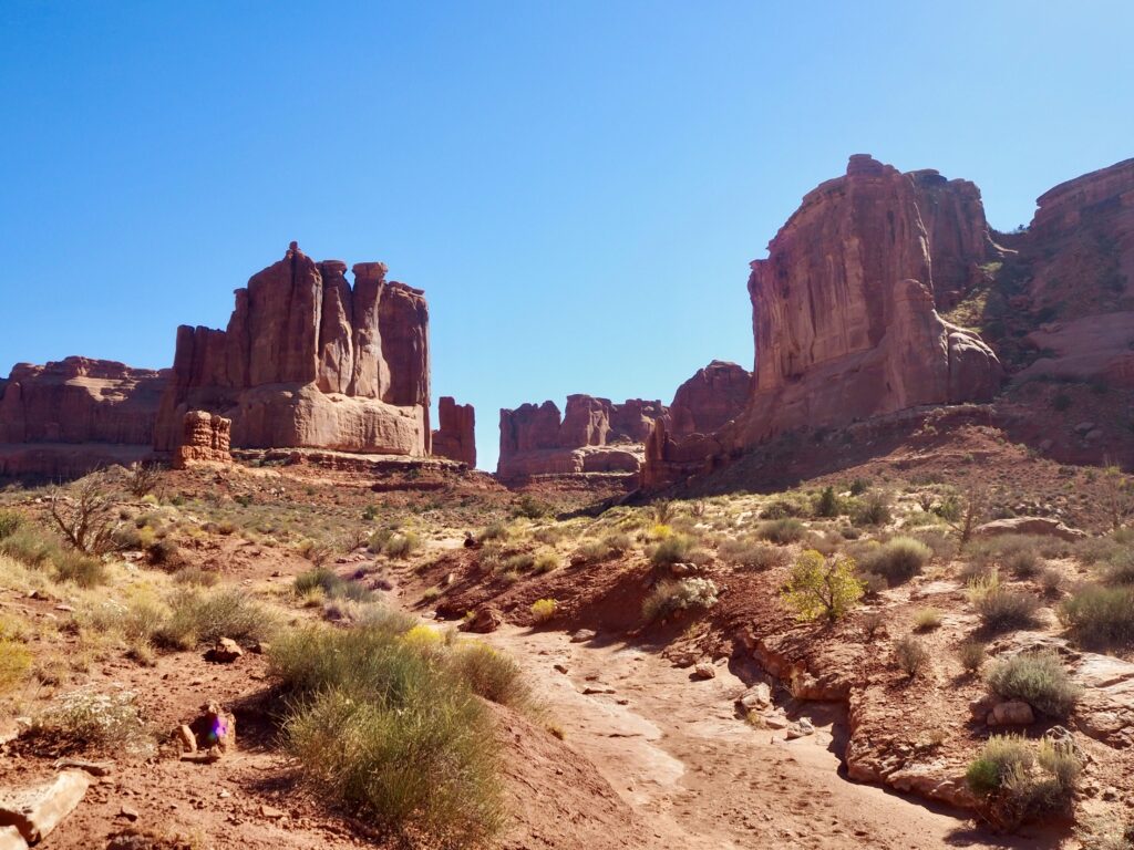
Park Avenue Trail
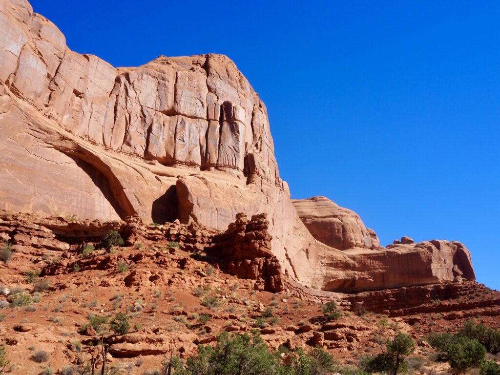
We hopped in the van again and our leader dropped us off at Park Avenue. This is a point-to-point hike through a valley of rock walls, and she was picking us up again on the other side. This one was a cool contrast to the rest of the park, as there actually weren’t any arches along here! Steep, sheer rock walls enclosed us on either side instead. It was really fascinating, throughout Arches, that these rock formations just sort of pop up out of otherwise fairly flat desert landscape. The hike itself had a slight descent overall, with some stairs along the way, but was reasonably flat and easy. It was nice to have a slightly more relaxed day overall, while still getting to appreciate yet more stunning rock formations. Seriously, I was always a water and greenery kind of girl, but these deserts are fascinating!
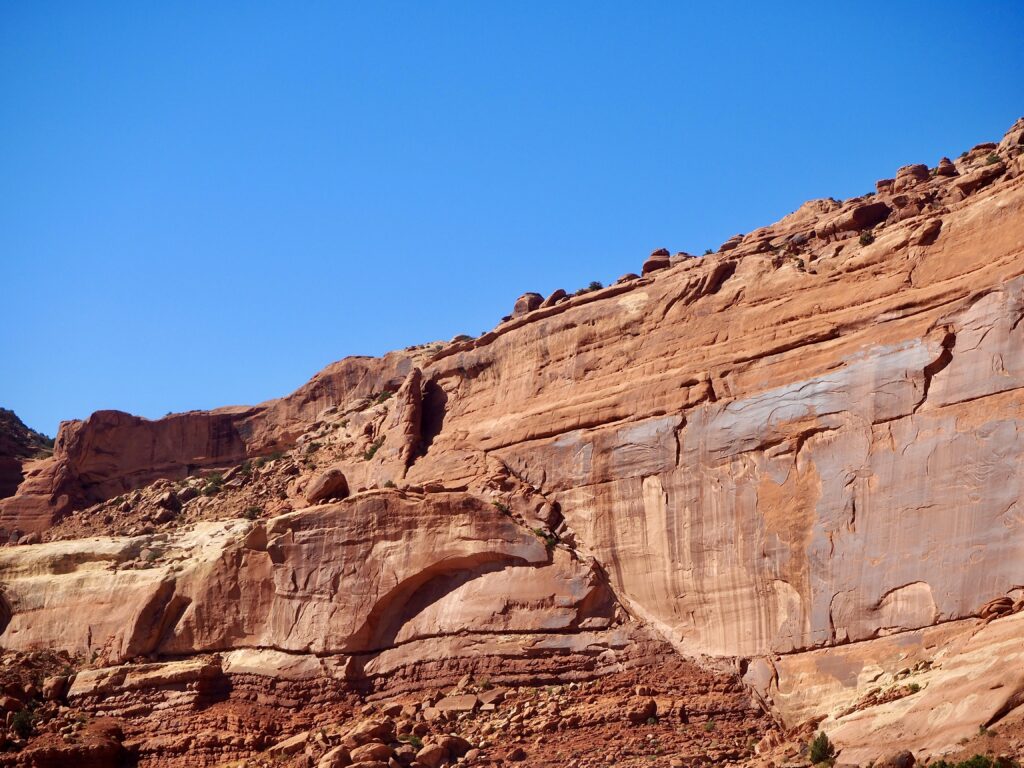
After reaching the end of the avenue and jumping back in the bus, we headed out the park. We also made a brief roadside stop on the way out to look at the fault line. To be entirely honest, I don’t remember all the geological history we learned on the trip (except it was super interesting at the time!), so I can’t recall the particular significance of this. But being able to see a fault line carving through the rocks, evidence of the immense natural powers of the earth, was very cool!
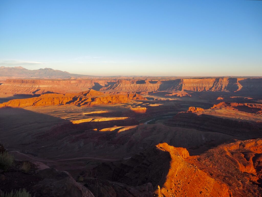
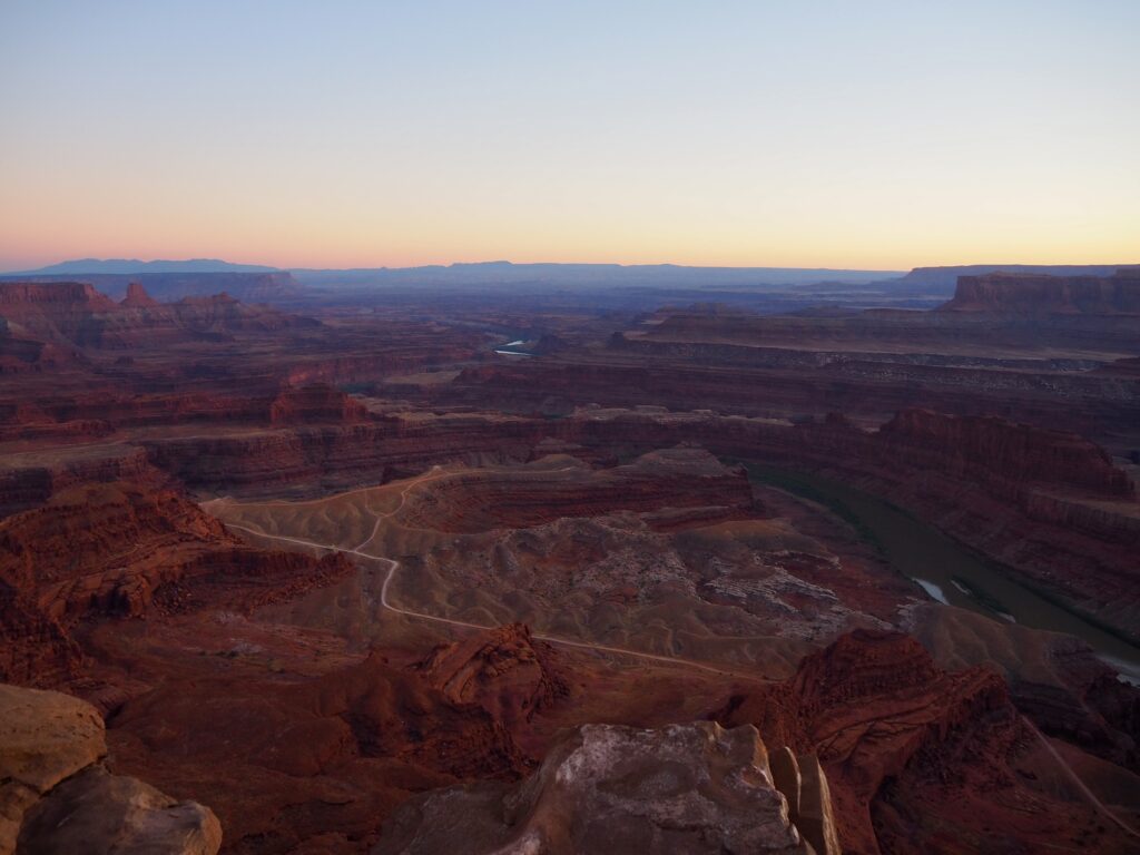
Sunset at Dead Horse State Park
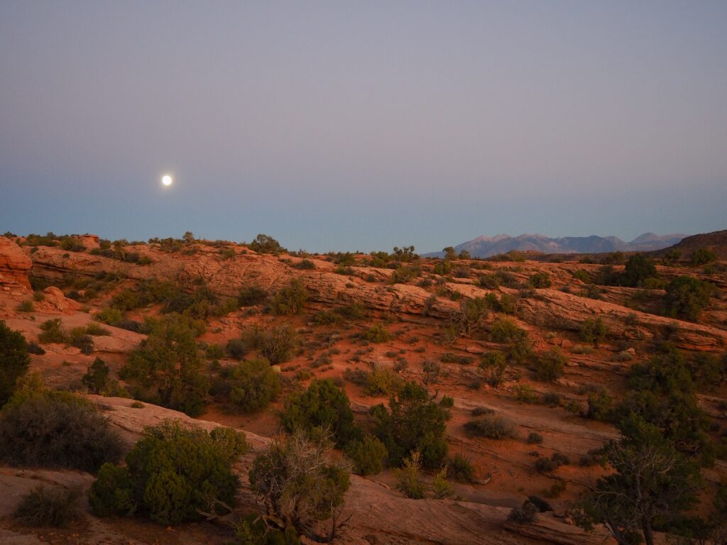
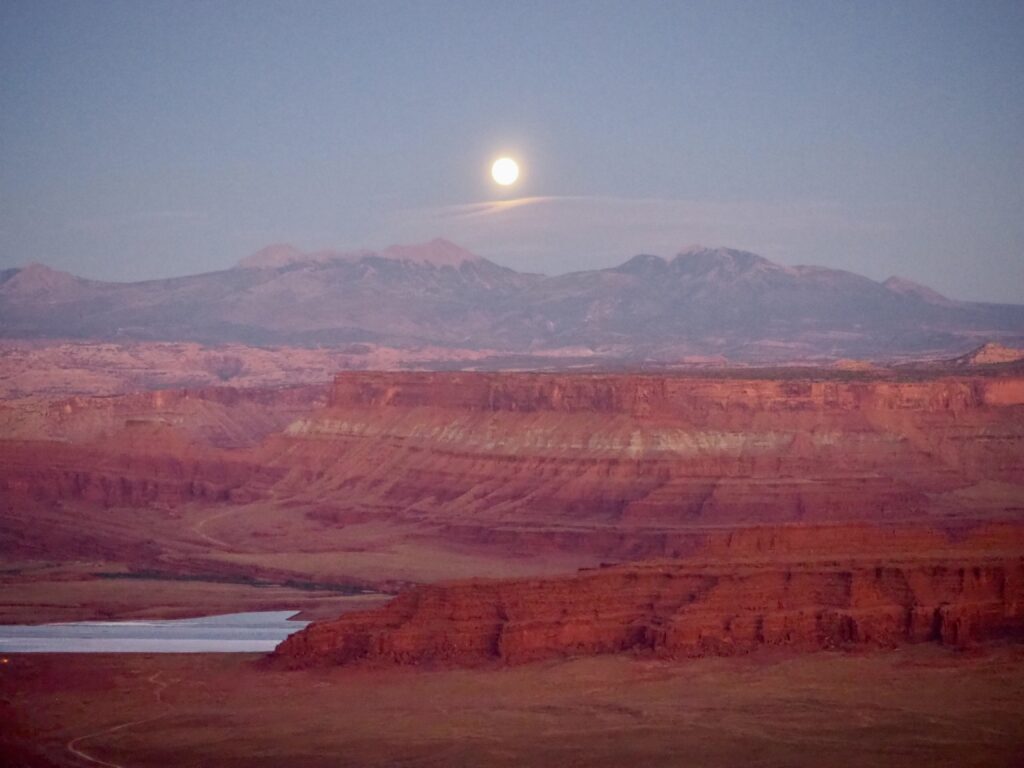
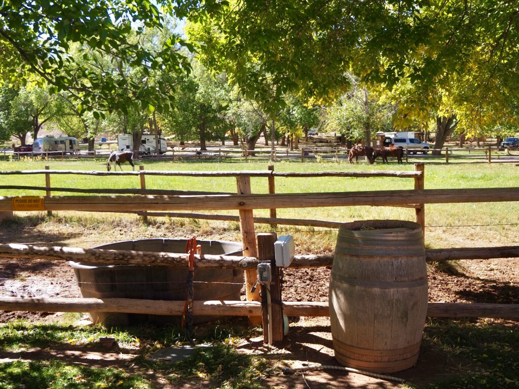
Picking up the rest of the group back at the cabins, we all headed to Dead Horse State Park for the evening. There’s a slightly morbid story behind its name that I’ll leave people to research for themselves if they do or don’t want to… Anyway, we were here to see the sunset and brought our camp cooking equipment to have dinner. The park sits on a plateau, the road snaking out to the end of it. It’s a pretty narrow plateau too, so once you reach the end, it’s only a short walk from one side to the other. So, on three sides, the ground drops away into a vast, wide canyon below.
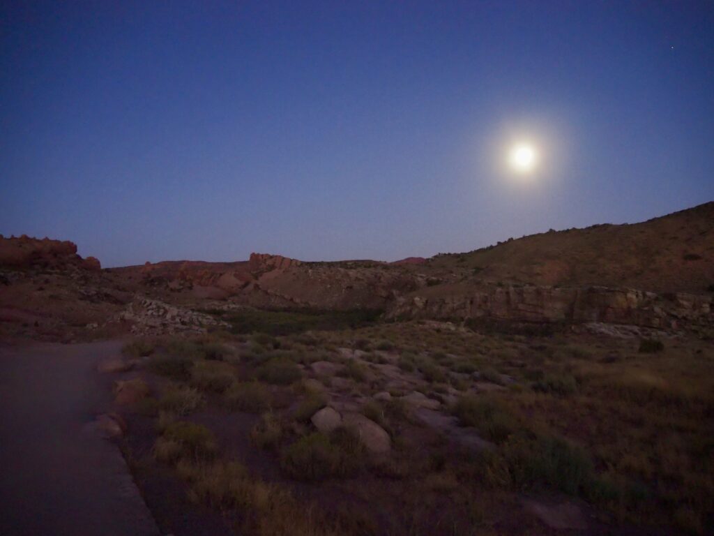
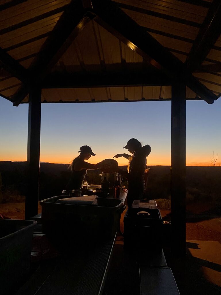
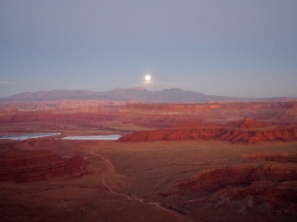
We spent some time ambling around the edges, taking in the sweeping desert vistas. The sun dropped lower, lighting the canyon in deep orange and making shadows dance across it. However, I think the best part for me came just after the sun went down. We’d started wandering back to the parking spot, where a few group members had already started cooking dinner. I wasn’t being lazy, it was their turn on the rota! Anyways, as we got back, another member alerted us to an astonishing sight. The moon, still reasonably full, was perfectly aligned between two mountain tops. Racing back to the other side to capture it, the canyon below had also turned into a sea of dusky pink and purple, bathed in the cool moonlight. This might have been one of the more memorable sunsets!
Naturally, we ate in the dark but had torches, drinks, and conversation. After eating, we had to wash and pack everything into the van again to return to our cabins. There weren’t a lot of late nights on this trip in general since there were so many early mornings!
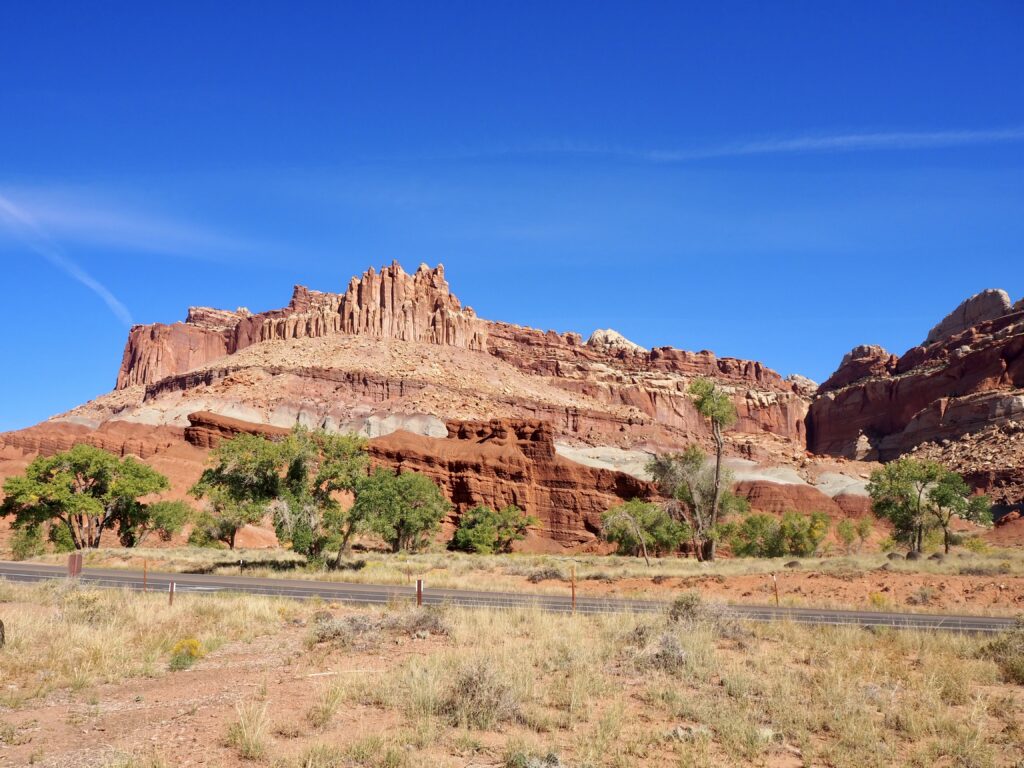
Capitol Reef National Park
Fruita
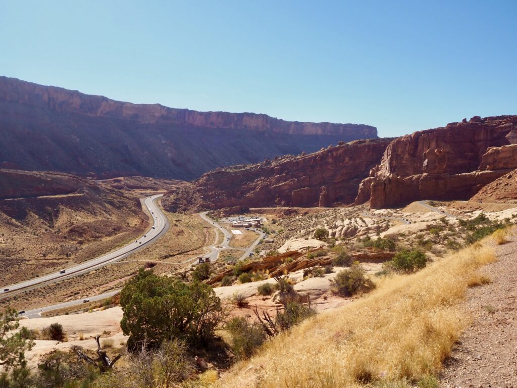
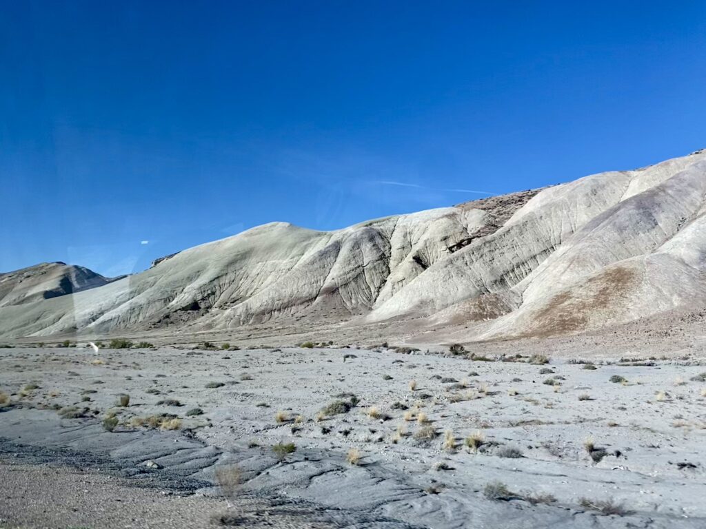
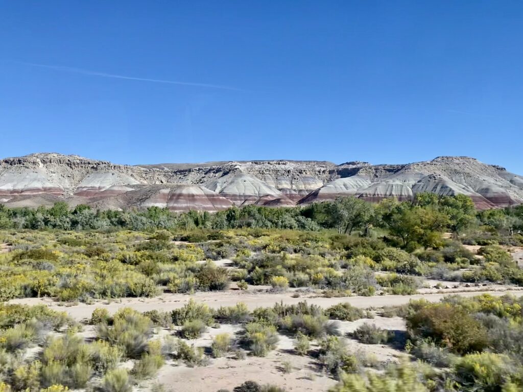
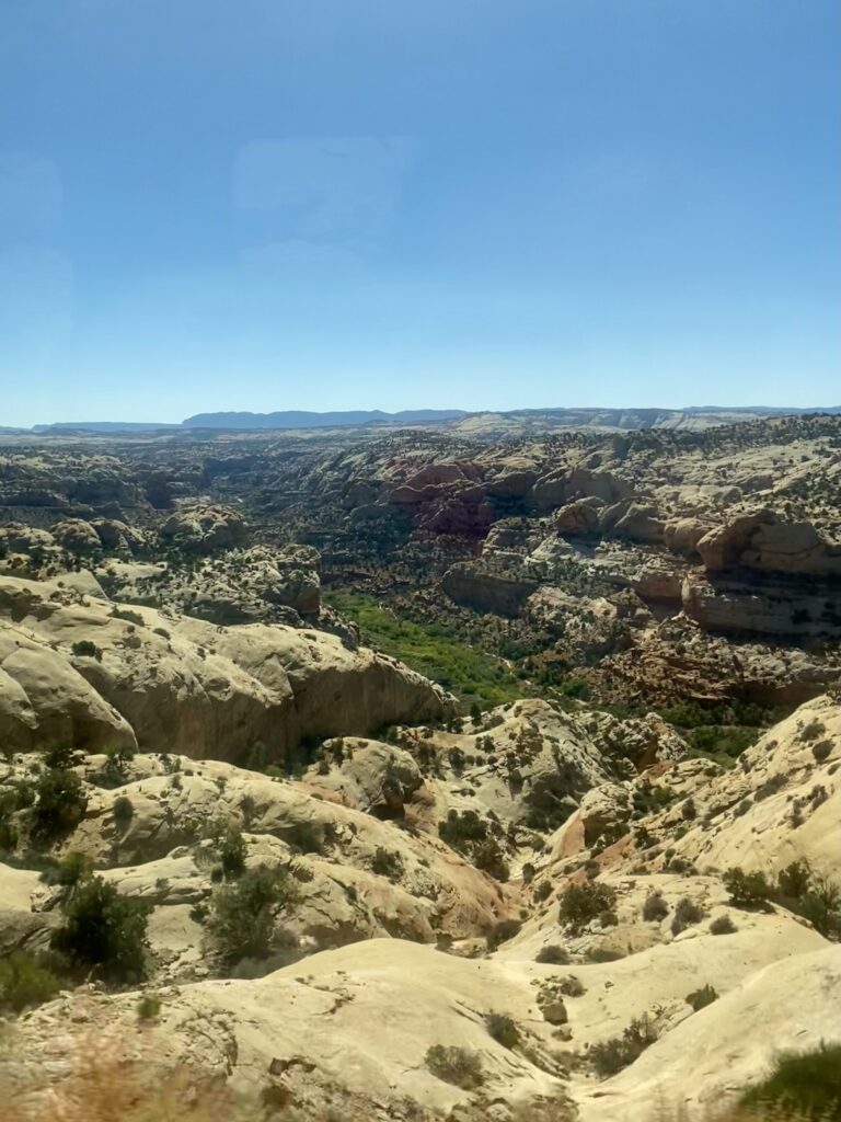
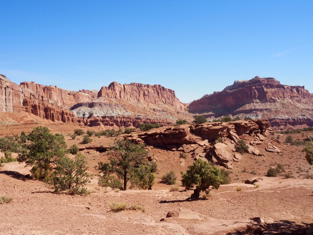
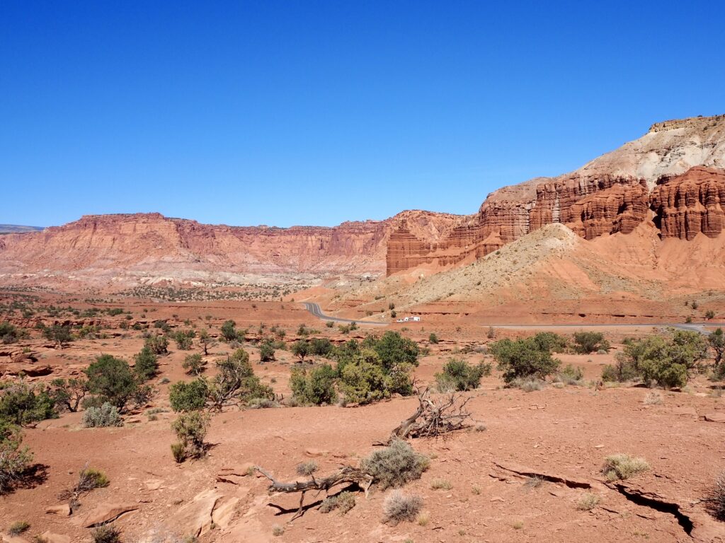
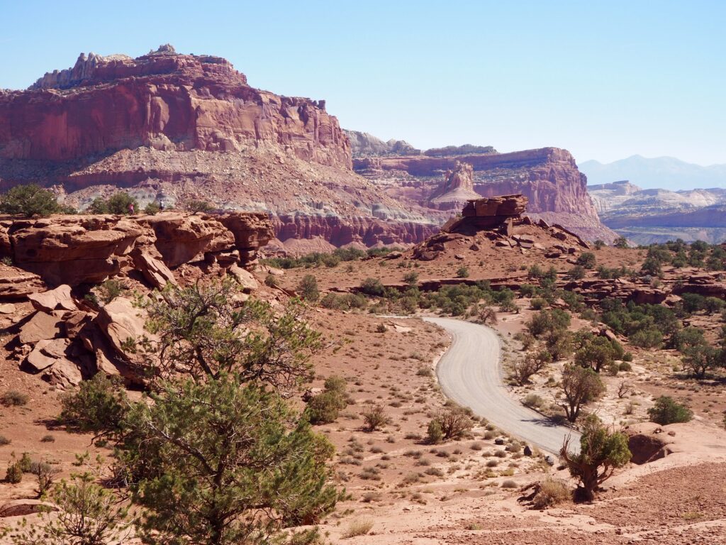
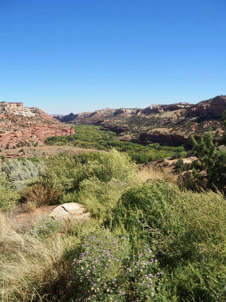
Departing Moab the next morning, we began our journey back west, skirting to the north of our loop this time. Our destination was Bryce Canyon, but the route took us through another of Utah’s National Parks first, Capitol Reef. There’s a road that cuts through it from end to end, so it wasn’t even a detour! I’d definitely recommend factoring in time to stop if you’re making the same drive. The landscape changed again before our eyes as we drove, the rocks becoming long, snaking formations and taking on tints of blue and green. As well as more green appearing in the land again, as trees blossomed out of the desert.
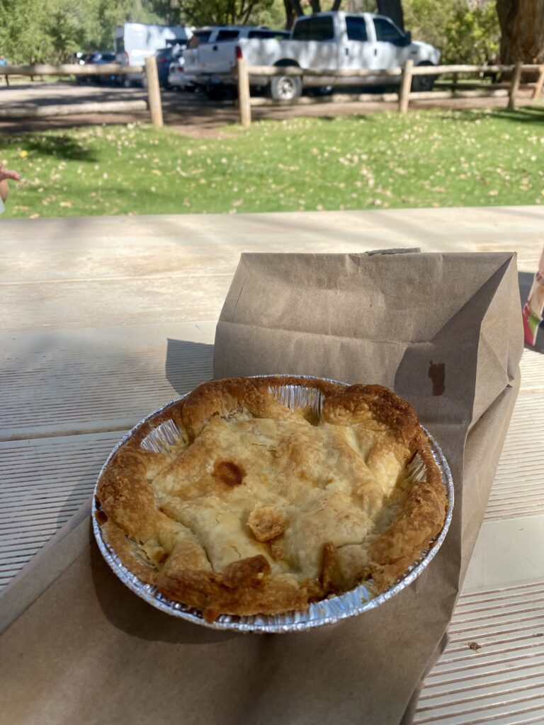
Our first stop was the Visitor Centre, for a quick look around the exhibits and to check out the view of Navajo Dome across the road. There are a few popular sites near here, like the Natural Bridge and Petroglyph Panels, but the parking was all full up. Instead, we drive down the back road to the Fruita campsite for our lunch stop. Capitol Reef has many orchards, which are not a natural feature, but the Park keeps them for their cultural and historic significance (Mormon settlers planted them!). Sitting under the shade of all these green trees was quite a change from the last few days. We wandered into the village of Fruita as well, with its small, old-fashioned buildings. Here, we made a beeline for the shop, which sells freshly baked fruit pies from the orchards. A delicious desert for after lunch!
Panorama Point
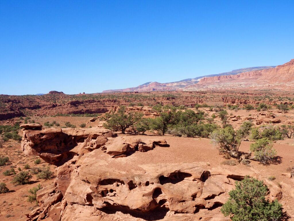
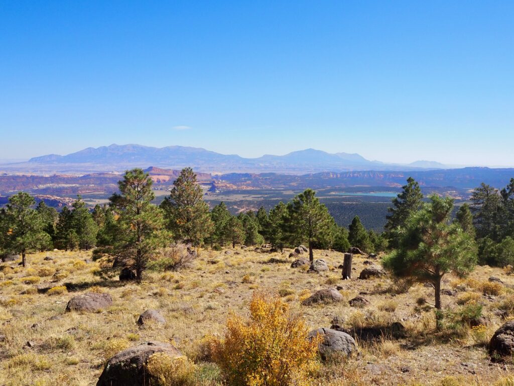
A little further along the road, we stopped at Panorama Point for a short walk. It’s hardly really a hike, as you barely have to leave your vehicle to see the view. The park opens up on either side, a long valley stretching into the distance, surrounded by low domes and mountains. The road slithers through it all, winding lazily along the valley floor. I don’t think there’s been a bad viewpoint or landscape on this trip really. And Panorama Point was no different!
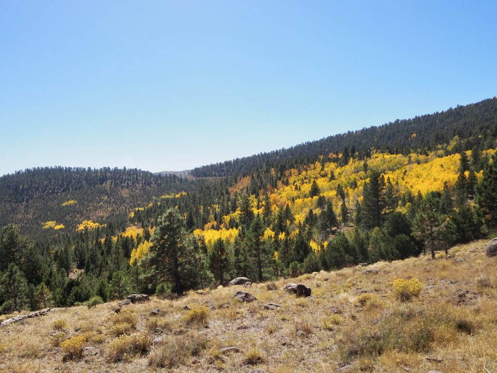
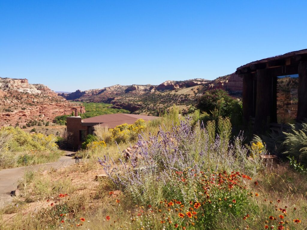
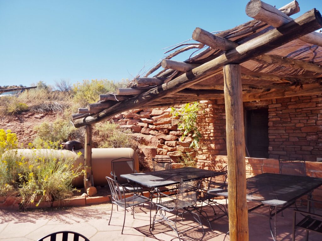
It didn’t end there, either. As we left Capitol Reef, we started to ascend dramatically, scaling roads that curved up mountainsides. We found ourselves in a rich forest, turning yellow in the early autumn already and glowing in the sun. We stopped briefly at some viewpoints, astounded at how the red, rocky desert had transformed into tree-covered mountains. Our last stop before Bryce Canyon was Kiva Coffehouse. Nestled up in the mountains and designed to blend in with the landscape, this rustic little building has the most stunning view over the deep, green valleys below. Wildflowers buzzing with insect life surround it, and of course, they serve delicious drinks and snack to enjoy while taking in the view.
Bryce Canyon National Park
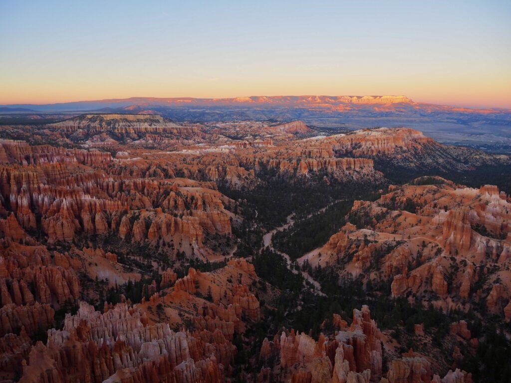
Sunset at Inspiration Point
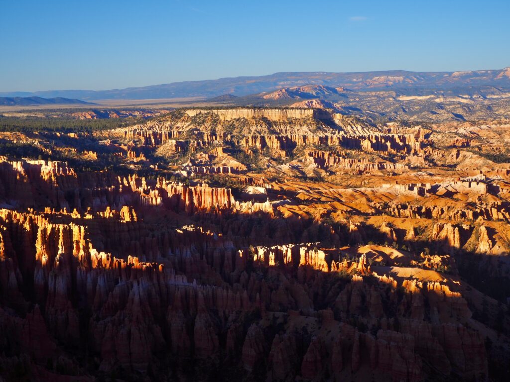
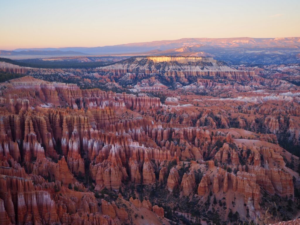
We eventually pulled into our campsite for the night, just outside the Bryce Canyon park gates. Quickly setting up camp, we then hurried into the park in time for – you guessed it – another sunset! There were so many on this trip, but each landscape offered a new, breathtaking sight. There is a place called “Sunset Point” overlooking the canyon, but we followed our tour leader’s wisdom to Inspiration Point instead.
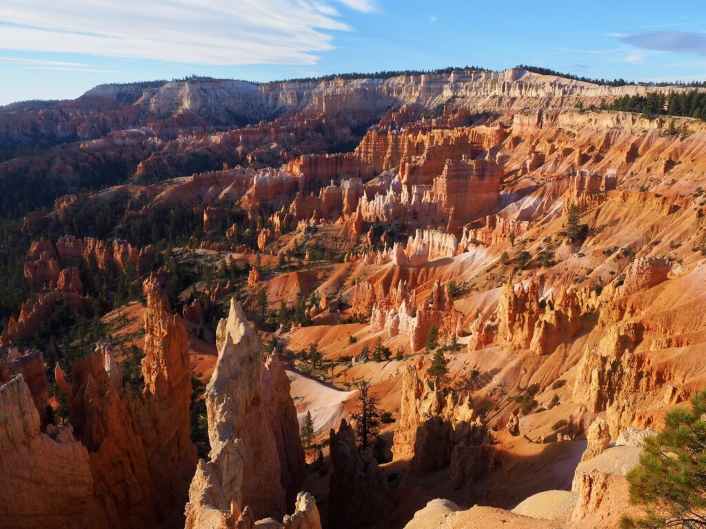
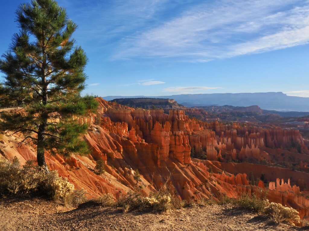
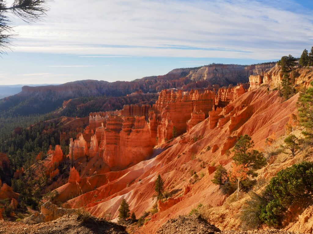
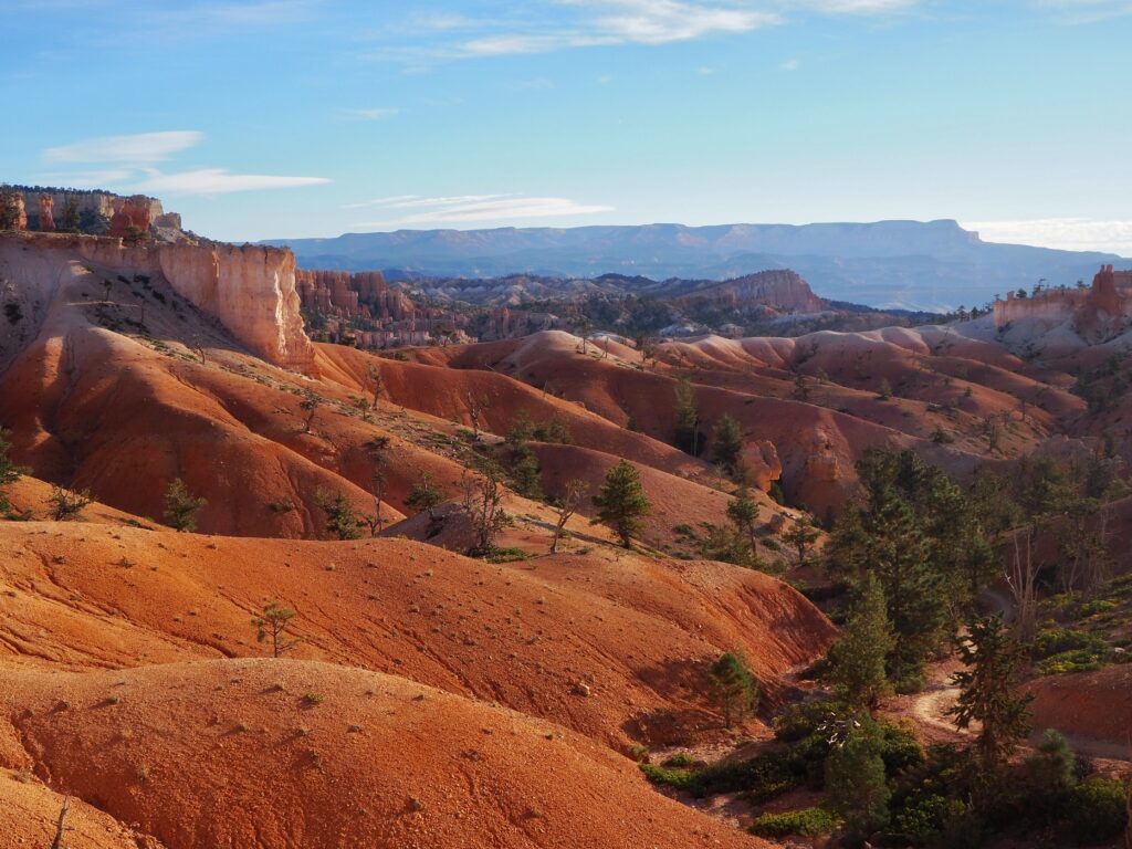
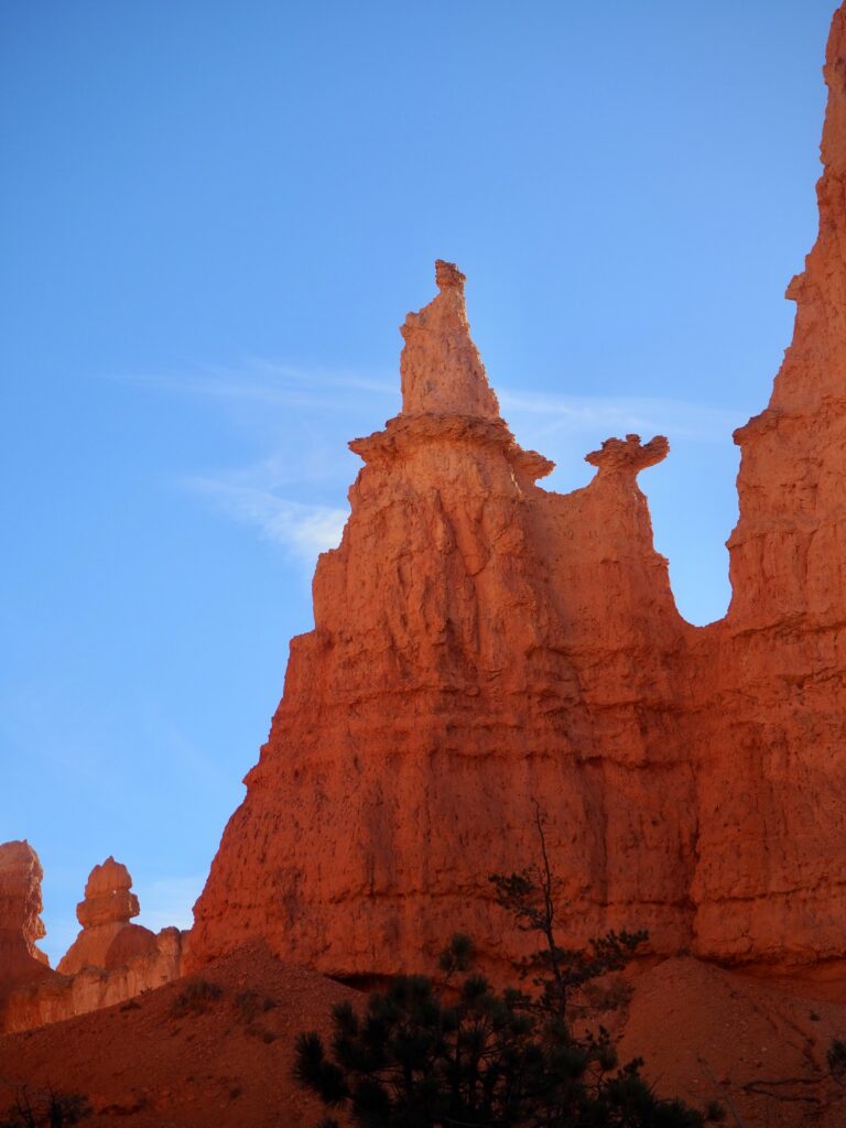
While named ‘canyon’, Bryce is really more like an amphitheatre. A rim trail curves around the back of it, and the floor opens up to stretch out to the horizon on the last side. The key rock formations in Bryce are the hoodoos. Once arches, they’ve long since lost their tops, and now tall spires remain. Hundreds upon hundreds of them, filling up the amphitheatre floor like fairytale turrets or a forest of stone growing beneath. Again, yet another new and unique formation within this (relatively) small loop of Utah’s national parks!
The sun was setting behind us, so the colours didn’t last quite as long since the amphitheatre wall cast them in shadow pretty quickly. The moments just after sunset, as dusk fell and the horizon turned pink, actually offered better colours, as everything was cast in even light again. But darkness soon came, and we left the park again for the evening.
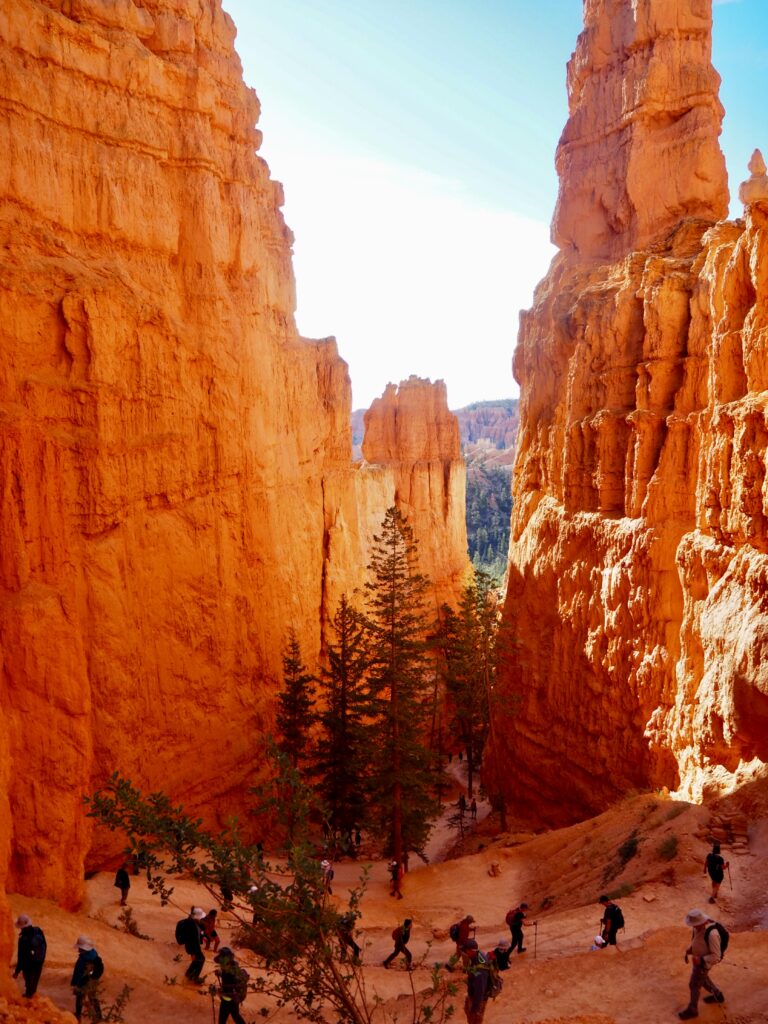
Queen’s Garden & Navajo Loop Hike
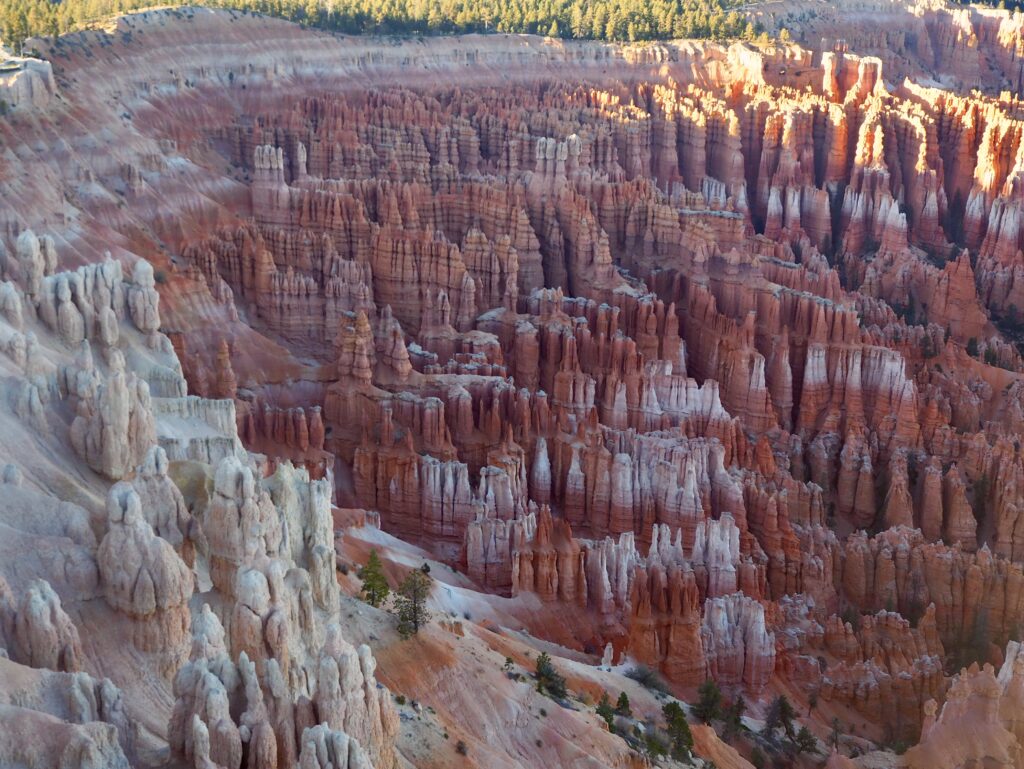
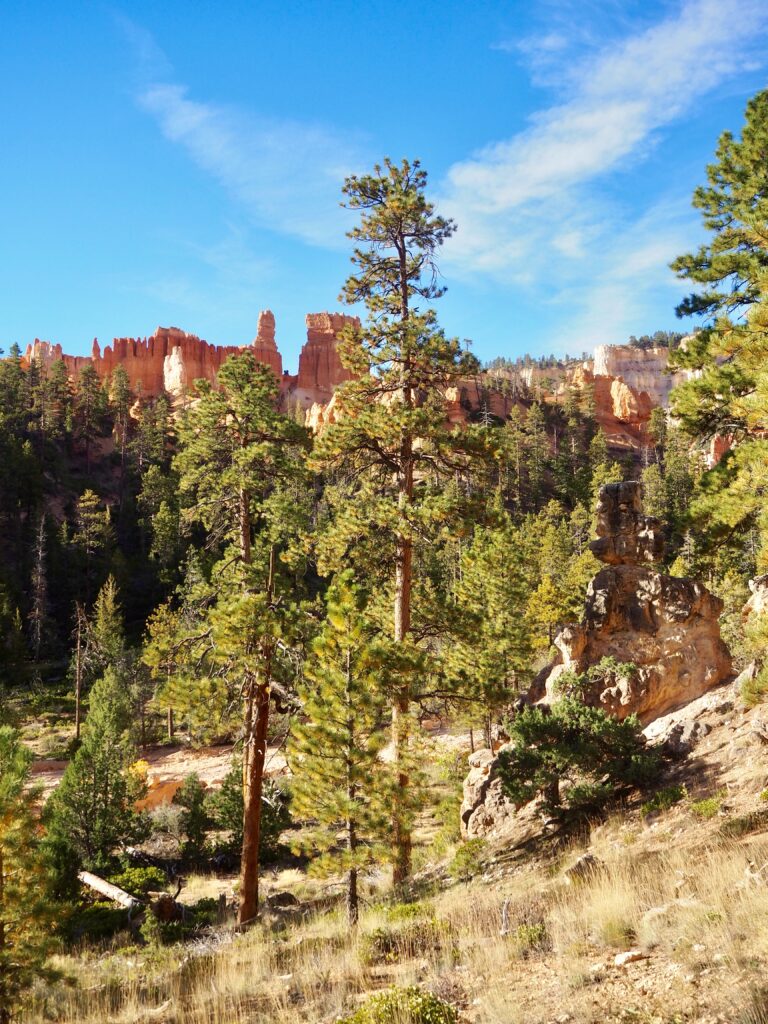
The next morning, we headed back into the park, where a few of us opted to tackle a hike down into the canyon. Starting at Sunset Point, we first followed the rim to Sunrise Point, taking in more amphitheatre views. It was early enough still that the colours were still a dark, burnt orange in the light. We descended into the canyon on the Queen’s Garden route, which would link up with the Navajo Loop to return us to Sunrise Point. Obviously, there’s a downhill followed by back uphill, but it wasn’t particularly far down. I think it took us about an hour and a half or so. There are other, longer trails, but we only had half a day before getting back on the road to Vegas.
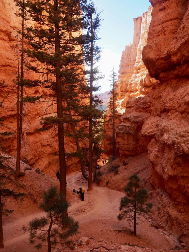
Walking down between the hoodoos was a pretty magical hike though, as it feels like you’re in some otherwordly landscape. Like, this could be something out of a fairytale realm. More orange and less green – aren’t fairytales usually in European forests? – although there are many trees interspersed with the rocks! But there was just something very whimsical and fun about the hoodoos. A few arches are still intact and the trail takes you straight through them. The Queen’s Garden is so-named because of a particular hoodoo that resembles Queen Victoria. It took us a moment to spot it, but once we did, we saw the similarity to her profile straight away! The final leg of the hike was a series of sharp switchbacks wedged between two steep walls, which creates quite the view when you look back down behind you.
Visitor Centre
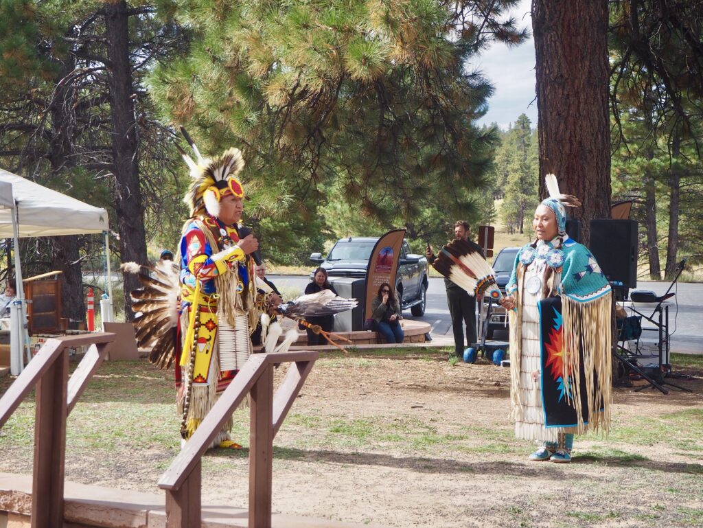
After we reached the rim again, we had a little more time spare so we caught a shuttle bus to the visitor centre. Like most others we’d visited, this one had some exhibits on the geology and local wildlife. There was also an Indigenous showcase taking place that day, with stalls outside and a dance performance. We watched outside, until our tour leader swung in to pick us up and leave Bryce Canyon behind. A short visit, but it is the smallest of the parks we went to!
Utah’s National Parks
And with that, our journey took us back to Vegas, concluding our loop through Utah’s National Parks. Not concluding our whole trip though, as we still had the second leg in Yosemite to come! It’s kind of crazy to look back at just how much we squeezed into a week. It was busy, but we absolutely made the most of our time in Utah! And it’s also incredible just how much variation there was between each of the parks, and learning about how they each formed. I’ve said it a few times already, but each landscape was different and unique and stunningly beautiful! I’m still a water child at heart, but I’ve certainly developed a new soft spot for these remarkable deserts.