A Week in Northland | New Zealand
After several long weekend trips around New Zealand’s North Island, including Tauranga, Taupō and Taranaki, my next adventure took me further and for longer. Trying to escape the impending winter weather in Wellington, I headed as far north as I could, to the appropriately named Northland. This is the region at the very top of the North Island, above Auckland. I flew in and out of Auckland, rented a car, and spent 10 days road tripping around the region. I was working remotely for a few days, so I had about a week in Northland to fully explore. And I certainly covered a lot of distance along the way!
Day One – West Coast
The Long Drive
After an evening flight to Auckland and staying overnight by the airport, I picked up my rental car first thing the next morning and hit the road. I managed to navigate the highways out of Auckland, avoiding the toll road, and headed northwest. The east side of Northland is the more frequented route, up the SH1. I’d seen many online itineraries for Northland road trips that stuck to that side only, but a few incorporated the lesser-visited west side. I thought it would be more interesting to take a different road each way, so west I went up Highway 16. My entire route for the week followed the Twin Coast Discovery Highway, a scenic tourist route through the region.
There weren’t many particular points of interest for the first few hours. I briefly rejoined the SH1 at Wellsford, where I stopped off for a bathroom and coffee break. The SH1 was actually closed in a few places, which fortunately didn’t affect my route too much. I left it again to join Highway 12, stopping again in Dargaville to pick up some groceries and lunch. I took a quick stroll along the riverside to stretch my legs, though the murky brown water wasn’t the most scenic. This was a big driving day, and while the USA got me used to long drives, it’s still not my favourite activity!
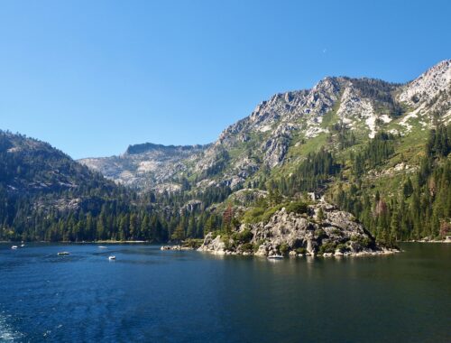
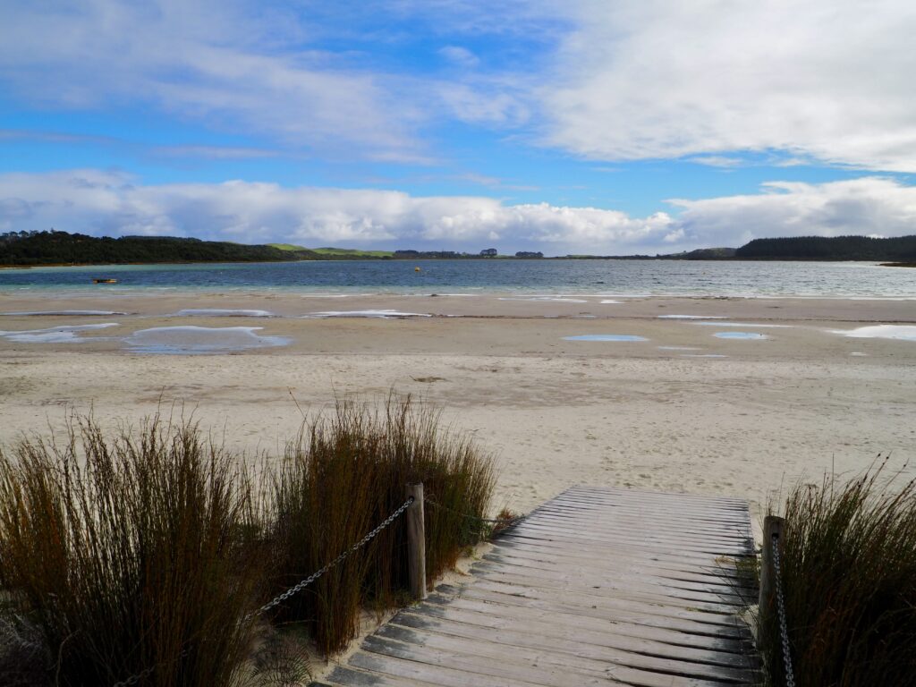
Kai Iwi Lakes
I finally turned off for my first bit of sightseeing today, heading to Kai Iwi Lakes. The photos I’d seen online showed dazzling bright blue lakes, set amongst lush green scenery. And I’m sure they do look like that sometimes, but unfortunately, the weather turned grey and wet as I approached. By the time I parked, it was pouring, so I ate lunch in the car and waited to see if it would clear.
I managed to hop out during a dry spell for a walk along the beach on the shore of the largest of the three lakes. The overcast skies meant it wasn’t looking its bluest, but I could see hints of the colour. I got a better glimpse of it on my way out again, pulling over at a viewpoint to look down on the lake from above. It was a shame the weather wasn’t on my side, but some things just can’t be controlled, of course.
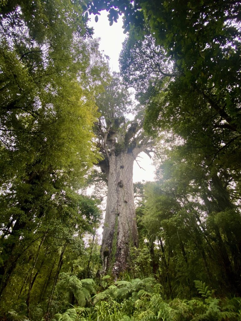
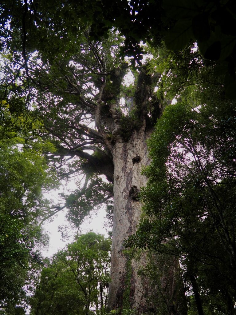
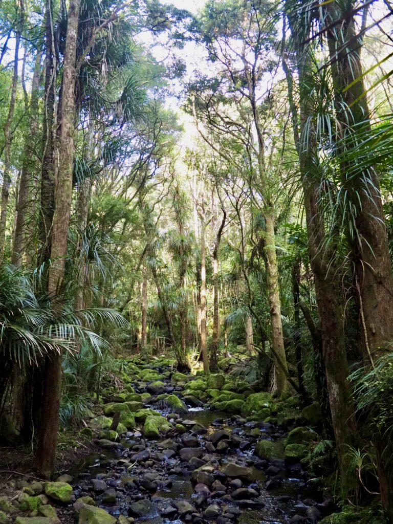
Tāne Mahuta Tree
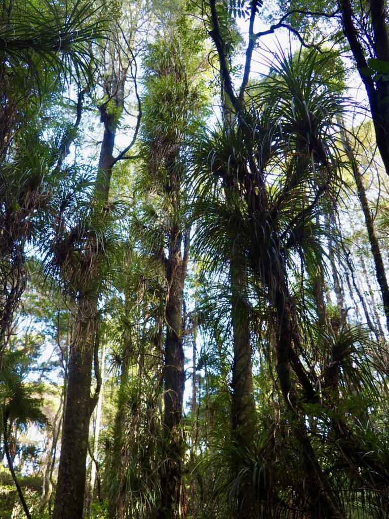
The next stretch of road took me through Waipoua Kauri Forest, which wasn’t my favourite part of the drive. New Zealand’s highways aren’t all large, wide, straight roads; here, the Highway 12 turned narrow and winding, with endless tight corners weaving through the forest. The rain had also come back, even heavier, and it took a lot of concentration here. I encountered several other similar roads later in the week, but none in such wet weather. It was torrential when I pulled into the road-side parking spots and yet again, I waited in the car for a break in the rain.
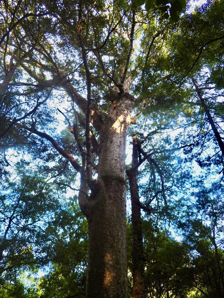
Eventually, I darted out and across the road, into the partial shelter provided by the kauri trees, a native coniferous New Zealand species. Providing they don’t get diseased (all too common nowadays sadly, hence the disinfectant stations as you enter the forest), they can live for centuries and grow to be massive. Tāne Mahuta is the largest of them all, the “Lord of the Forest”, believed to be up to 2,000 years old! It’s truly staggering to see, towering above the surrounding forest, as I craned my neck back to gaze up. The walk is very short and on wooden boardwalks, so it’s easy to reach and definitely worth pulling over for if you’re driving this way. I was breath-taken and even in the rain, it was the highlight of the day for me.
Opononi
I only had another half hour or so to drive before I finally reached my destination for the night, Opononi. Since we’re heading into winter here, the days are getting shorter and sunset was around 5-5.30pm in Northland this week. I don’t like driving in the dark if I can help it, so I arrived in each new location before then. It was a little earlier when I pulled into Opononi though, so I had time for a quick walk, catching the golden hour glow in another gap in the rain. Although it was still very windy!
Opononi sits on the south shore of Hokianga Harbour, a vast natural inlet cutting into the west coast. My motel was just across the road from a small beach, which I wandered along, enjoying the golden hour lighting. The inlet is massive, stretching far off into the horizon! Opononi’s main attraction is the Manea Footprints of Kupe, a cultural centre telling the story of Kupe, the Polynesian navigator who first discovered Aotearoa (New Zealand). It was already closed when I arrived of course, and I left too early the next morning for an equally big driving day, so I had to skip this one. I headed back to the motel to make dinner and relax for the night, listening to wind and rain howling outside!
Day Two – Cape Reinga
Ahipara & Ninety Mile Beach
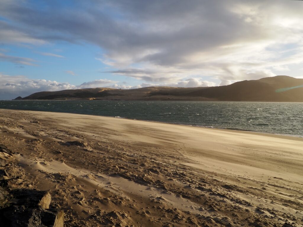
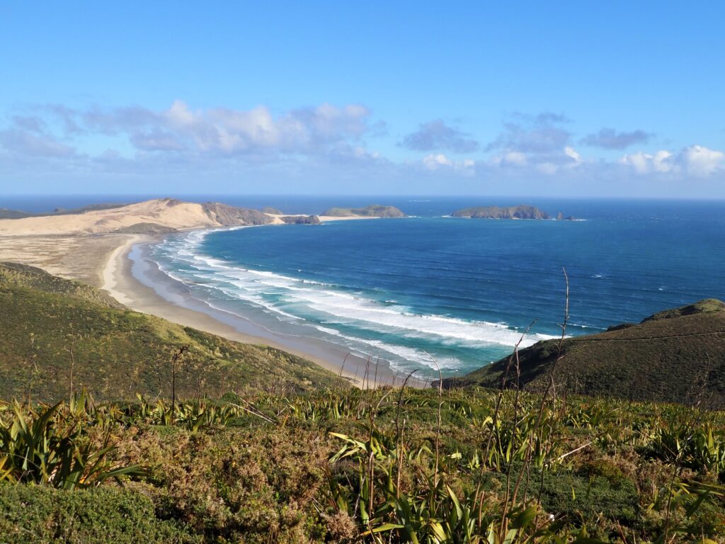
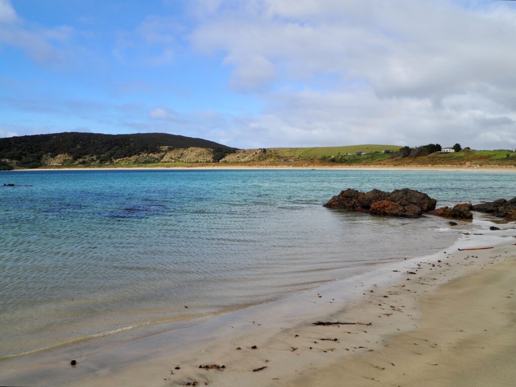
The next morning was just as wet, as I continued my drive bright and early. This was a big day, starting with the 2-hour journey to Ahipara. This wasn’t my original plan, which was to rejoin the SH1 and go straight up through Kaitai. But the road closure forced me west to Ahipara, which is actually the Twin Coast Discovery route. Although I could have lived without the random 20-minute stretch of gravel road halfway along!
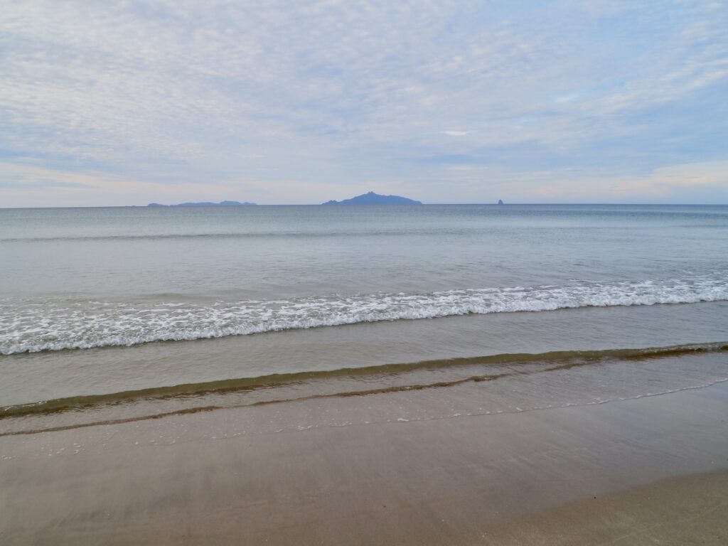
It worked out well though, when I realised that Ahipara is the start of Ninety Mile Beach. My brother had told me about this and most people visit it on the way to or from Cape Reinga, up that narrow peninsula. But it has limited access points, and adds at least an extra 30-40 minutes on to that journey, so I wasn’t sure about even more driving. So, Ahipara ended up being the perfect place to stop instead!
I grabbed a coffee, then found a parking bay next to the beach. The rain had stopped, though it was still windy and overcast, but I took a walk along the beach and back again. Not all 90 miles obviously! The cool thing about stopping in Ahipara is that the curve of the coast allows you to see the shore of the peninsula along the horizon. It was a little hazy in this weather, but I could just make it out. And it’s pretty impressive that it’s all one beach stretching all that way!
Cape Reinga
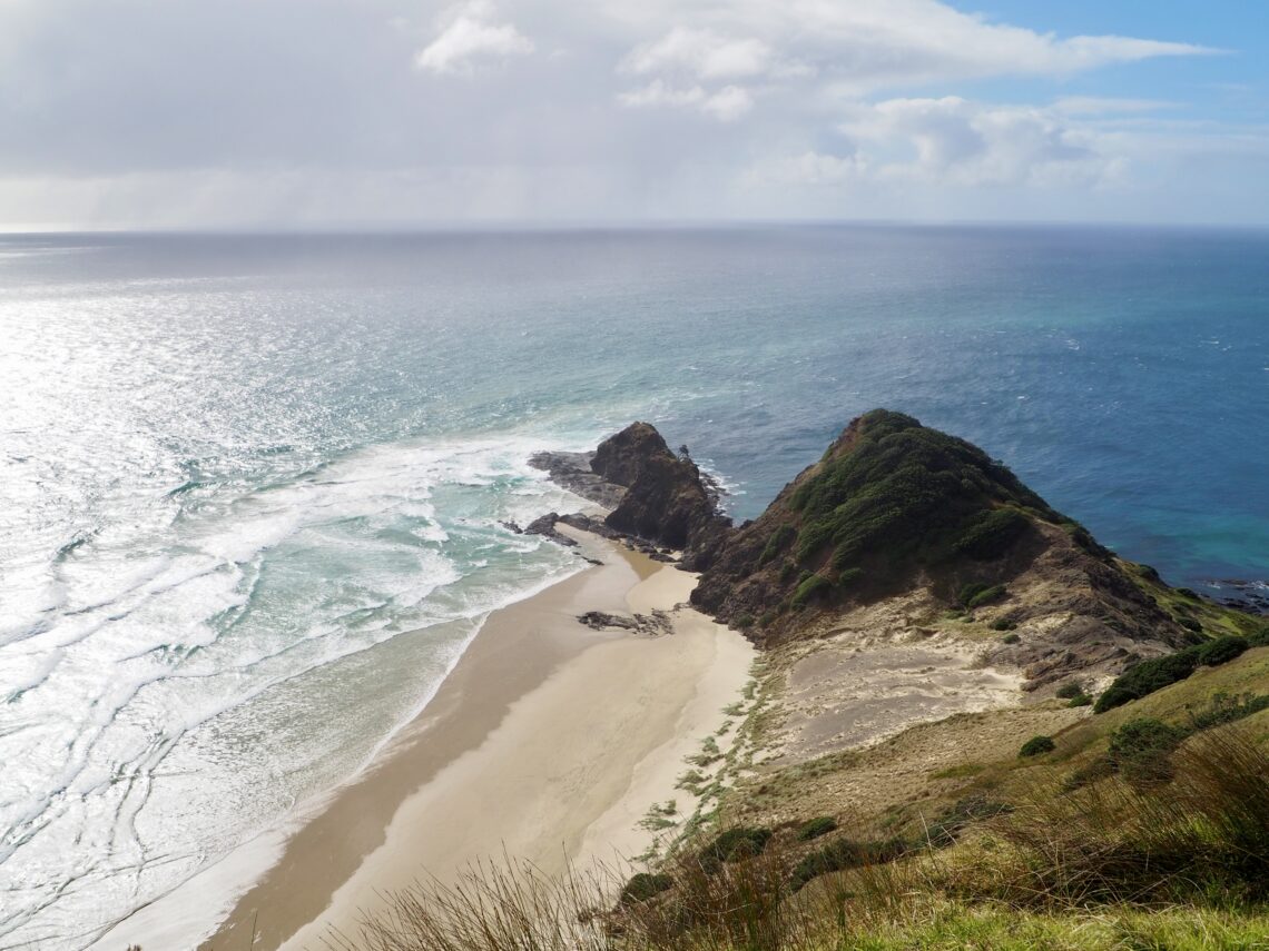
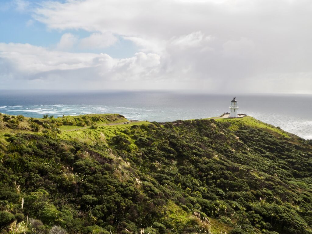
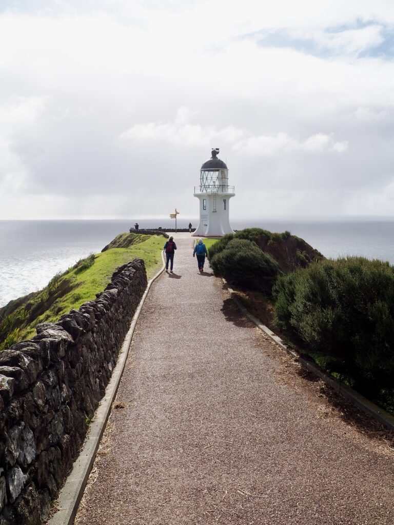
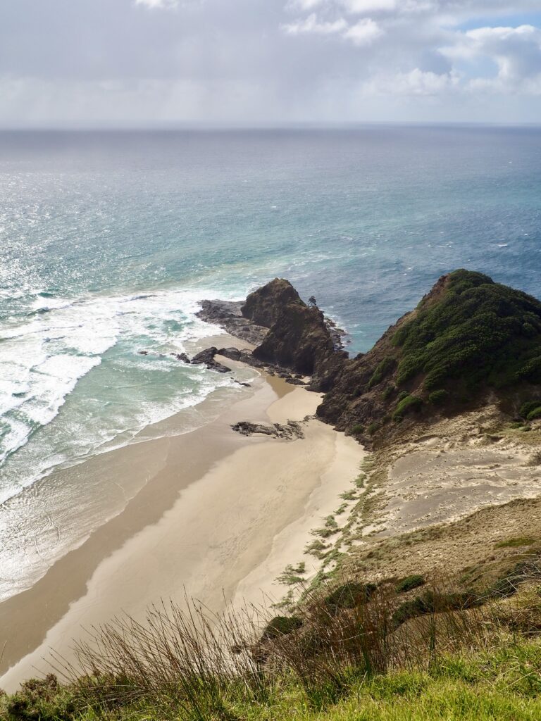
Continuing on, I drove onto the peninsula myself, heading for Cape Reinga, New Zealand’s northernmost point. The road took me over a hilly, farming landscape, with occasional glimpses of the sea. There weren’t many opportunities to pull over for the views and it started raining a few times, but it was lovely scenery overall! The car park for the Cape was pretty quiet since it’s low season – I can imagine it getting very full in the summer months. I then set out on foot along the short path towards the Cape Reinga lighthouse.
There were stunning views, the sun shining on a brilliant blue sea overlooking Te Werahi Beach to the west. I could even see Motuopao Island and its own Cape Marie Von Diemen lighthouse. As I continued on, Kapowairua or Spirits Bay came into view, a sacred place to the Māori people. This is the final spot where their souls leave Aotearoa (NZ) after they die to journey to the ancestral Polynesian homeland, Hawaiki. The bay has a gnarled, 800-year-old pōhutukawa tree clinging on to its rocks, known as the Spirit Tree. You can only access the bay on a long hike down, which I wasn’t doing, and you should behave respectfully in this sacred place in general.
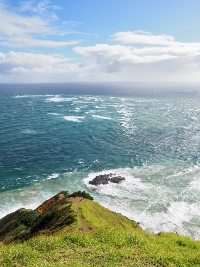
Staying on the main path, I reached the bright, white Cape Reinga lighthouse, atop the cliff. On my other side, a line of white foam cut through the sea. This is where the Tasman Sea meets the Pacific Ocean, their opposing current causing waves to crash into each other. It was fascinating to observe such a clear divide between them! The whole walk was pretty short in general, relative to the driving distance, but it was a really interesting and beautifully wild, rugged place to explore
Kaitaia
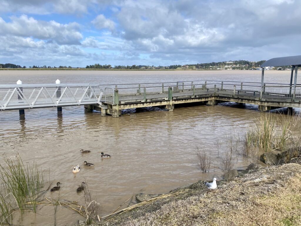
Once I’d soaked in the views from the very north of New Zealand, there was only one way to go; south. I retraced the road back down the peninsula, which took about an hour and a half to reach Kaitaia. After so much driving over the past few days, I was pretty exhausted! I arrived in the late afternoon and went out again just long enough to pick up food and see the town. It’s pretty small overall, with one main street of shops and businesses. The Awanui river flows through the town and in the morning, I went for a walk to Mathews Park and partway along its banks. The path turned overgrown with tall, damp grass after a while though, so I didn’t get very far. There’s not much to see or do in Kaitaia itself, but it’s a convenient overnight stop on a Northland road trip.
Day Three – Karikari Peninsula & Kerikeri
Maitai Bay
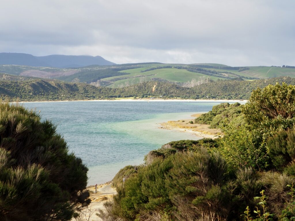
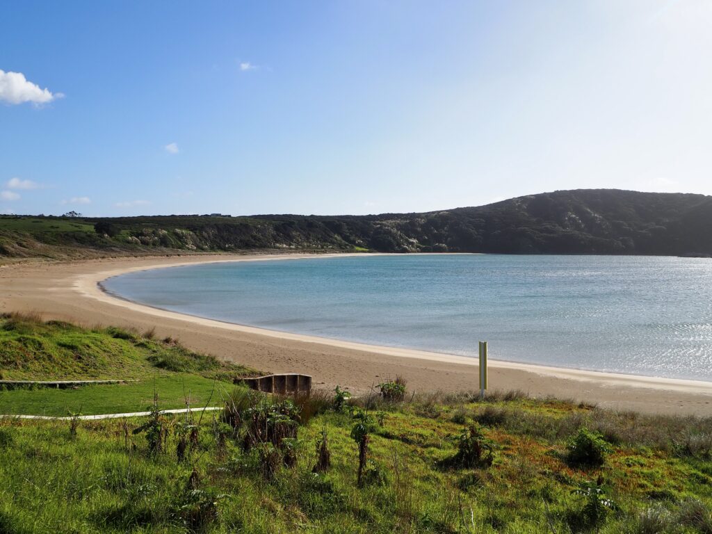
Departing Kaitaia, the next leg of my journey took me east. I detoured slightly on to the Karikari Peninsula, which I’d read has some stunning beaches. Some of them seem to be difficult to access, down gravel tracks or leaving your car by the roadside and hiking. Instead, I followed the road almost to its end, including a short gravel stretch, before turning off for Maitai Bay. There’s a campsite here, so the road is paved again and you can stop in as a day visitor for free.
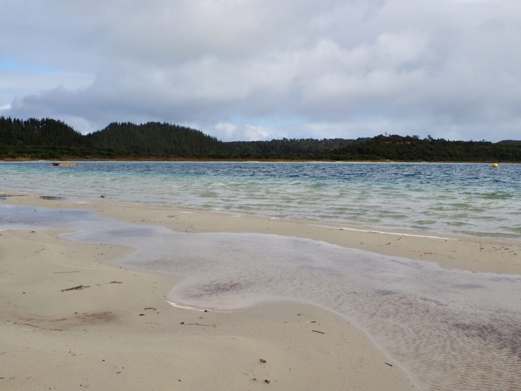
I almost had the beach to myself! The sun was out, treating me to bright blue water, surrounded by perfect white sand nestled in the green landscape. A picture-perfect sight! And the solitude made it all the more idyllic and untouched, like many of New Zealand’s wild, remote landscapes. It was too cold for swimming or sunbathing at this time of year, but I took a leisurely walk along the beach. A small headland separates Maitai Bay from the neighbouring Waikato Bay, taking only 5 minutes to cross. Waikato is a larger bay, the coast stretching almost all the way around its pale blue water. I didn’t make it as far along this one, as the rain returned again. Instead, I beat a hasty retreat to the car!
The original plan was to visit one more beach, with Tokerau looking like my best bet. A small village sits alongside, so it’s more accessible than many others. But when I arrived, it was pouring with rain still, wind howling down this long, straight beach. I drove on, leaving the Karikari peninsula behind. Although I made one more quick stop around Doubtless Bay, finding a viewpoint overlooking the water as the sun came out again! Then it was southward, on to Kerikeri.
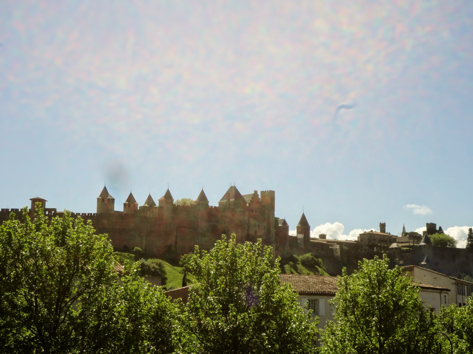
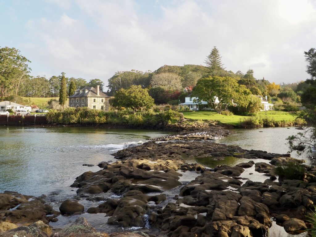
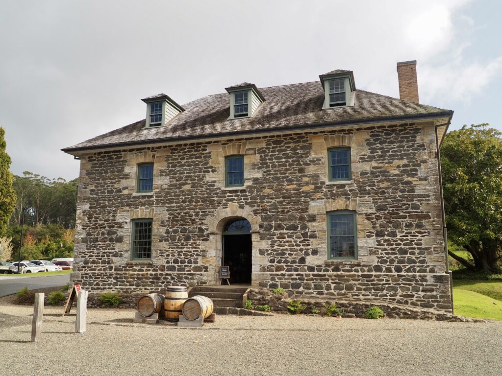
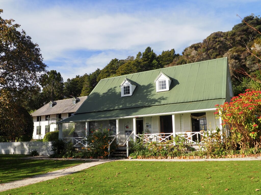
The Stone Store
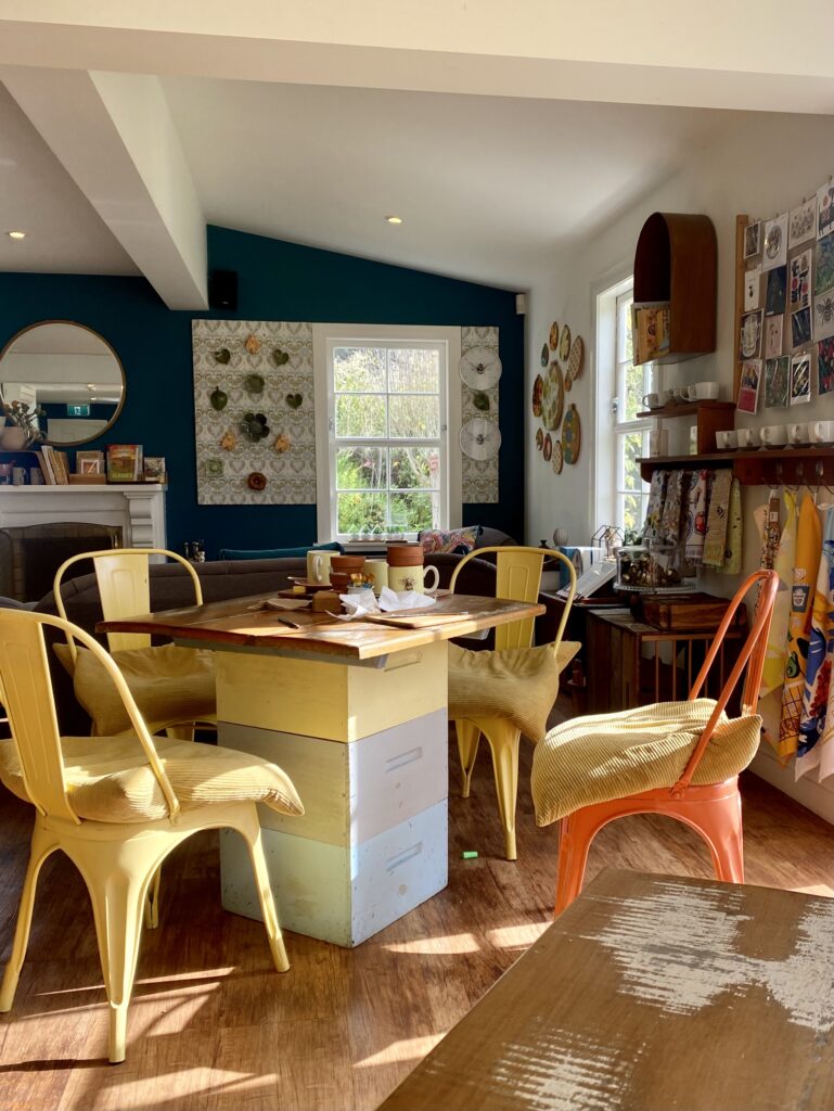
Kerikeri is the largest town in Northland and one of the oldest settled by Europeans, all the way back in 1814. The first permanent mission station was established here soon after, and Kerikeri now boasts some of the oldest buildings in all of New Zealand. These are mainly found in the town basin, by the Waipekakoura River, which was my destination. After parking on the far side of the river, I crossed the footbridge and stopped in at Honey House Cafe for lunch. It’s decorated with a bees and honey theme, which was super cute! Then right next door sits the Stone Store and the Kerikeri Mission House.
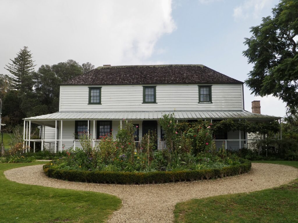
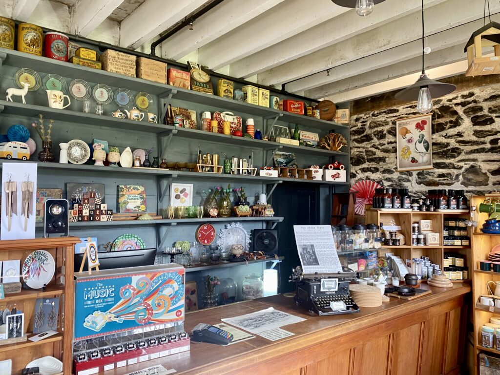
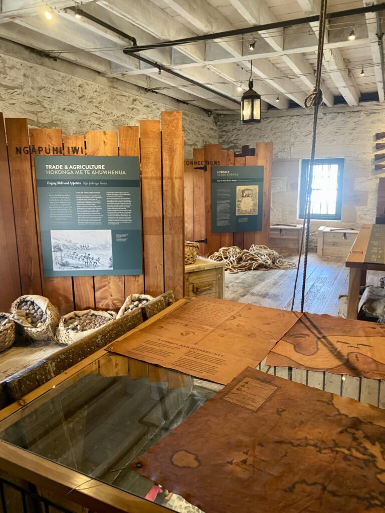
The latter, built in the 1820s and where the first missionary family lived, has to be visited on a guided tour and in your socks to protect the floor! I skipped this, in the interest of time, and headed to the Stone Store. It’s the oldest shop in New Zealand, dating from the 1830s. It’s worth taking a moment to admire its stonework from the outside first. Inside, the ground floor is still a shop, full of all sorts of gifts, souvenirs and handicrafts for the most part. It’s absolutely crammed with goods, which I spent a while browsing! Then I paid the small entry fee to head upstairs to the museum, spread across two floors. It’s self-guided and covers the history of those early Christian settlers, which was interesting reading.
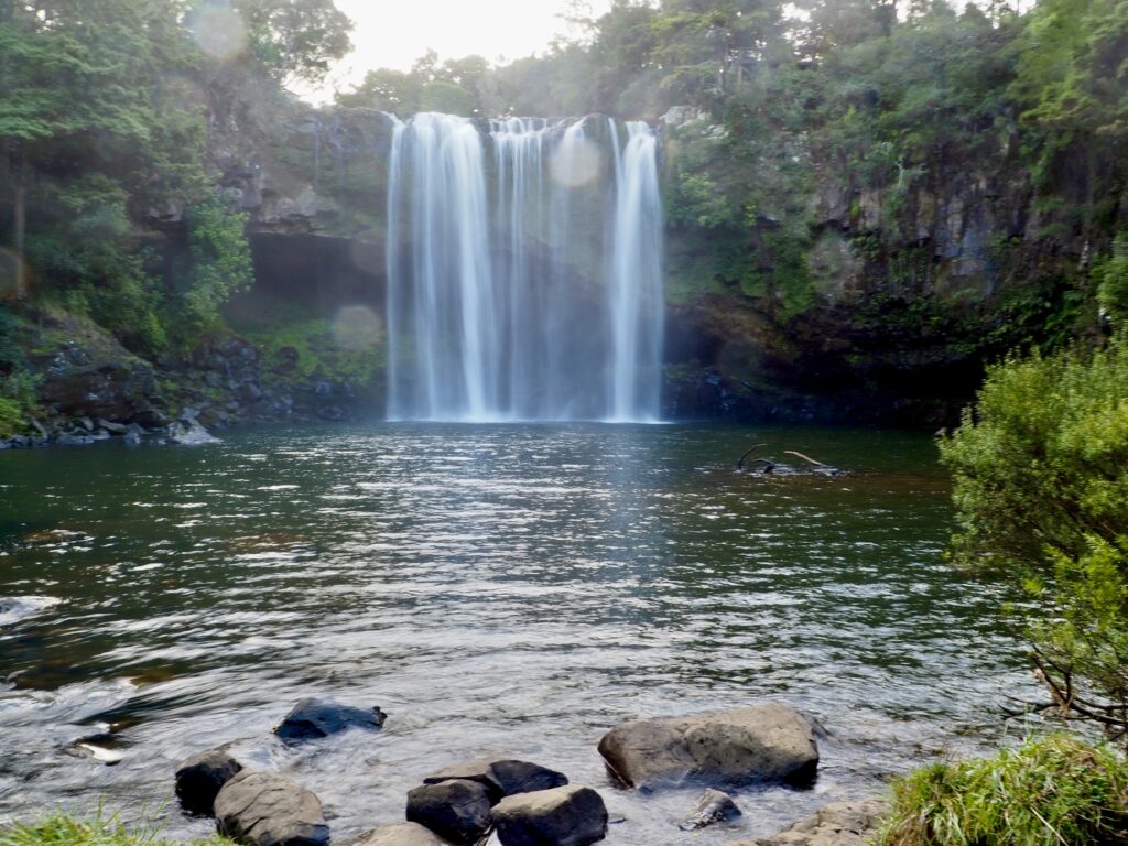
Rainbow Falls
After leaving the Stone Store, I crossed the river once more and set off on the Kerikeri River Track. This walk takes about 45 minutes to an hour in each direction, linking the Town Basin to Rainbow Falls. It’s a mostly flat trail, following the riverside as it winds through the forest. I passed a few other people on the way, but it was fairly quiet and peaceful overall. About halfway along sits Wharepoke Falls, a low and wide waterfall stretching across the river.
Rainbow Falls is a higher drop off a cliff face, tumbling into a large pool below. Since it was afternoon, and the days are short at this time of year, the sun was low and almost behind the falls. Not ideal lighting for photos and no rainbows, but I still sat and admired the view for a few minutes. I could even feel a light spray on my skin, despite how far away the waterfall was! Once I’d enjoyed my break enough, I retraced my route back through the forest to the car park. I drove out of Kerikeri along its main street, peeking at the shops along the way. They looked pretty cute, but similar to many other small towns in NZ. And I was getting tired so I drove onwards for my final half hour stretch to Paihia, my base for the next few nights.
Day Four – Bay of Islands
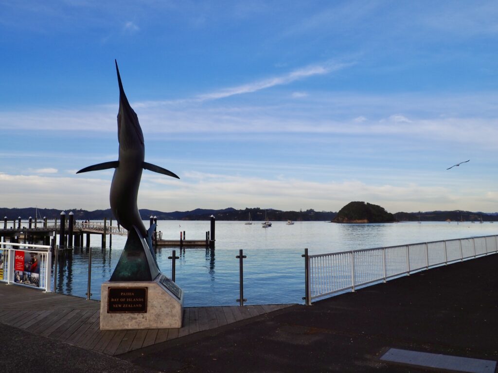
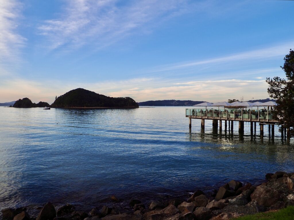
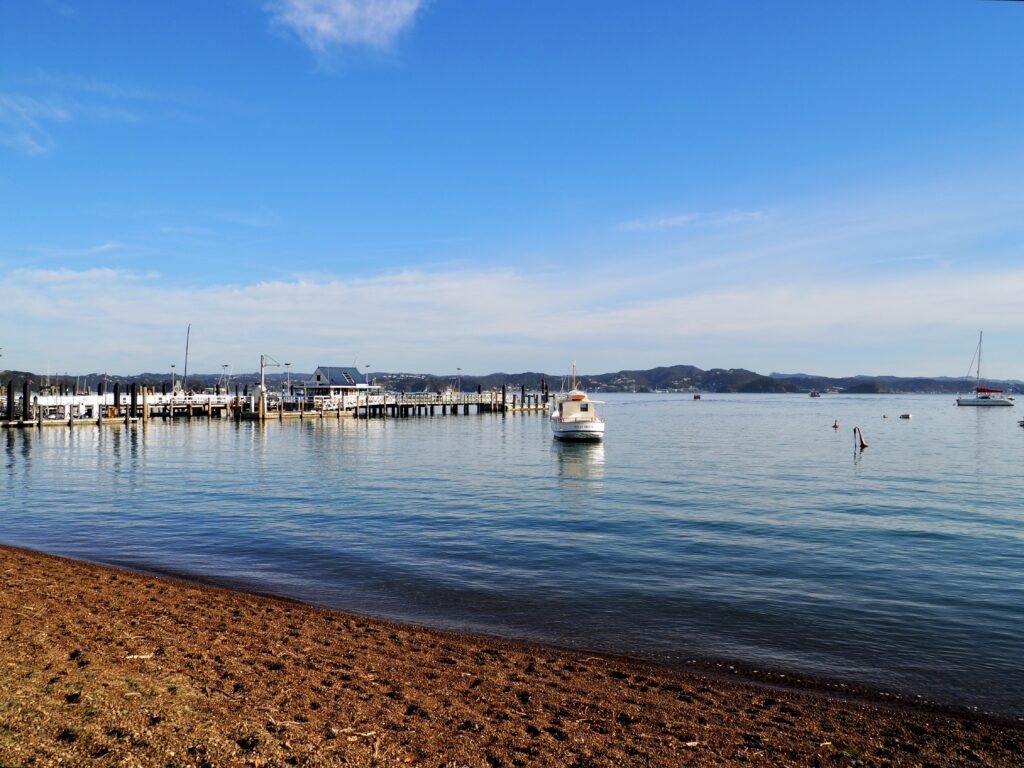
Paihia
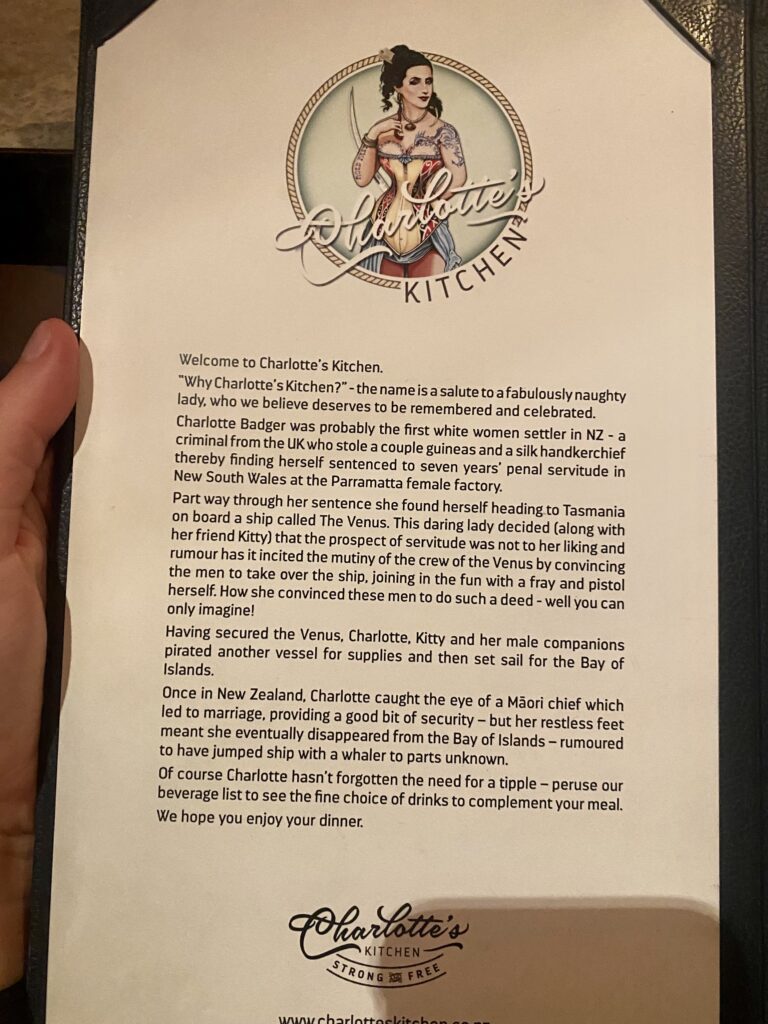
Paihia is the gateway to the Bay of Islands, a popular stop and a must-do on my week in Northland! As the name suggests, the bay is home to collection of various islands, as well as some marine wildlife. Paihia is the most accessible town and the departure point of most cruises, so it was the natural choice for my base. It’s a pretty small town, with a few shops and restaurants on the waterfront and up its main street, plus a short stretch of beach. I worked here for a couple of days, taking walks on my breaks to browse the shops. There are some good dinner options that I tried too, including Pizza Shack, CBK and Charlotte’s Kitchen, which has a fun backstory to the name.
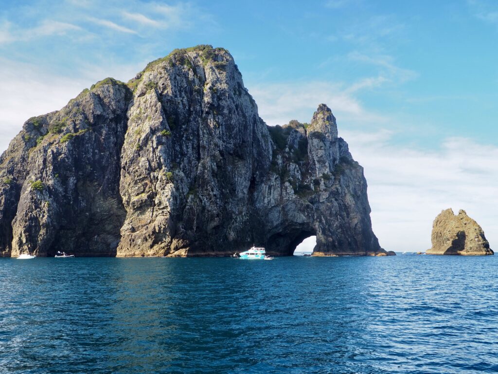
Hole in the Rock
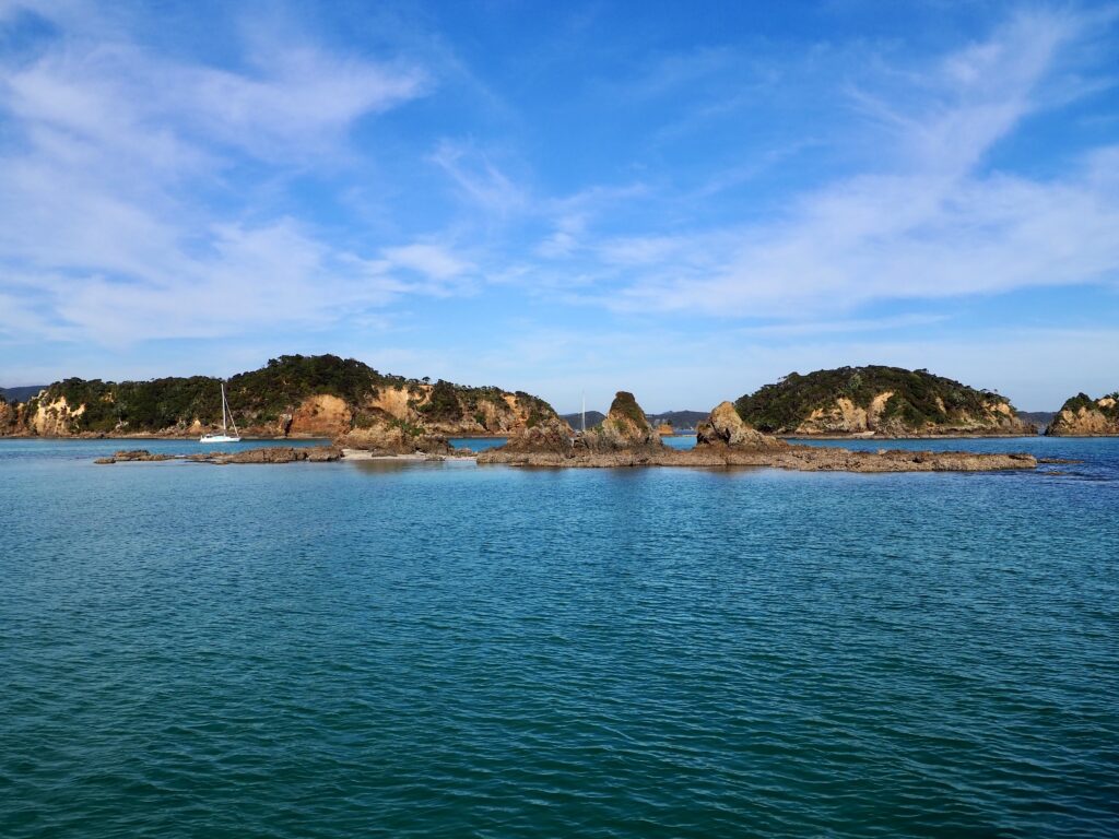
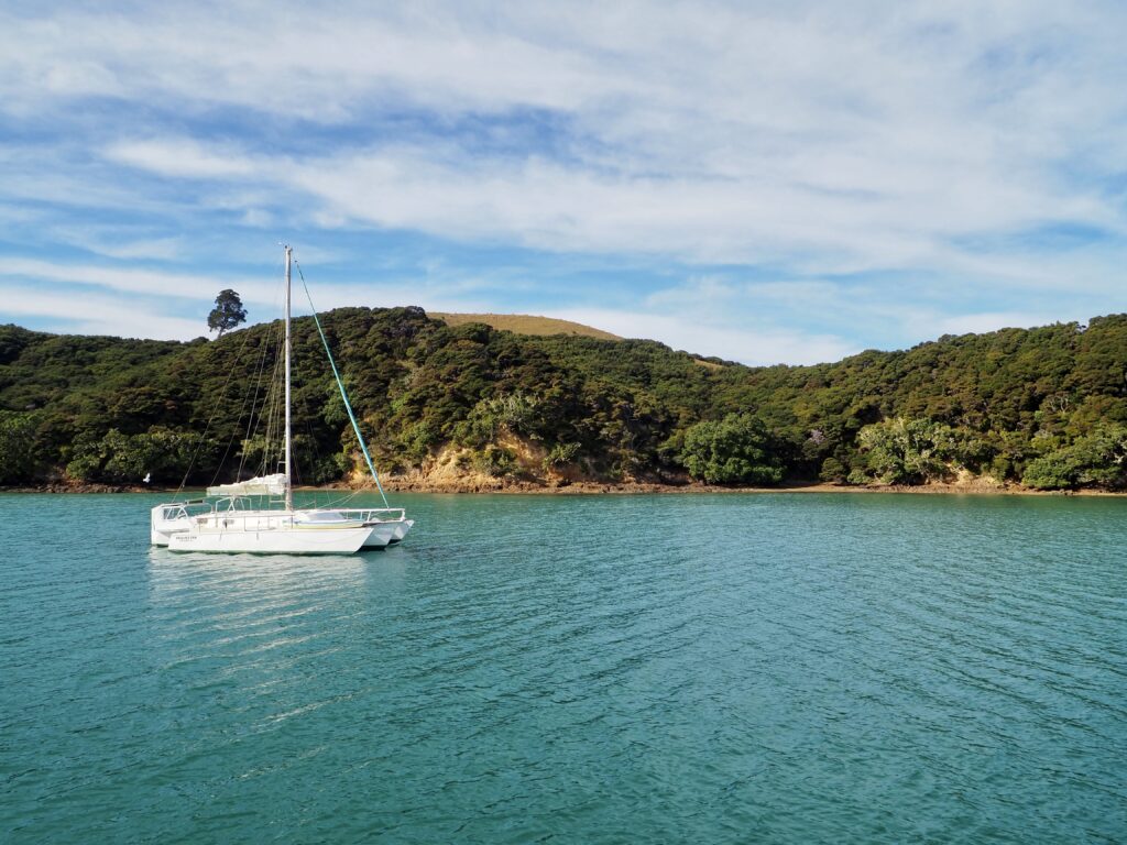
For my full day here, I got lucky with fantastically sunny weather all day! I headed out on a cruise around the bay to see some of its more well-known sights. Plus, it’s one of the best places to spot dolphins in the wild in New Zealand, so I was keeping my eyes peeled! It was a bit chilly out on the water though, so I didn’t last long on the busy, upper decks. Instead I chose a spot near the front of the indoor lower deck, where I could step out onto the bow every so often to take photos.
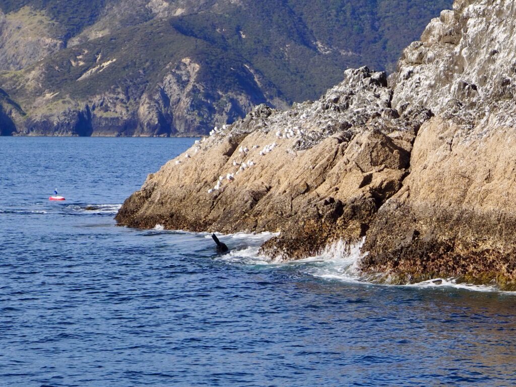
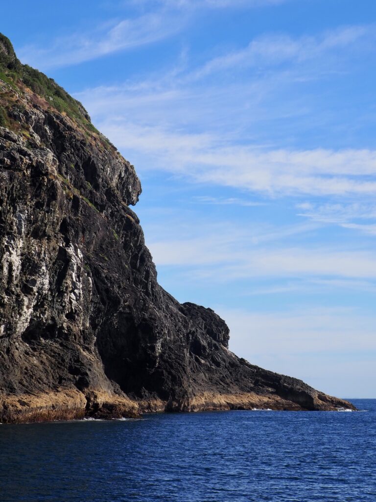
We cruised through the bay, with the skipper providing commentary about the area and its many islands over the speaker system. It was very relaxing just sailing along and enjoying the stunning views. Clear, blue water and lush, green islands dotted throughout! Our first destination was at the far end of the bay, where it flows into the Pacific Ocean. There was a small lighthouse at the end of Cape Brett, alongside a hut where the lighthouse keeper’s family once lived.
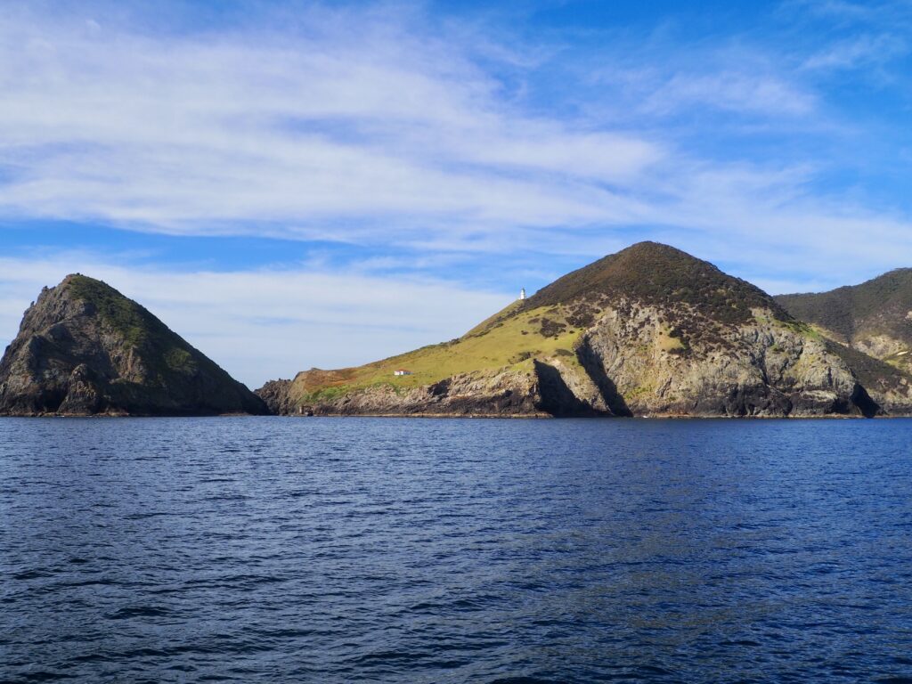
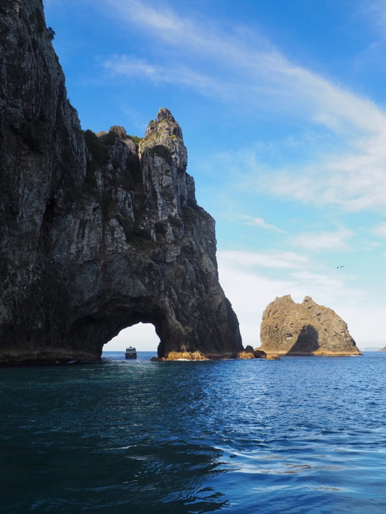
Then, off the coast, another tiny island where you’ll find the Hole in the Rock. The name pretty much explains itself! We snapped photos from a distance, waiting for the other cruise boat to finish up and avoid a traffic jam. Then our skipper assessed the conditions and decided we could sail through today. The boat was full of cheers as we did, although honestly, there’s not much to see besides black stone walls. We took in the view from the far side, then sailed around the island and back towards the bay once more.
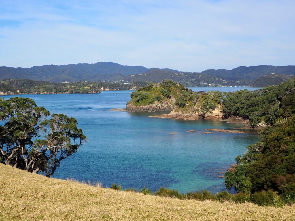
Urupukapuka Island
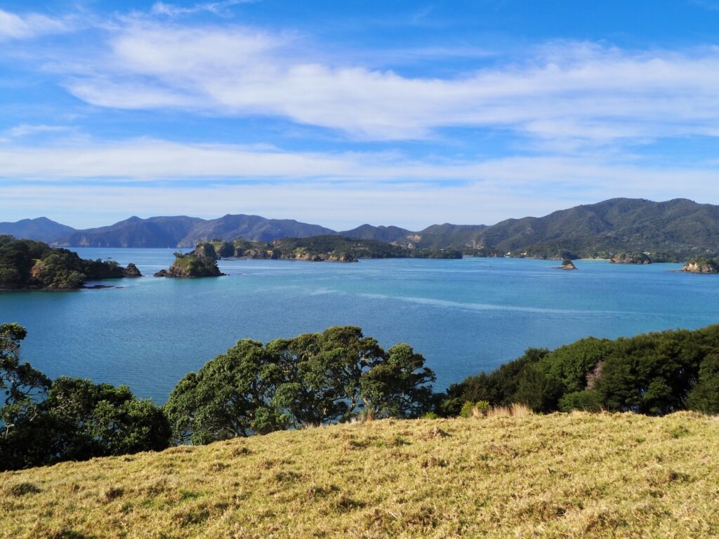
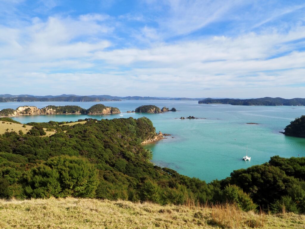
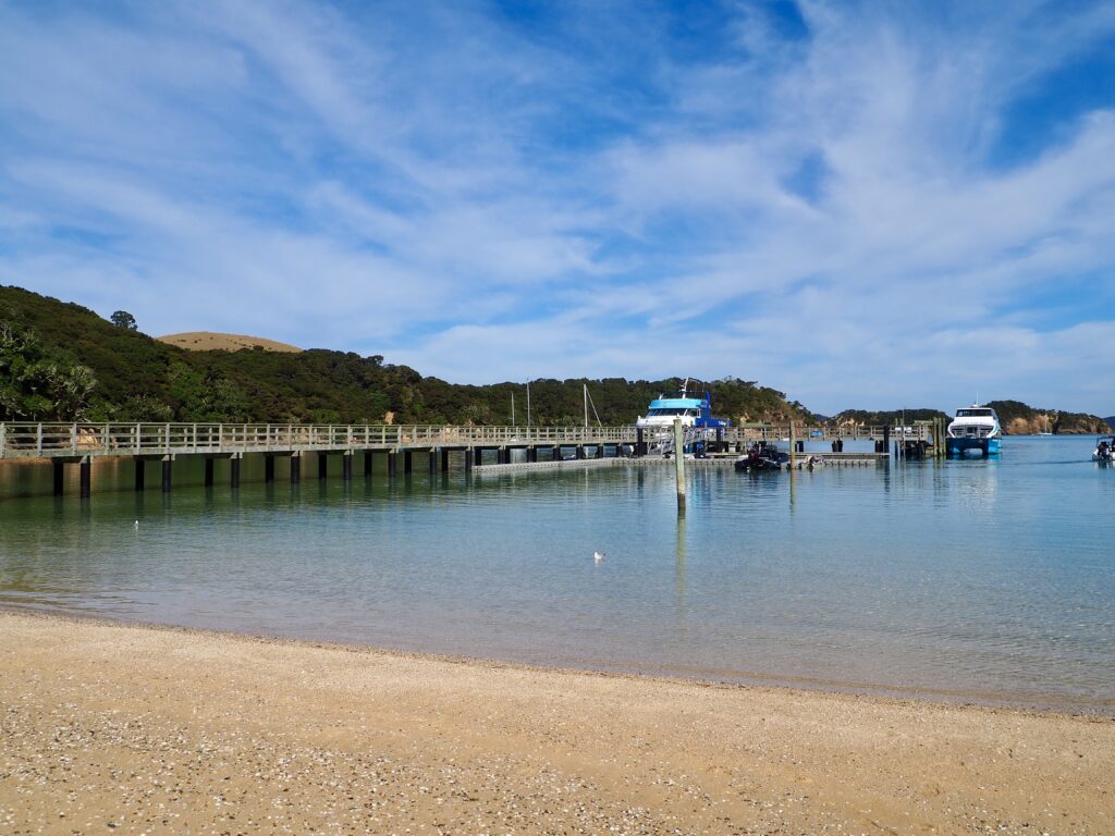
Halfway back down the bay, we moored at one of the largest islands, Urupukapuka, for a chance to disembark and stretch our legs. We had about an hour here so you couldn’t hike too far from the wharf but a short option was available. Heading uphill, I followed the narrow trail over farmland – watch your step for sheep droppings! The steep but quick incline brought me to a hilltop where views of the surrounding bay began to appear. I took the loop trail around the hilltop, opting not to continue on the longer trail to the neighbouring one. The views were still spectacular, in every direction! From up here, the water of the bay was a sparkling, deep turquoise under the sun. And I could get a better sense of the number of islands in the bay, dozens of them!
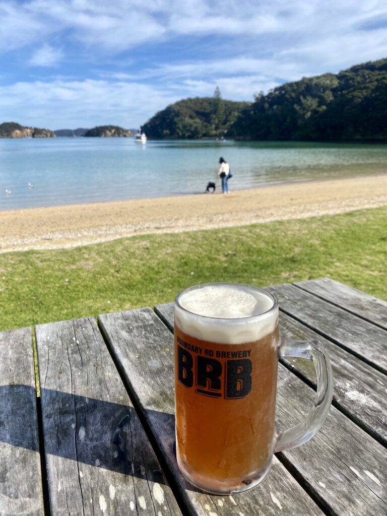
I headed downhill again, leaving enough time to relax by the beach. It’s pebbled, so not the most comfortable for sitting or lying on. But there is a cafe by the shore, which has picnic tables available out front available if you purchase from them (you can’t use them to eat a packed lunch). I’d eaten my lunch on the hilltop, but such a sunny day called for a pint! Grabbing my beer, I nabbed the last free table, close to the water. With the sun shining and the water so clear and pretty, it was a lovely spot to relax until the cruise continued.
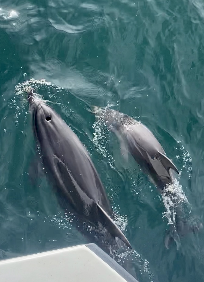
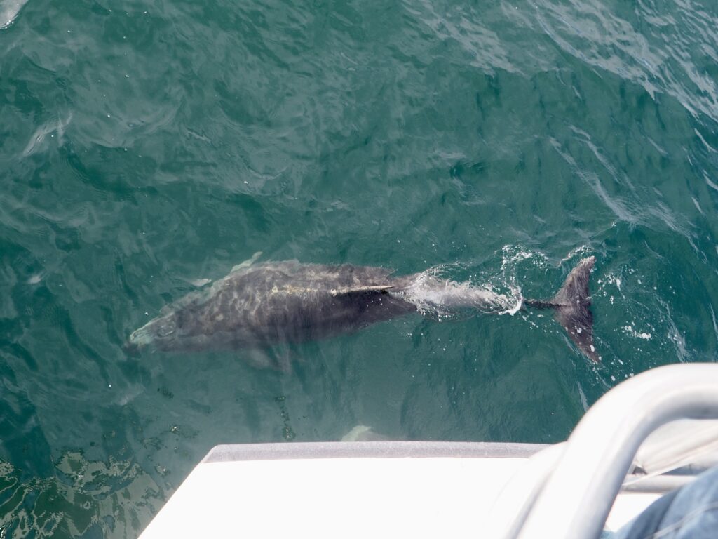
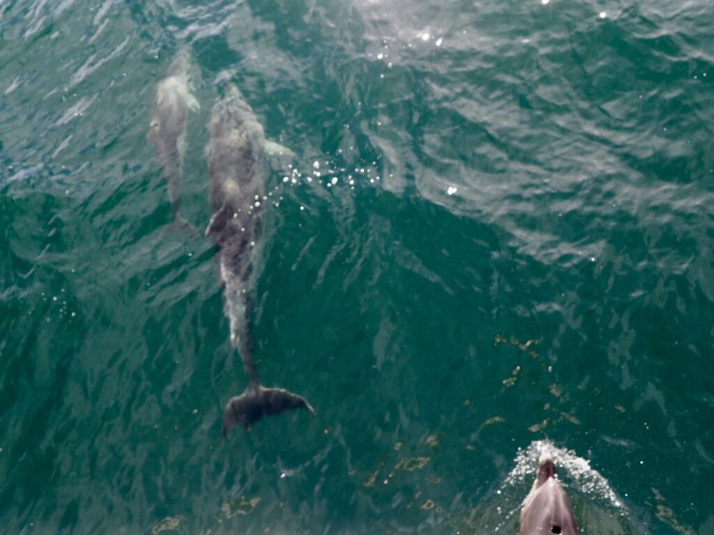
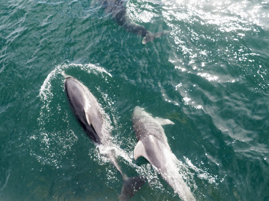
Dolphin Spotting
From there we began heading back to port, and I’d resigned myself that we weren’t going to see any dolphins. With any wildlife spotting excursion, there’s no guarantee you’ll see what you’re looking for! But then suddenly the skipper noticed movement on the water’s surface and changed course to investigate. And as luck would have it – a pod of bottlenose dolphins! I’d been sitting on the lower deck again so I raced out to the bow and was able to stand right at the front edge of the boat. The perfect spot really, because dolphins love to come surf the boat’s wake. Meaning I had an incredible view of them right beneath my feet!
I’ve been whale watching a few times, but I think this was my first experience of dolphins in the wild. Making for a very memorable day! We stayed with the dolphins for a while, until it was time to reluctantly head back to shore.
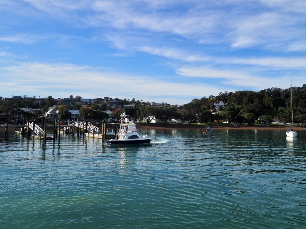
Russell
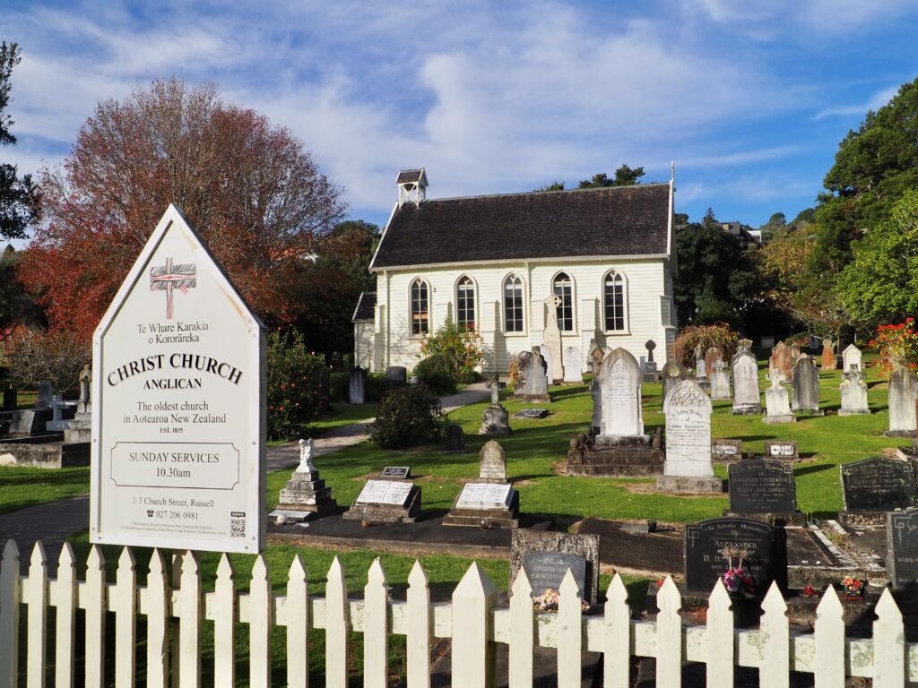
The cruise docked in both Paihia and Russell, on the other side of the bay. There’s a regular foot ferry between the two, so I opted to disembark in Russell for a look around, before catching the ferry back to Paihia later. Russell is another small town on the waterfront, with a wharf and pebbled beach. There are a few historic buildings here which I went to find. I wandered past Christ Church, which seems unassuming but is actually the oldest surviving church in New Zealand! Then down by the water, I saw the Pompallier Mission, from the 1840s, and then the Duke of Marlborough, the oldest licensed hotel in New Zealand. Northland definitely boasts a lot of history!
After I’d wandered the main streets, I grabbed another beer from one of the pubs and got an outdoor table looking over the water. Winter is creeping in here in the Southern Hemisphere now, so I was certainly making the most of the sunny weather while I can! I relaxed here, reading for a little bit, before heading back to the wharf for the ferry back to Paihia.
Day Five – Paihia to Whangarei
Matapouri Bay
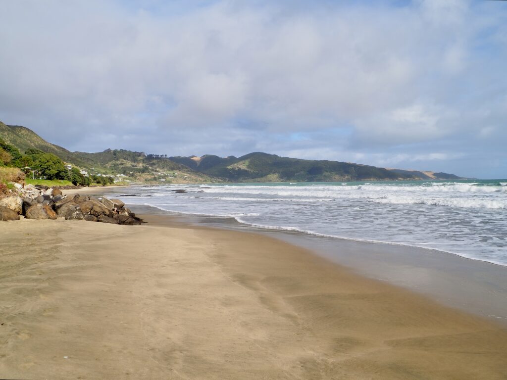
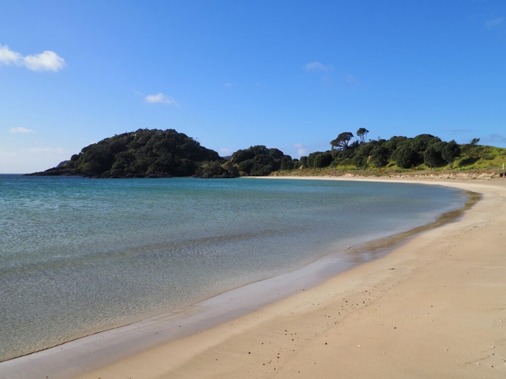
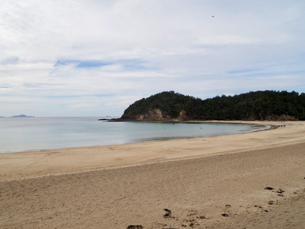
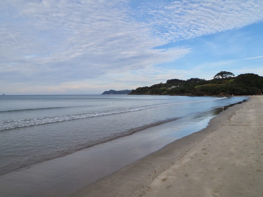
Leaving the Bay of Islands behind, my journey continued south. I was heading to Whangarei for the final night of my week in Northland, with a few sightseeing stops along the way. I’d read that the Tutukaka area has some of the best beaches, so I left the highway and followed a narrow, twisty road in that direction. Northland seems to have endless beaches and coves, especially along the east coast, but some aren’t the easiest to get to. I was headed to Matapouri, a small village on the main road, where the trickiest thing is finding parking! I got lucky and slid into the last spot of one of the car parks just off the beach.
Wandering down onto the sand, there were quite a lot of people swimming or lying out on the beach, despite the clouds overhead. I hadn’t come prepared for such activities, though I did get fairly warm walking in the sun! I walked along the small bay, one way and then the other, taking photos of the view. There were lots of dogs running around, which I enjoyed watching as well! Whale Bay sits on the other side of the headland, a walking trail connecting them. The walk seemed a little on the long side from the map though, so I ended up skipping it in favour of other plans for the day. Once I’d stretched my legs sufficiently, I hopped back in the car and continued on.
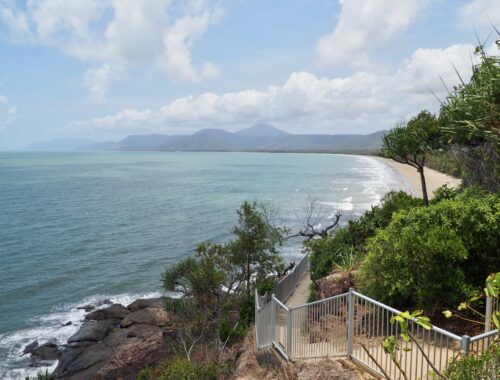
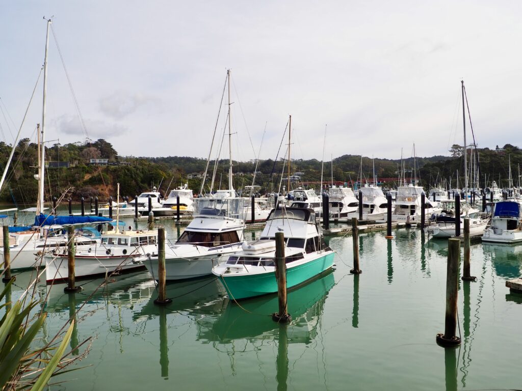
Tutukaka
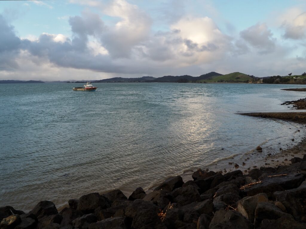
The next main town on this stretch of road is Tutukaka itself. This is more of a port town than a beachfront one, which made a nice change. There is a walking trail to a beach and lighthouse on the headland above the town but the “private road” sign threw me off and I missed the turning. When I looked it up later, turns out you are fine to drive along that road to the trailhead. Oh well! I parked in town instead and took a wander along the marina, which was plenty full of boats moored. The town sits around a natural harbour, with the jagged coastline protecting it well from the open sea. Even right the way out at the end of the marina, I couldn’t see the open ocean! I stopped at Schnappa restaurant for lunch, taking advantage of the sun coming out to dine outside.
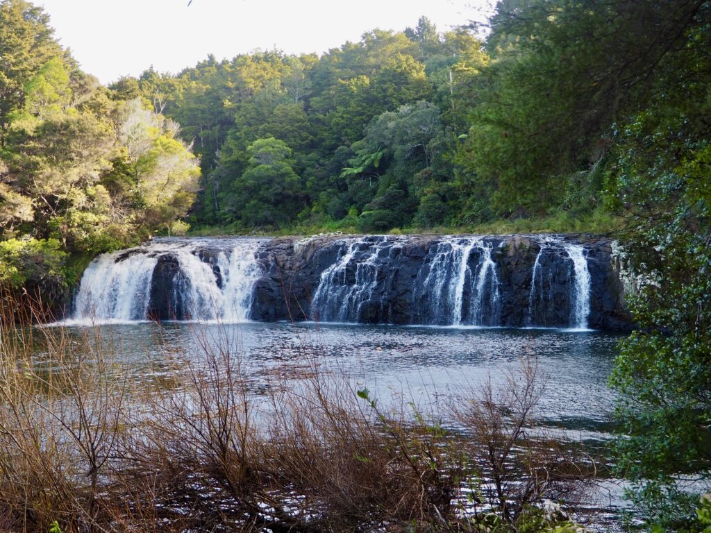
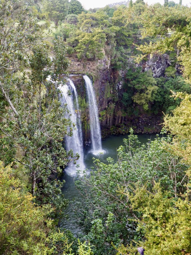
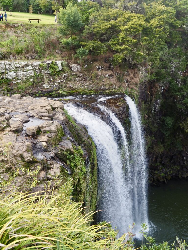
Whangarei Falls
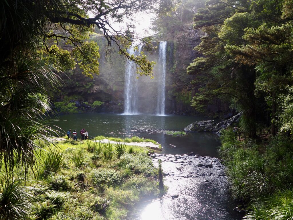
My journey south continued, following the twisty road away from the coast and back inland again. I was getting close to my destination for the night, Whangarei, the capital and largest town in Northland. It has quite a few sightseeing options, many of which I was saving for tomorrow morning. But Whangarei Falls was on my way into town, so an easy place to stop off at before heading to my accommodation. The small car park (again, managed to nab one of only a couple free spots!) is next to the top of the falls, just a short walk from a viewing platform. The river itself is pretty small, but the drop into the plunge pool below is steep and wide enough for a fairly impressive waterfall.
I admired the view from the top, then used the small footbridge to cross the river. A walking trail winds steeply downhill into the forest, towards the plunge pool, where a second bridge crosses back over the river below. There’s a pretty view from the bridge, with the forest foliage surrounding the waterfall. A lot of people were posing for photos closer to the falls, which made it harder to take pictures there. But I also found that the sun was right behind the falls again, making for tricky lighting. I admired the view for a while anyways, but quickly tired of the crowds.
Rather than heading straight back uphill again, I decided to follow the walking trail downstream along the Hatea River. It was much quieter and more serene here! The trail takes you to a kauri forest, which was a pretty spot to wander around, before retracing my steps back to the waterfall car park again. From there, it was a short drive into town to my accommodation for the night.
Day Six – Whangarei
Town Basin
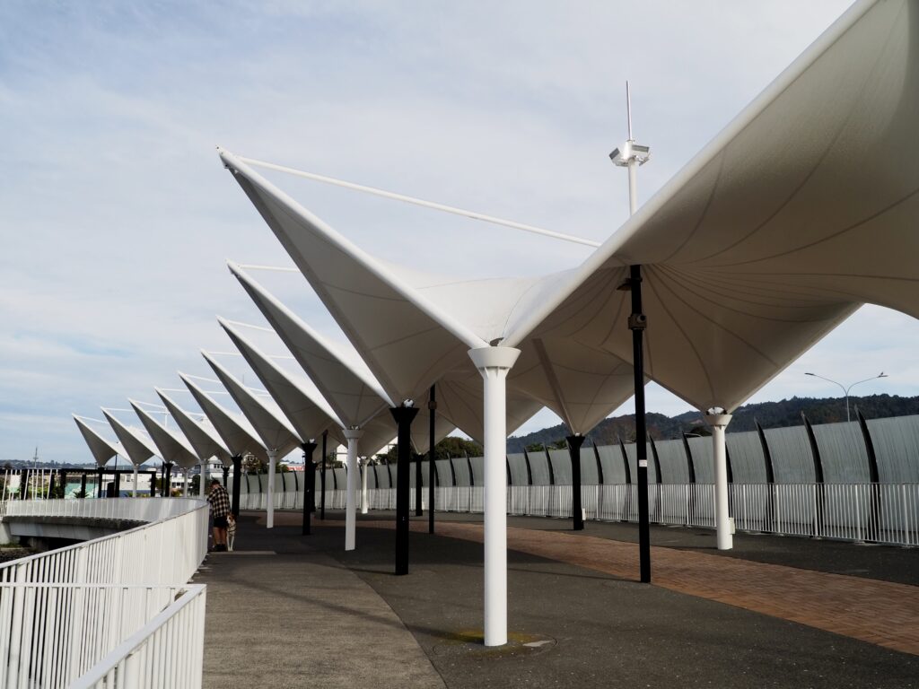
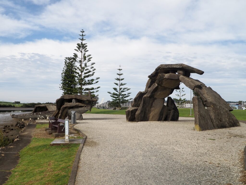
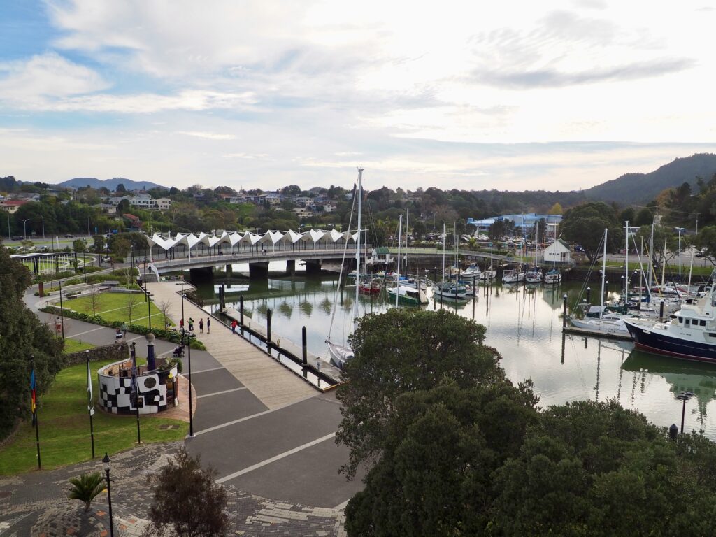
For the final day of my week in Northland, I spent most of it exploring Whangarei itself. I needed to be back at Auckland airport for my evening flight, but I had the whole day ahead of me first. After a leisurely start to my day, checking out of my room almost as late as I could, I parked the car in one of the Hatea Drive car parks near the town basin. This is a pedestrianised area along the bank of the Hatea River, full of cafes, craft shops and tourist attractions. Luckily the sun was out again, and the floral arrangements, outdoor seating and boats filling the marina all made for a very pretty place to explore.
I actually started by crossing the Victoria Canopy Bridge and taking the Town Basin Loop walking trail down the far shore. You then use the Te Matau a Pohe bridge to cross back, before returning up the other side. It seems to be a popular route, judging by the number of other people walking it on this public holiday morning! I found the scenery a little less pretty and more generic town further downstream, but it was a good way to stretch my legs at least.
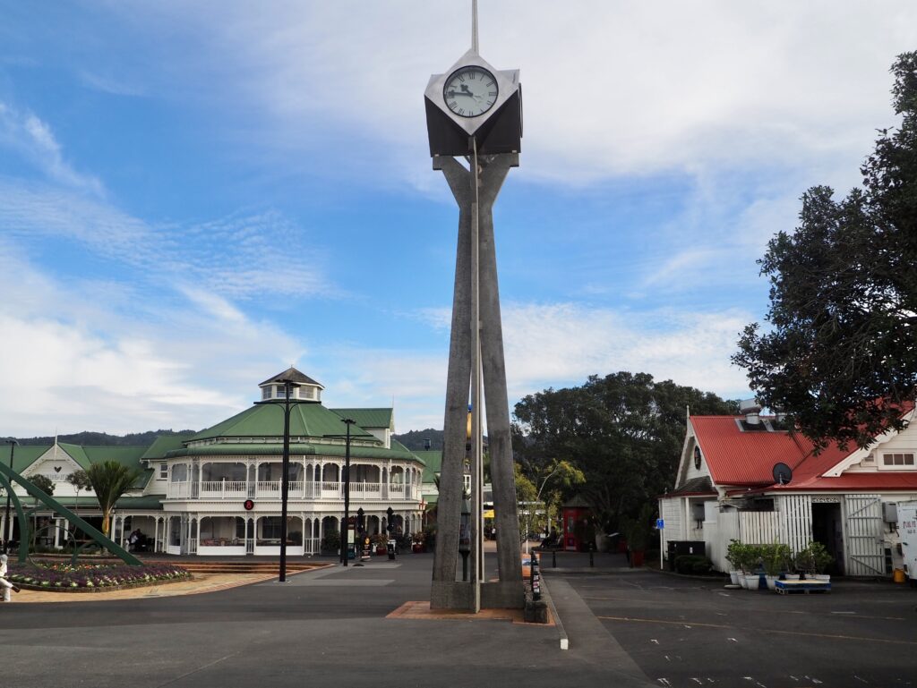
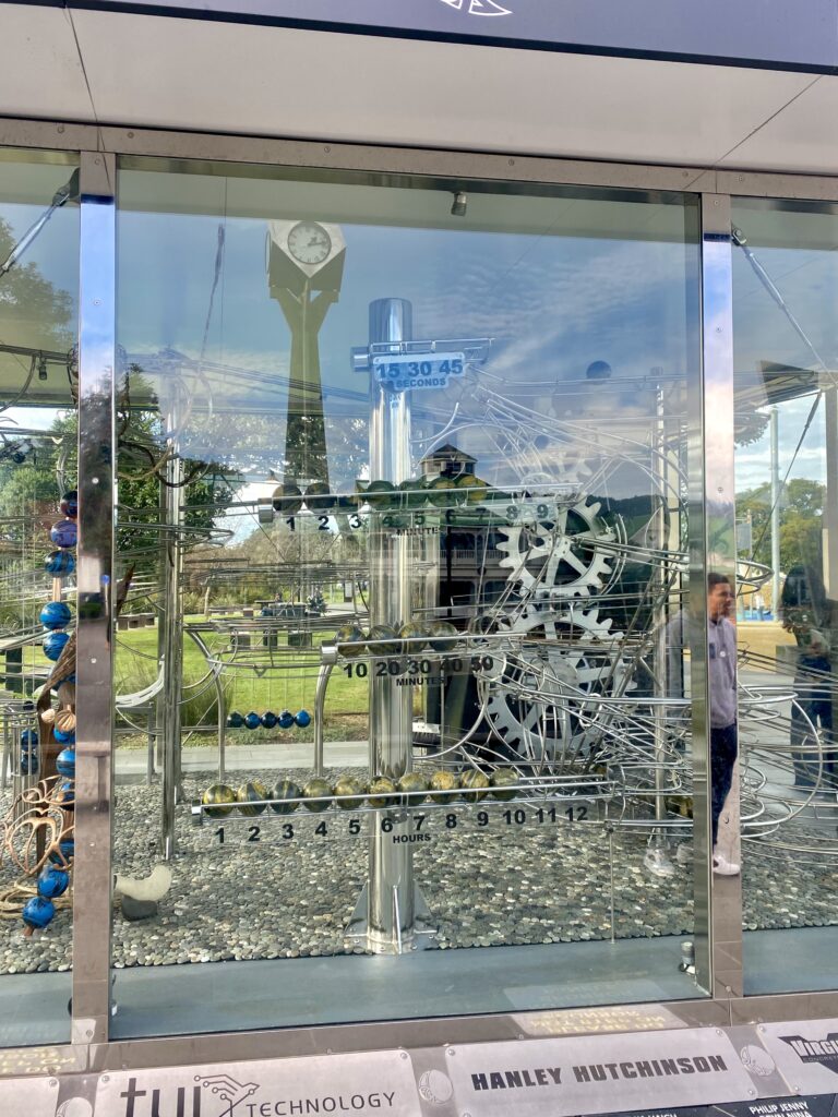
Going clockwise meant I finished back at the main town basin, where I popped into a couple of the shops to browse. There’s also a Clock Museum, full of quirky timepieces, which I didn’t visit but there’s a sun dial and the “Rolling Ball Clock” you can see outside for free. I thought the rolling ball one was an art installation at first, until I figured out how to tell the time from it. It’s a really clever design and mesmerising to watch!
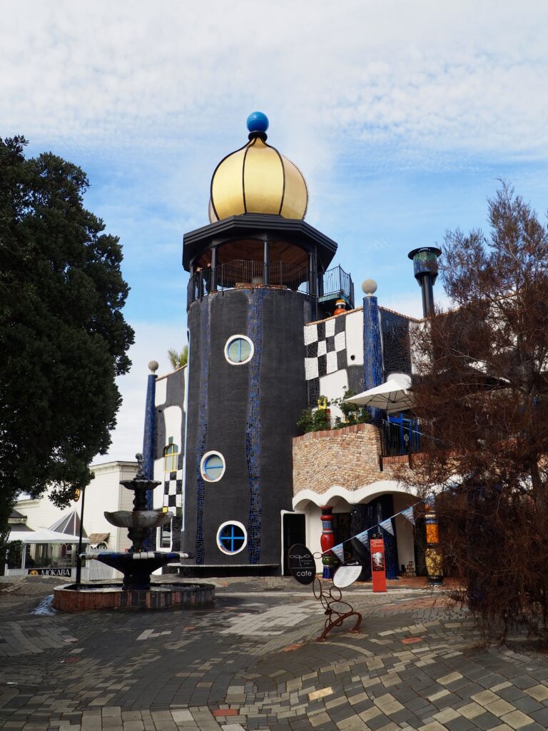
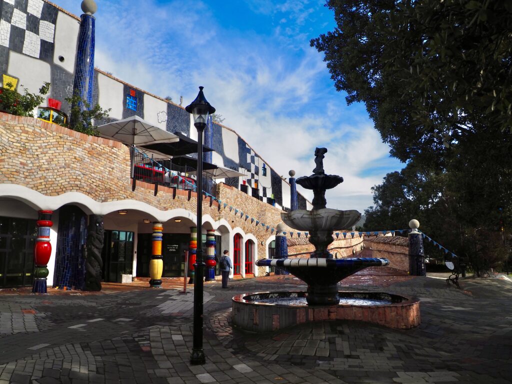
Hundertwasser Art Centre
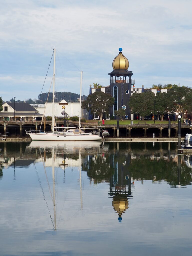
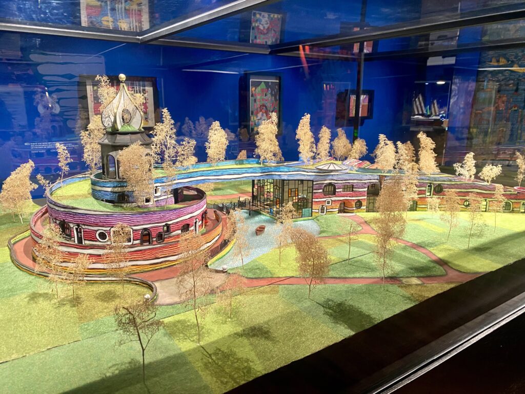
The most striking building in the town basin is the Hundertwasser Art Centre. Its tall black tower and golden cupola, and elaborately, colourful tiled walls are definitely eye-catching! There’s a small exhibit of Māori art, but mostly its dedicated to the work of Hundertwasser himself. I hadn’t heard of him before, but the building’s design was intriguing enough to make me want to find out. He was an Austrian artist and architect, and the exhibit includes many of his paintings and models of buildings he designed. He used a lot of bright colours and spirals and swirls in all of his works. The paintings were perhaps not my usual preferred style, but his architecture was super interesting and unique! He designed the art centre itself and his other buildings were similar.
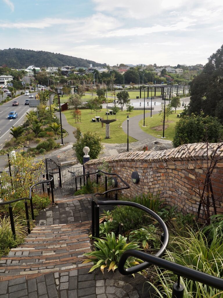
After exploring the exhibit, I headed up the spiral staircase inside the tower to visit the rooftop garden. Hundertwasser was an environmental advocate as well, so many of his buildings featured similar garden. It was quite small and early winter is probably not its finest time of year, but I still appreciated incorporating a green space like this into the building! The main attraction, however, is the view from the cupola. Up here you can see far across Whangarei, including the river and town basin below. I soaked in the view then descended again, popping into the gift shop for a browse on the way out. Then I picked one of the waterfront cafes for lunch as a busker played nearby. It almost didn’t feel like winter!
Kiwi North
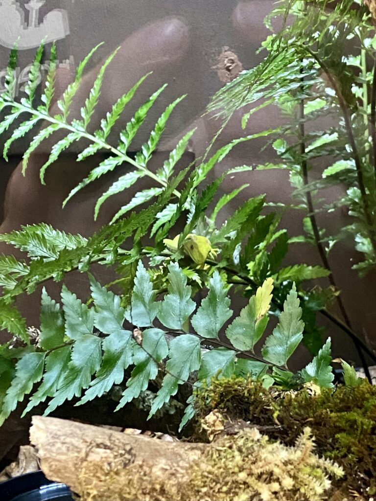
Leaving the town basin behind, I had one more stop on the outskirts of Whangarei. Kiwi North is a slightly eclectic combination of local museum, kiwi enclosure and heritage village. Starting from the ticket desk, the staff directed me first to the kiwi house. Here they have a pair of young kiwis, who are raised in the enclosure for a couple of years before being released into the wild. Kiwi eggs and chicks are most vulnerable to predators, so raising them here increases their chances of survival. Kiwis are nocturnal, so they keep the enclosure dark by day to allow visitors to see the birds. I only saw one of them, but it was certainly active, running back and forth! It takes a few minutes for your eyes to adjust to the dark, so definitely stay in there for a while.
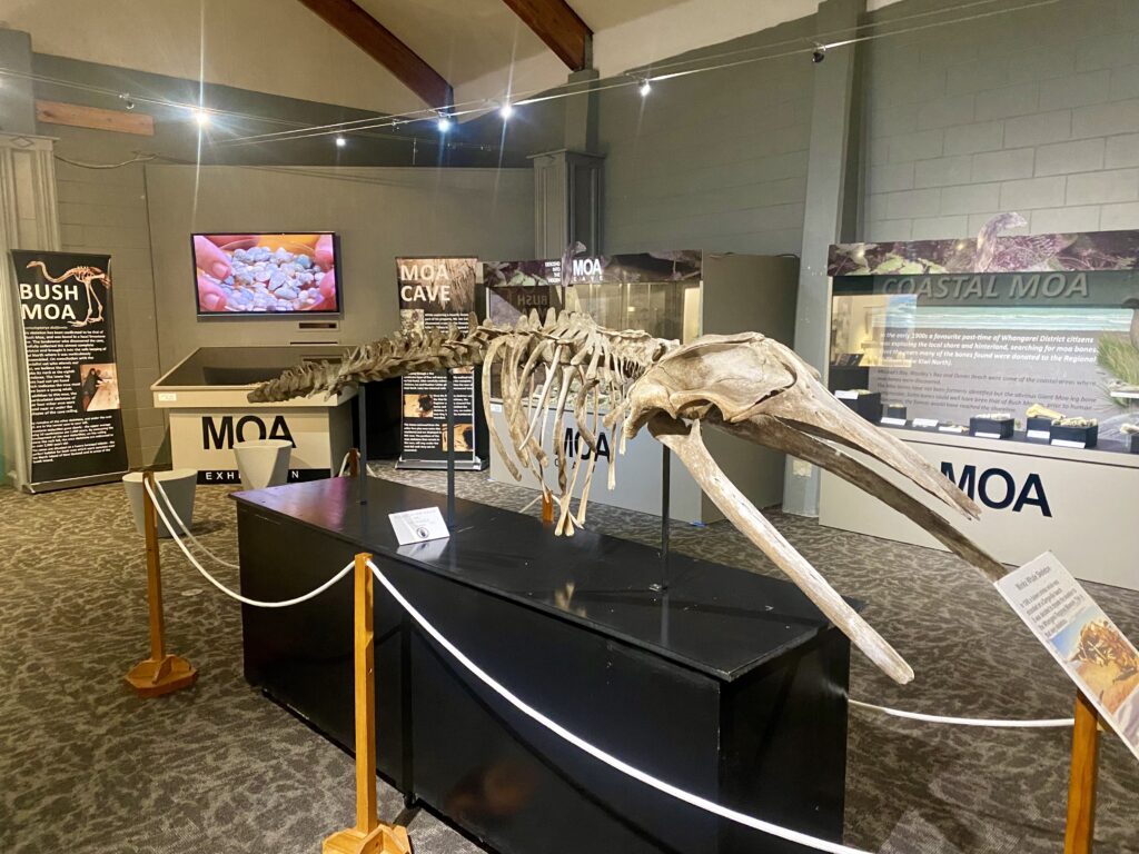
Exiting the enclosure and adjusting to daylight again, there’s a small corridor with tanks containing various geckos and insect species. Told you it was eclectic! Then upstairs you’ll find the Whangarei Museum for a glimpse into local history, including moa bones (a now extinct giant bird species), stories of sunken ships and treasure hunters, and Māori waka (canoes). It’s a small museum, but packs a lot in!
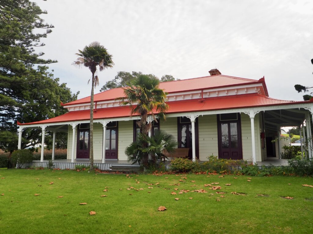
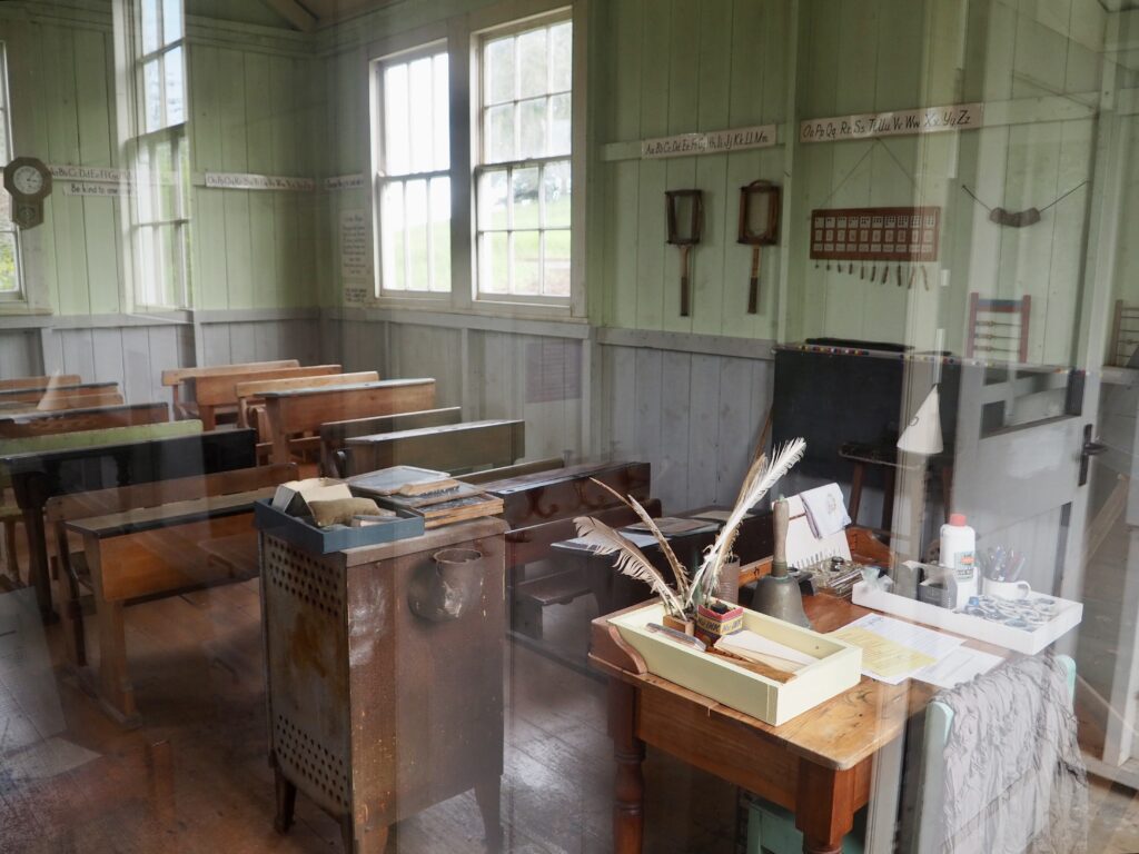
Then outside is the Heritage Park, a collection of older buildings with a small railway line looping through them. Most of them are used by local societies, and the reception staff said the members are happy to chat to people when they’re there, but it varies what day of the week. Since it was a public holiday, none were around, but I had a quick look anyway. You can pop your head into the old schoolroom, and there’s a larger stately house down the bottom which is pretty impressive from the outside!
Waipu Beach
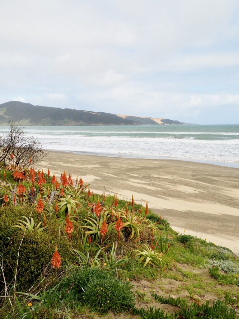
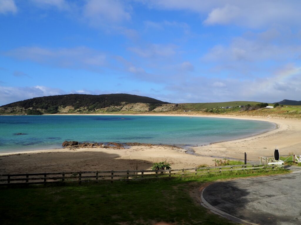
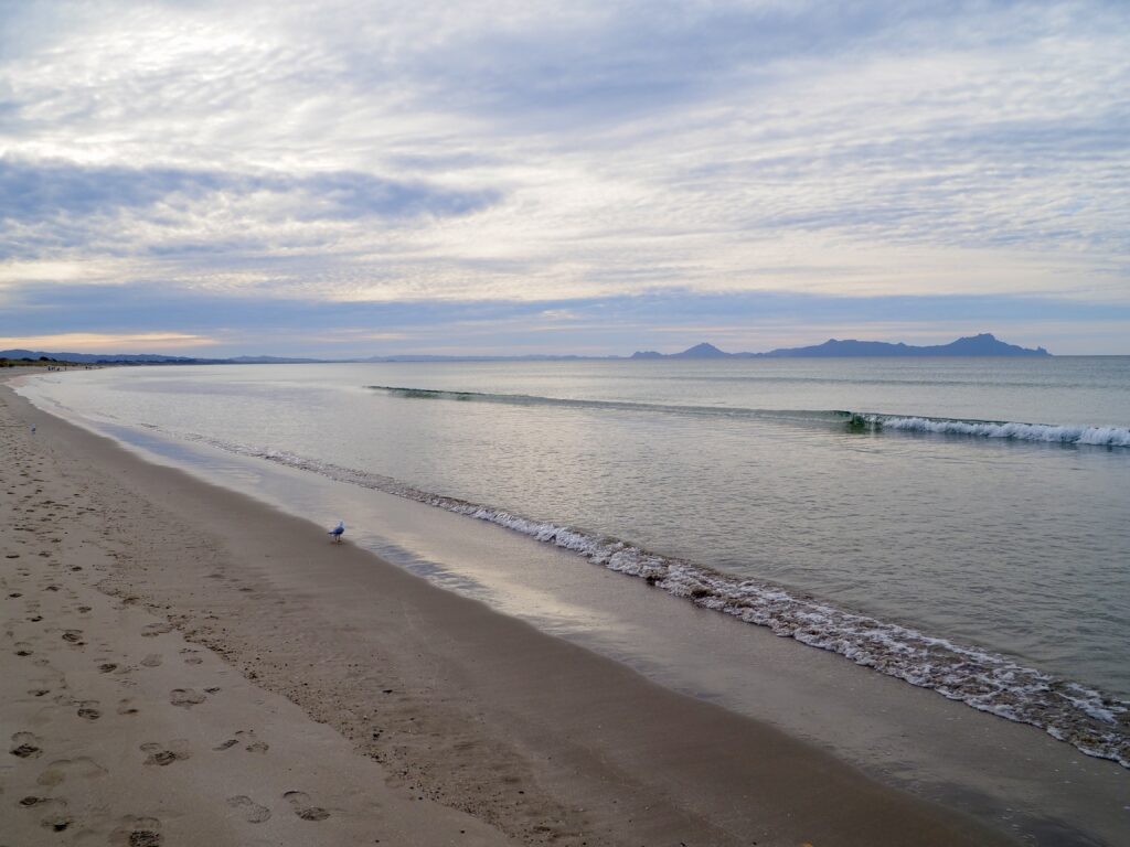
Then it was off back towards Auckland again, with a few hours of driving to get there. I’d looked at a few beach options to break the drive up. Mangawhai Heads was initially high on my list, but I discovered that the trail is closed right now. Possibly for the best, as traffic was busy and I would have been concerned about making it to Auckland on time! The SH1 was closed from near Waipu, so I had to detour along the coast anyway. Waipu Cove was a quick, easy turn-off right beside the road, so I pulled into the small car park here.
Like every other beach I went to this week in Northland, it was very nice but only weather for a walk at this time of year. I enjoyed the view of the islands out in the bay though, which I later learned are “Hen and Chickens Island”, an excellent name! The sun was getting low by this time of the afternoon too, creating some pretty light on the ocean. I didn’t make any other stops on my way to Auckland, especially as it was dark by the time I approached the city. But I did opt to avoid the toll road, sticking to the Twin Coast Discovery Highway instead, which took me on an interesting, pretty coastal drive through Waiwera and Orewa.
A Week in Northland
Honestly, I don’t think road tripping is my thing. I just don’t enjoy driving enough and there was a lot of it on this trip, even with the workdays off inbetween. The scenery also reminded me a lot of the UK, which was very pretty but I usually like seeing places that are more different to home when I’m travelling. I loved the beaches and spending time by the coast, though some of them started to all look similar after a while. And I could’ve lived without some of the convoluted drives to them!
But all in all, Northland is still a beautiful area to explore! With hindsight, I might have skipped the West Coast. It was a lot of extra driving for sights that were nice but not as memorable as the rest of the trip. Although to be fair, the weather didn’t help. The Bay of Islands was absolutely stunning though, and I really liked Kerikeri and Whangarei as well. Cape Reinga was a long way to travel to, but understanding its cultural significance made it more worthwhile I think!
It was nice to take a longer trip for the first time since I arrived in New Zealand as well. My next few trips will actually take me out of the country and I’m quite looking forward to the change of scenery again. I still have plenty more New Zealand plans for later in the year though, especially for the South Island!

3 Days in Taranaki | New Zealand