Hiking in Picton | New Zealand
After kicking off my New Zealand South Island summer in Nelson, I headed east along the coast to the town of Picton. This little port town is many tourist’s entry point to the South Island, catching the ferry from Wellington to cross the Cook Strait. But then most people drive straight on, to Nelson or Kaikoura or Christchurch. Since I had plenty of time on my three-month adventure, I decided to stick around for a bit longer! I’d seen stunning pictures of the Marlborough Sounds and there seemed to be a few options for hiking in and around Picton. There are even more options if you have time to explore the many jagged peninsulas of the Marlborough Sounds but that wasn’t to be for me!
As mentioned, due to my work schedule, I stayed in most locations for a week, travelling onwards at the weekends. Usually I have one full weekend day in each place but Picton was the exception to that rule, partly due to the fact most people don’t spend long here. Also because I spent the weekend prior in Abel Tasman and needed the one after in Kaikōura. I arrived on the Sunday evening and departed again the following Saturday around midday. Anyway, this meant my hiking options were limited to a couple of hours after work in the evenings, and trails accessible without a car.
Picton – The Town
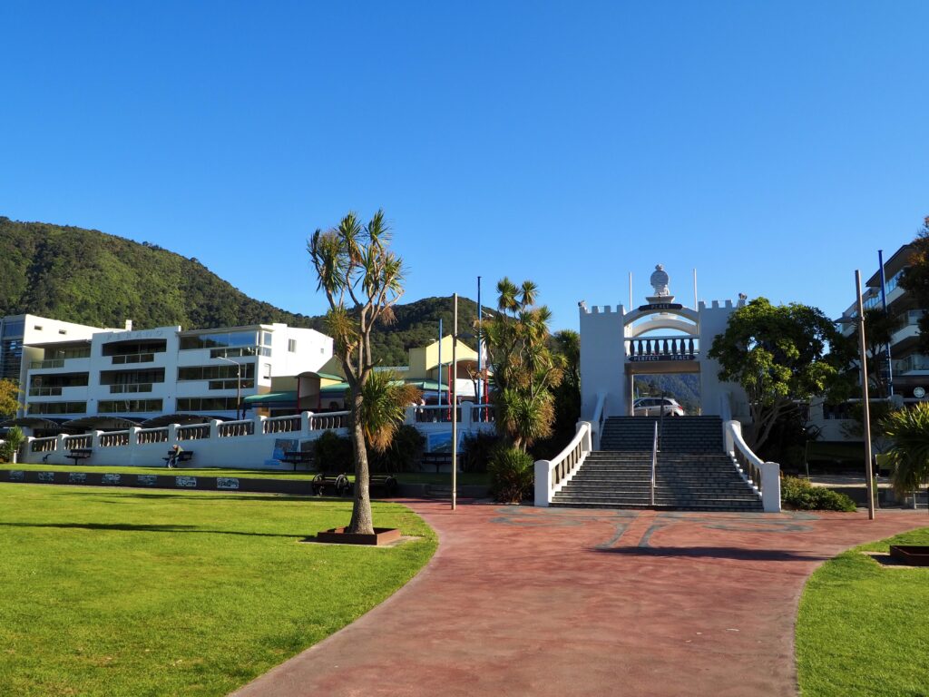
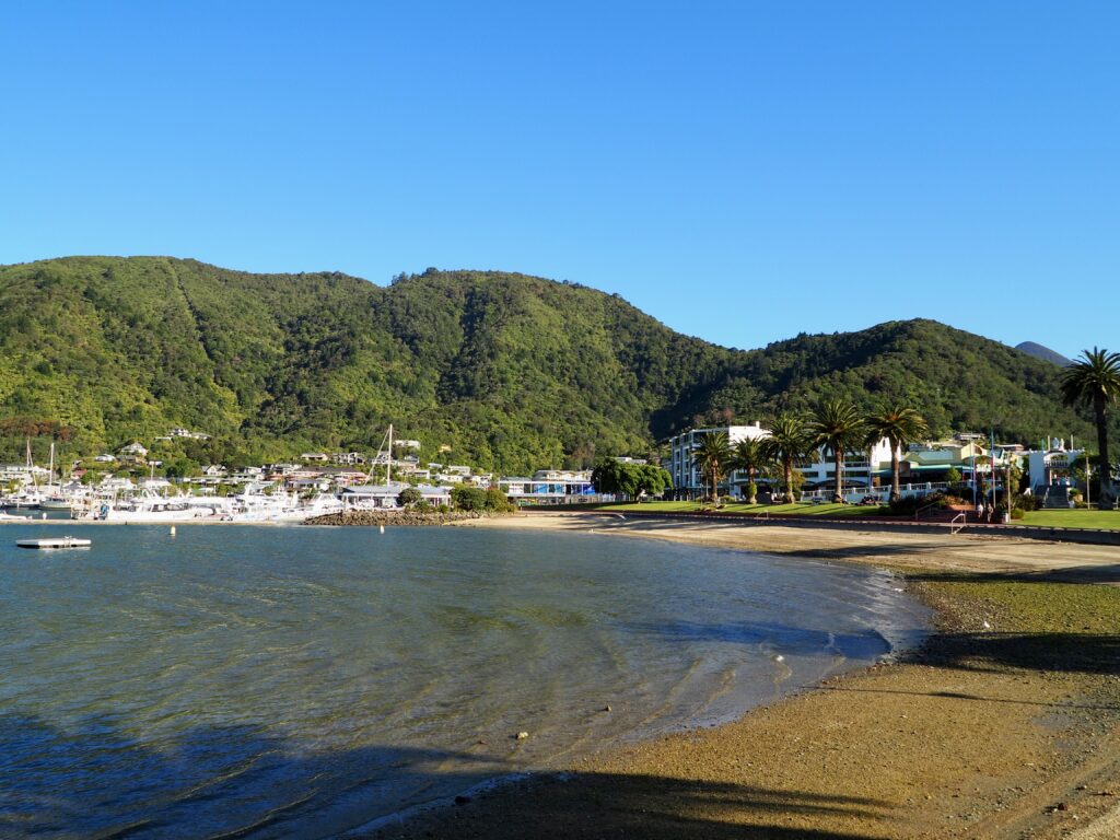
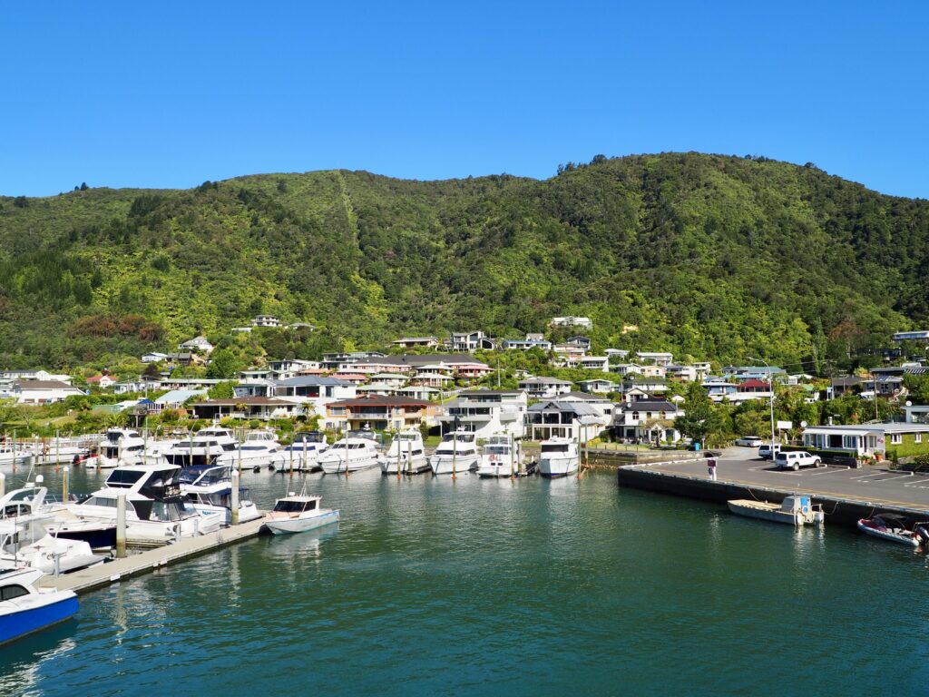
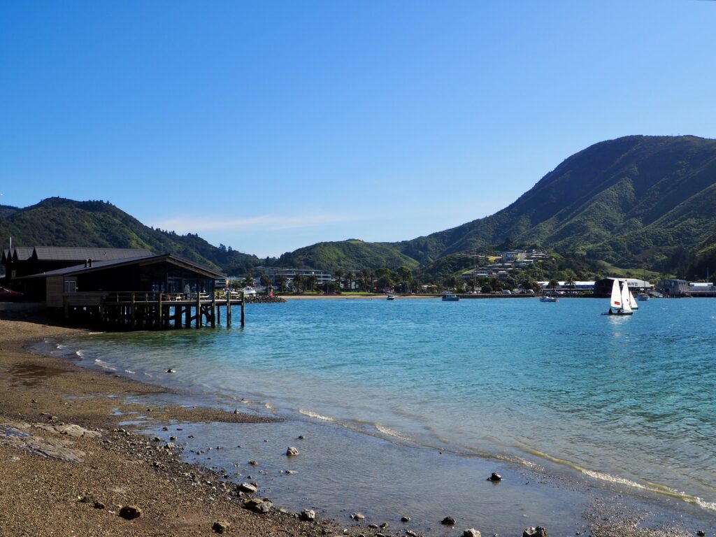
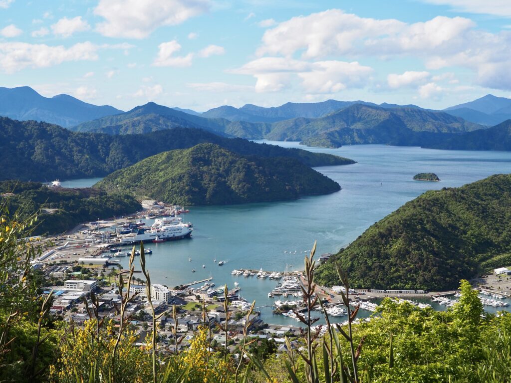
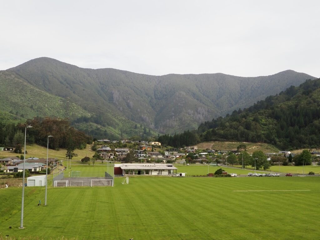
Picton often felt quite busy, mainly due to the number of people arriving or leaving on the ferry. But in reality, the town is quite small. The main street has a handful of cafes and gift shops to browse. I wandered a few of the other streets one day, including the park at Nelson Square, but they’re mainly all residential. Down by the waterfront and the port sits Picton Memorial Park. This was a lovely spot to explore or sit and enjoy the sunshine, watching the ferries and other vessels sailing up the sound. I got lucky with good weather most of the week, bar one rainy day!
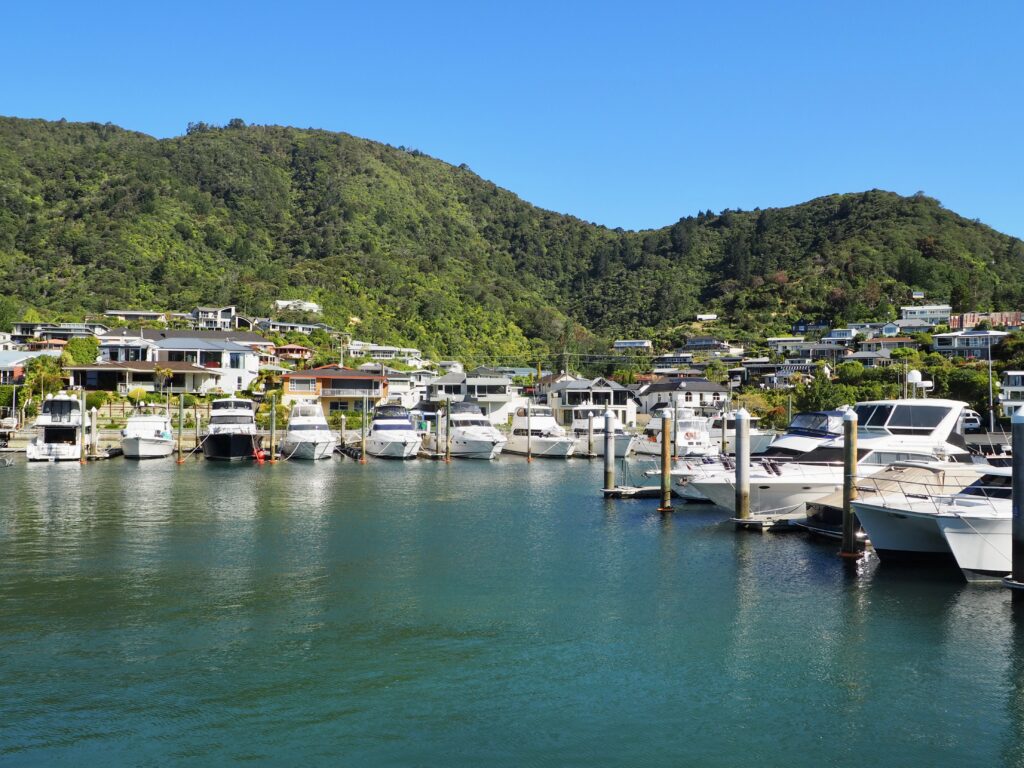
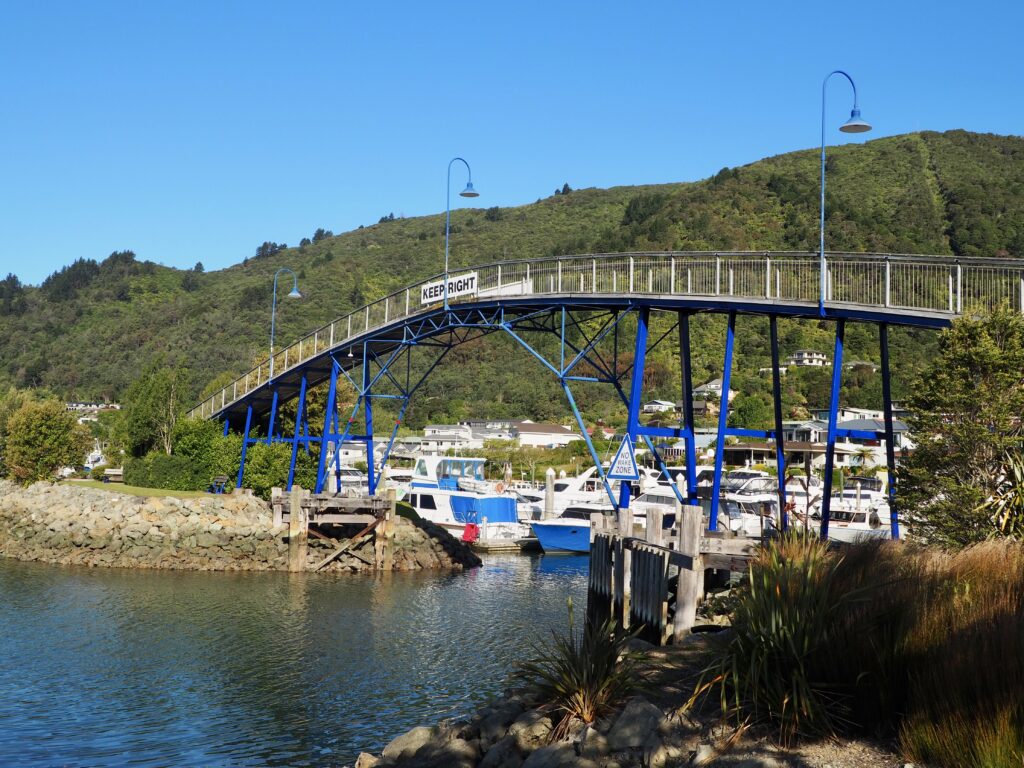
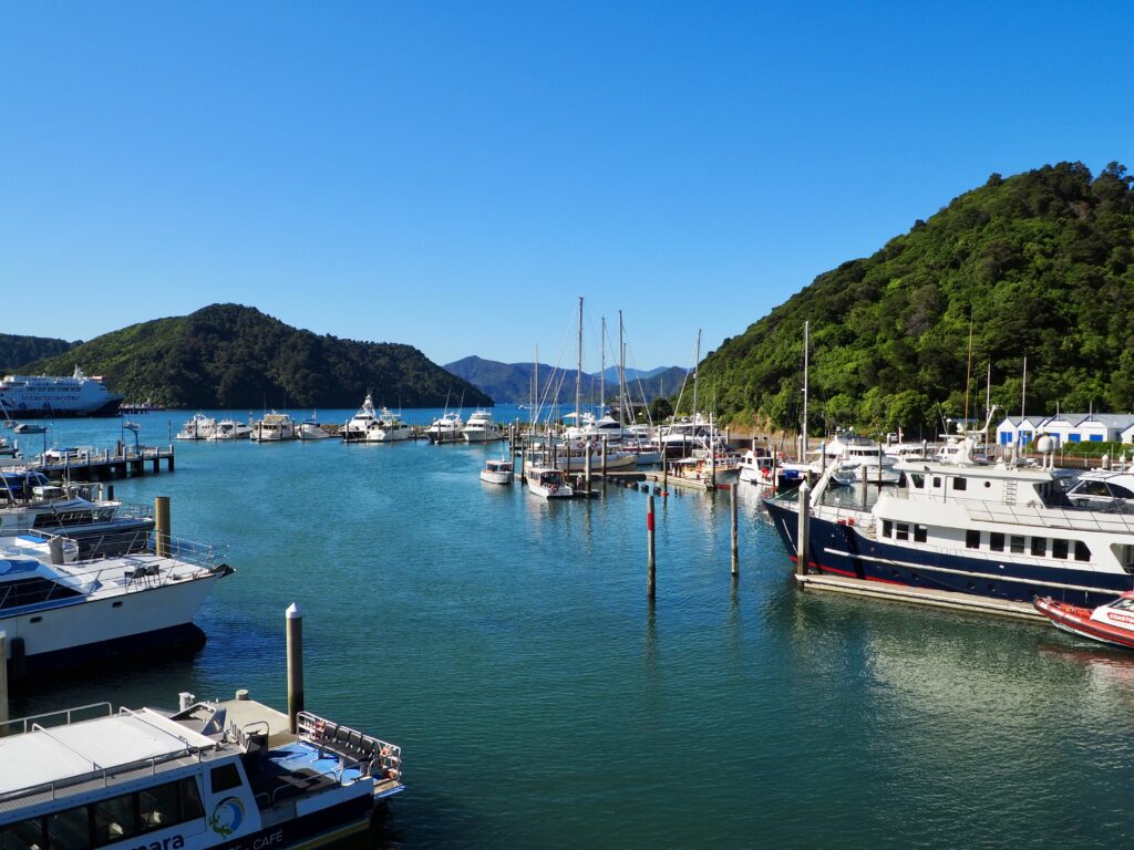
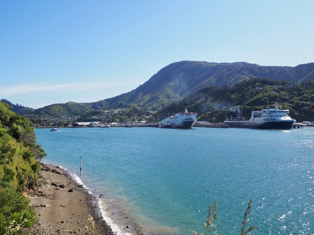
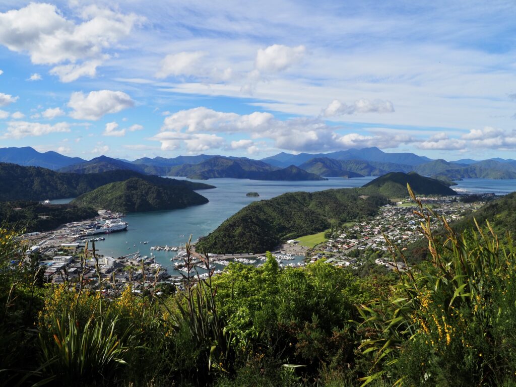
Further along there’s also the Picton Marina, full of stunning sailing yachts. And in order to let them out the marina, they sail beneath the rather high ‘coathanger’ pedestrian bridge. I cross this a couple of times, and it’s a pretty steep incline to walk up and down! It does provide a great view of the harbour and the town, allowing you to see how it’s tucked neatly in amongst the surrounding hills.
Bob’s Bay Track
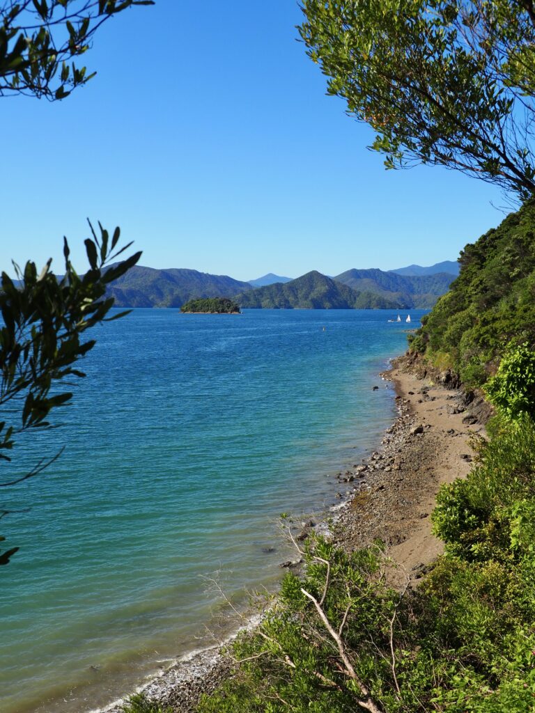
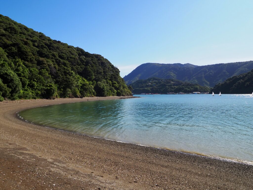
There are a couple of hiking trails near Picton that take you up the east side of the Queen Charlotte Sound. The best named sound in my opinion – I love anything that shares my own name! Bob’s Bay Track is one of the shorter options, starting from the other side of the marina, across the bridge. There is an upper and lower track, so I took one in each direction to make a loop. Much of the track is under the cover of trees, with peeks out to the sea between the foliage every so often. There was a good view looking back at the town, and the ferry had just arrived into port too.
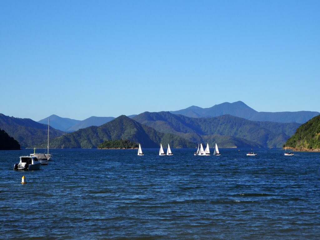
Bob’s Bay is a small curve in the coastline, which obscures the town from view once you arrive. I headed down to the pebbled shore, perching on one of the benches installed to enjoy the sun. There were some sailing yachts practising in the sound that I watched for a while too. I took the upper track on the way back, so there was a bit more of an ascent involved, but it’s still not a big elevation gain overall. A great, fairly easy hike to fill a couple of hours!
Time: 1 hour round trip (from the marina)
Distance: 3.5km (from the marina)
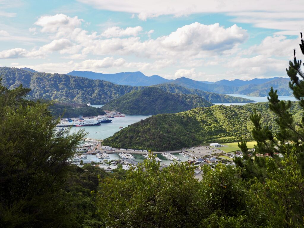
Tirohanga Hill Track
If you want elevation gain and a workout, this is the track for you! Tirohanga Hill was easily the most uphill of any of the hiking I did in Picton. The hill is to the southeast of the town centre, offering views to the north and west. The trail starts at the end of Newgate Street, near the marina. Then it rapidly ascends in a series of switchbacks. The path is quite narrow in places, with a steep drop visible through the foliage. I was a bit nervous about that and had to watch my feet most of the time. Which was also a challenge to remind myself to stop before looking up at the views! The trail is mainly through forest, so you only get a couple of glimpses of the town and the port on the way up.
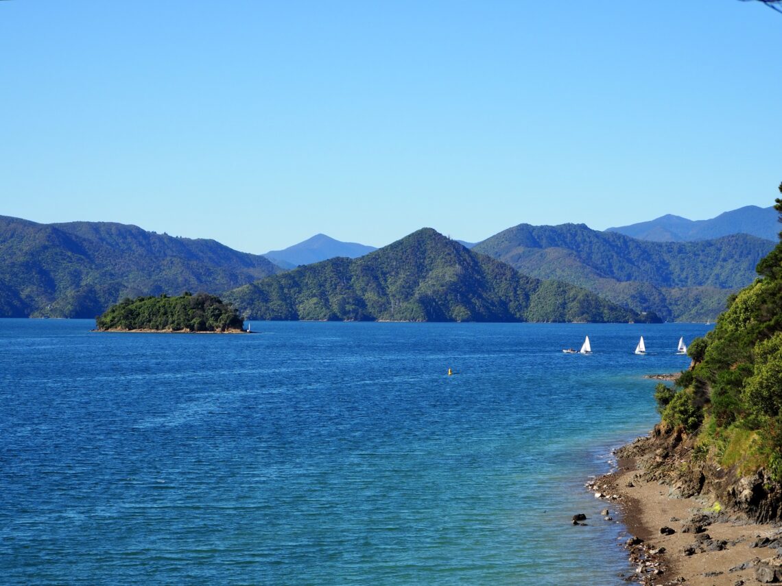
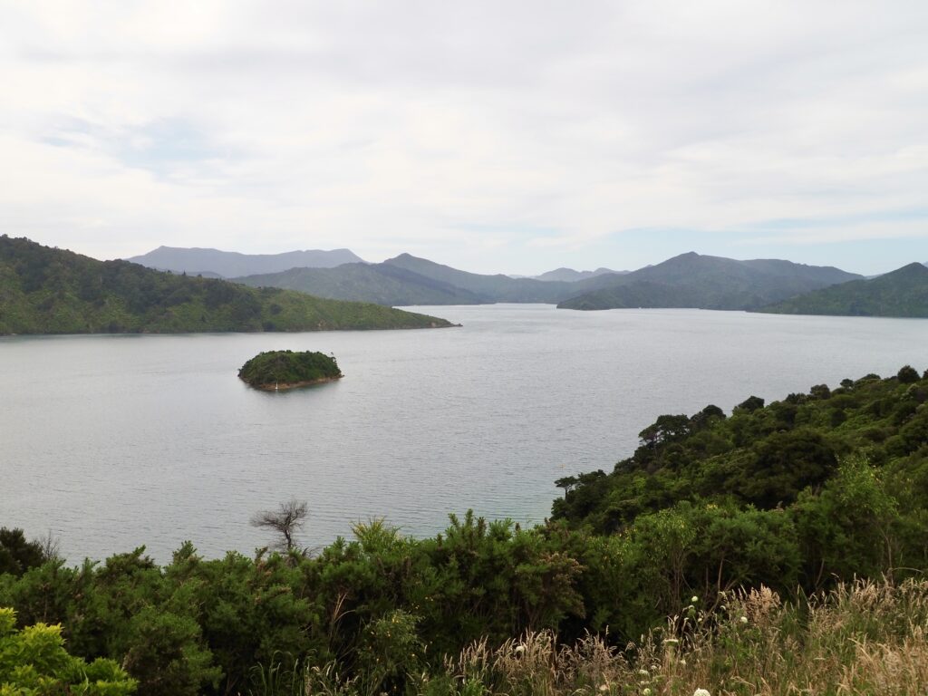
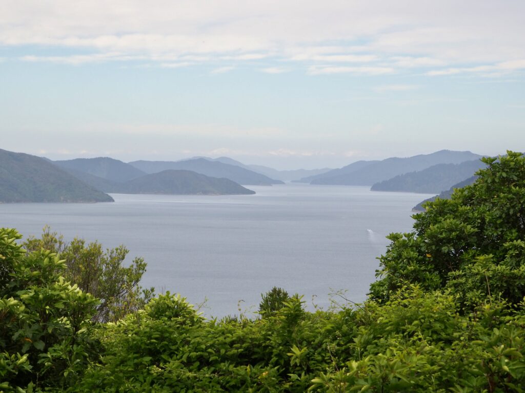
The top of Tirohanga Hill is the money shot though. The trees part to reveal a small clearing, with a bench facing the best part of the view. And it’s a stunning one! From here, you’re high enough up to all the way across to the mountains and hills of the Marlborough Sounds beyond. It was perfect weather too, the Queen Charlotte Sound a bright blue under the sun and puffy white clouds drifting scenically across the sky. I’m pretty sure I gaped and went “wow” out loud when I reached the top! While I didn’t get a chance to explore the Sounds extensively, it felt like this hike gave me a taster of the views you’ll find over there. You can descend the hill on the other side, towards the south of Picton, but I retraced the same route to Newgate Street.
Time: 1.5-2 hours round trip
Distance: 4km
Elevation gain: 250m
Snout Track
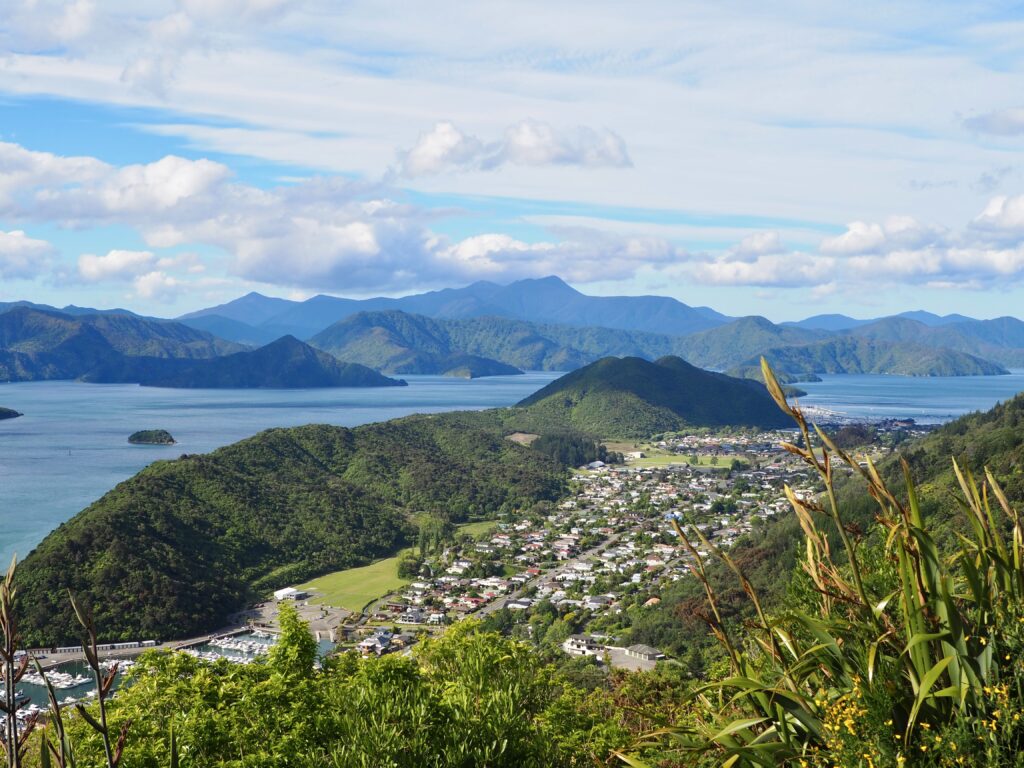
For my last day of hiking in Picton, the weather was a bit more overcast, but dry enough for me to head out anyways. I wanted to check out the Snout Track, along the peninsula that separates Picton from the neighouring town of Waikawa. The very end of the Snout juts into the Queen Charlotte Sound but I didn’t have time to make it that far. My destination was the Queen Charlotte Viewpoint instead. You could start with Bob’s Bay Track if you’re walking from town. Since I’d already done that, I walked up Waikawa Road instead. You can also drive that route and there’s a small car park at the end of Victoria Domain Road.
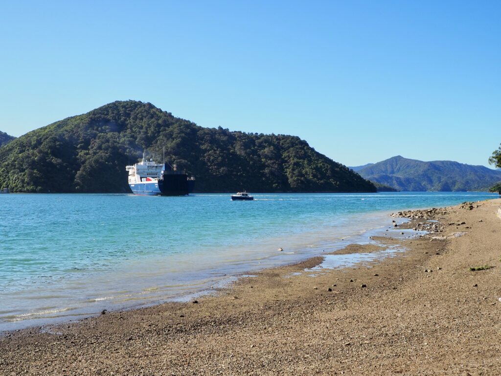
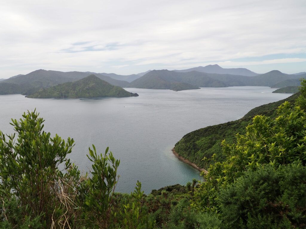
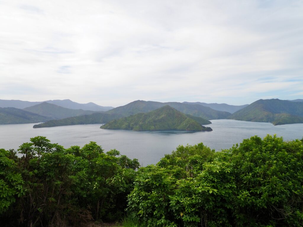
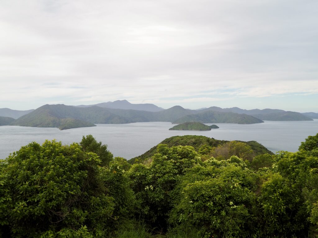
The real hiking starts there, following a rough track along the edge of the hill that runs the length of the peninsula, though not with too much elevation gain. Like the other tracks, it was mostly under tree cover with glimpses of views to the west. While the sky was grey, it was still clear enough to see the land across the Queen Charlotte Sound. Which is still part of the South Island mainland, just on a huge, jagged peninsula. The viewpoint faces north, at a high point of the hill, so you can see all the way up the Queen Charlotte Sound, the route the ferry takes. With so many hills and mountains on the horizon, it’s hard to believe it’s all the same landmass and not islands!
Rather than return via the road through town, I came back via the Ridgeline and some other walking trails that I could see on AllTrails (my favoured hiking app, not sponsored!). These routes run through the parkland on the other side of the long hill. So no waterfront views, but some nice green scenery and a small stream, until I reached the marina again.
Time: 1-1.5 hours round trip from car park or 2-2.5 hours from town
Distance: 4.7km from car park or approx. 8.5-9km from town
A Week Hiking in Picton
Now that I’ve had a taste of the Marlborough Sounds, it would have been cool to explore the peninsula more. But I’ve long since accepted you’ll never have time to see absolutely everything while travelling! I’m definitely glad I spent some time hiking in Picton though, and didn’t whiz past it as many people do. The trails I explored are great choices if you’re short on time, offering fantastic views of this incredible area of coastline. It was a relaxing little town to spend some time in too. I had another morning to browse the shops and enjoy lunch in the park before my departure as well. I was hopping aboard one of the New Zealand’s trains to continue my journey south, to another coastal town, Kaikōura.