Highlights of the West Coast | New Zealand
The West Coast of New Zealand refers to the region that stretches almost the length of the South Island. It’s a fairly narrow spit of land, tucked between the Tasman Sea and the Southern Alps. It’s also known for being the wettest part of the country, with all the rain gathered over the sea hitting the land here! Some people will skip the West Coast, choosing to stick to the east of the mountains. But with three months to fill on my New Zealand South Island adventure, I had loads of time. Indeed, I probably spent far longer here than most people, with a whole 2 weeks of exploring the highlights of the West Coast.
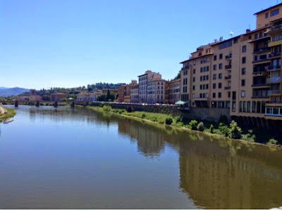
After my week in Lake Tekapo, I travelled back to Christchurch for a night. Then I boarded the Tranzalpine train, one of the most scenic rail journeys in the world, to cross the Southern Alps. I disembarked in Greymouth for a night, then spent a week apiece in Hokitika and Franz Josef. Working through the week as usual, with evenings and weekends for exploring and travelling. If you don’t have work to factor in like me, a 1-2 nights in Hokitika and 2-3 in Franz Josef would suffice!
Tranzalpine Train
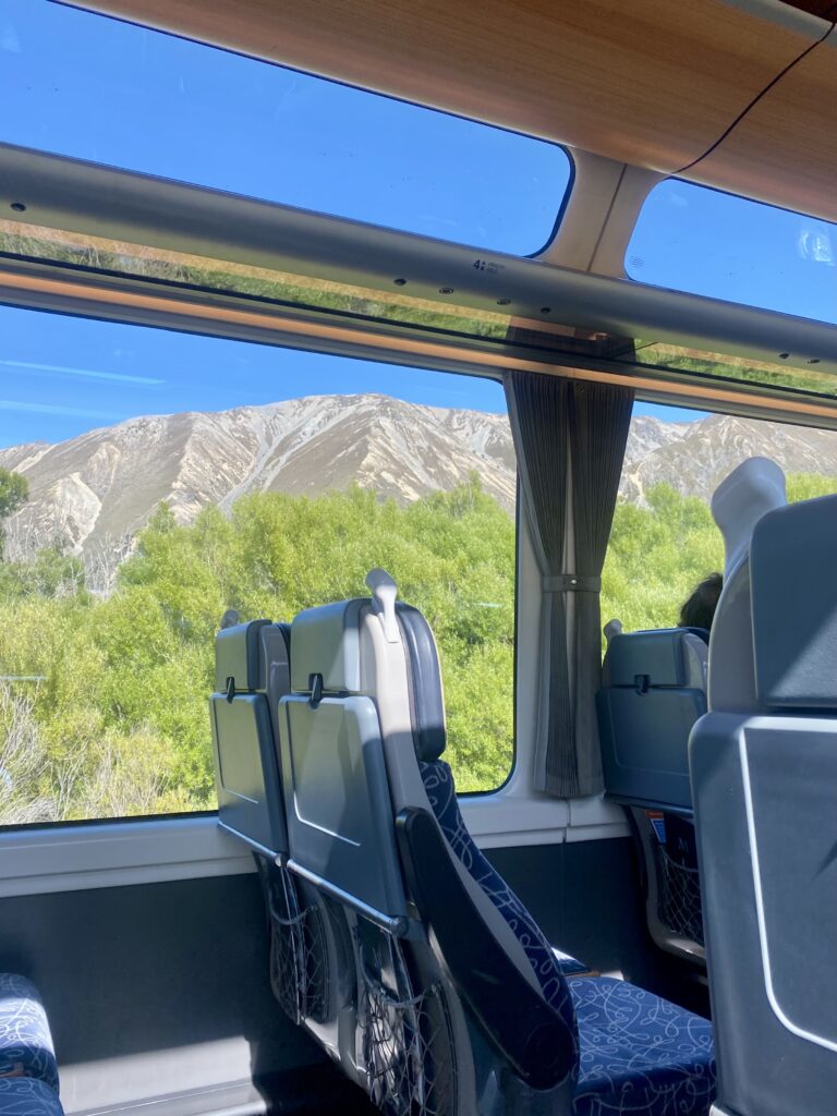
I’d heard great things about the Tranzalpine, but after my journey on the Coastal Pacific, I was even more excited. As I talked about in that post, the trains have huge windows to maximise the views. And there is an outdoor observation car, but personally, I think it offers a narrower field of vision. It also closes quite a few times on this route, due to the tunnels through the mountains.
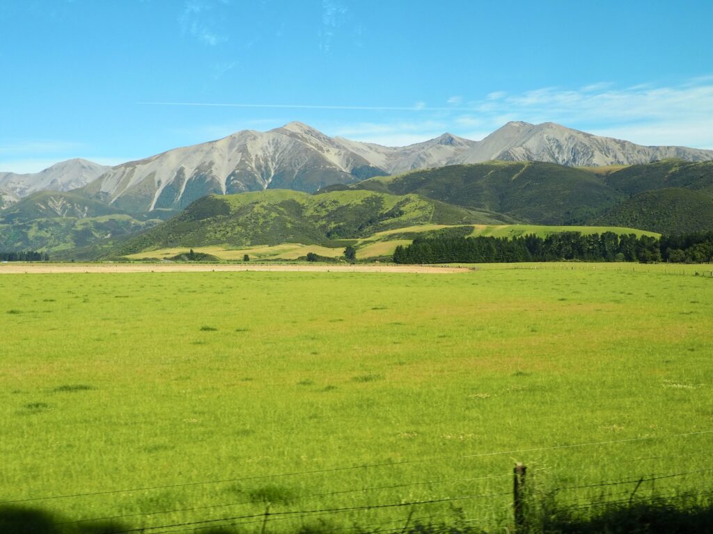
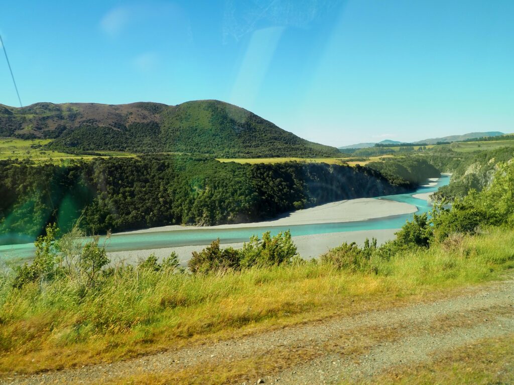
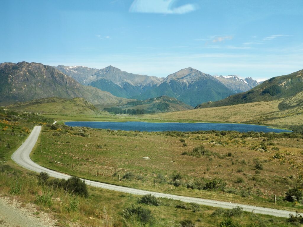
Departing Christchurch, we cruised across the flat Canterbury Plains. Mainly arable farmland, I was astounded by their gigantic irrigation systems! We also crossed a few braided rivers, with their ever-changing currents flowing over pebbled riverbeds and islands. The South Island is one of only a handful of regions in the world that has them. Then the journey began to ascend into the Southern Alps.
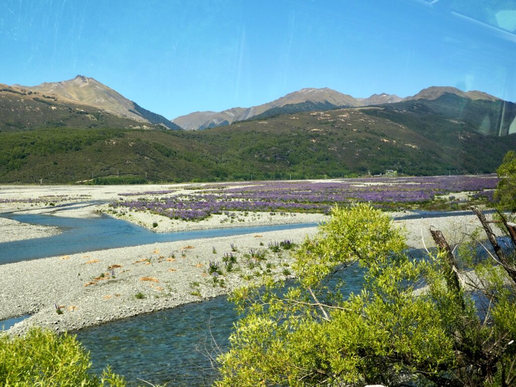
The track curves around the sides of mountains, overlooking sparkling blue rivers snaking through gorges, and through several tunnels. Being late spring, the landscape was scattered with colourful wildflowers too! The ‘High Country’ in the mountains opens onto wide plains, making it easy to forget how high the elevation actually is. Some of it is used for sheep farming, being too inaccessible for any other purpose. But of course, it’s lovely to see untouched, wild nature like this!
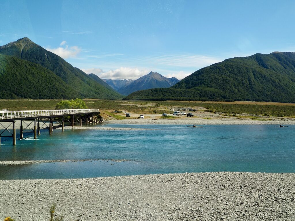
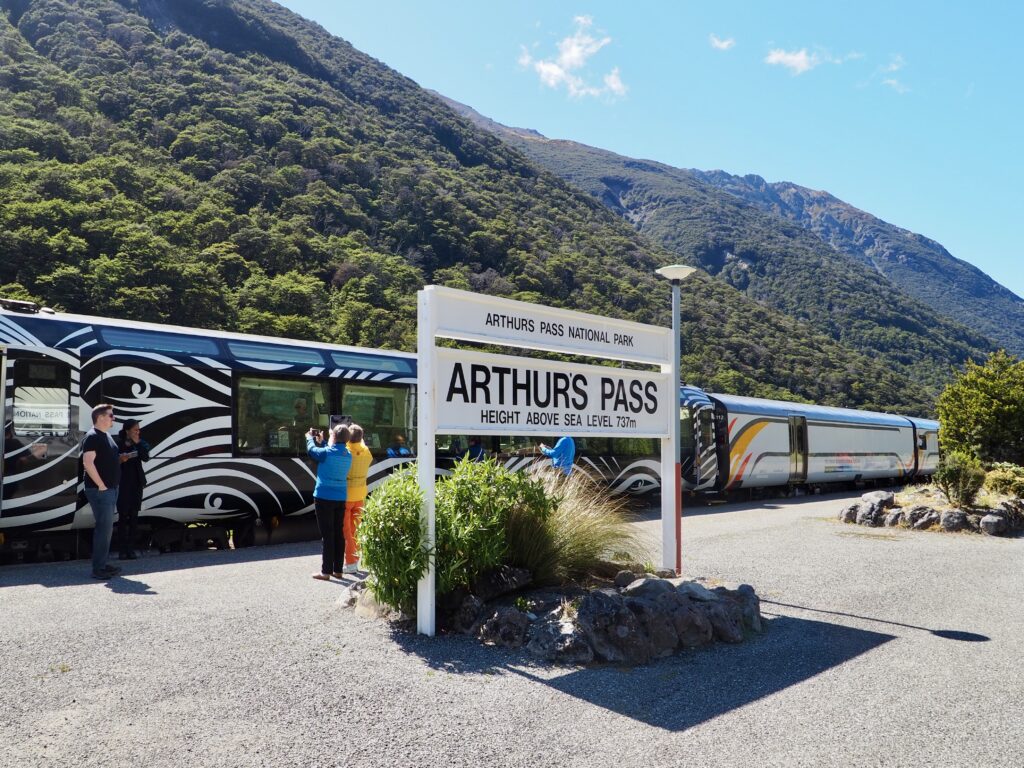
There are only three passes through the Southern Alps, and the train uses Arthur’s Pass. The town boasts the highest railway station in the country, at 737m above sea level. There was time to hop off for photos before we continued. Then we had to remain seated for the nearly 10-minute tunnel, which brought us out onto the West Coast. The weather here was immediately more overcast and wet! The best of the views were behind us now, as we descended into Greymouth.

Greymouth
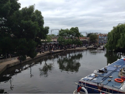
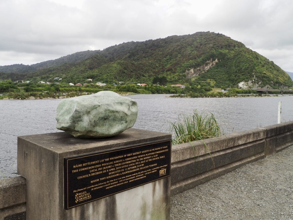
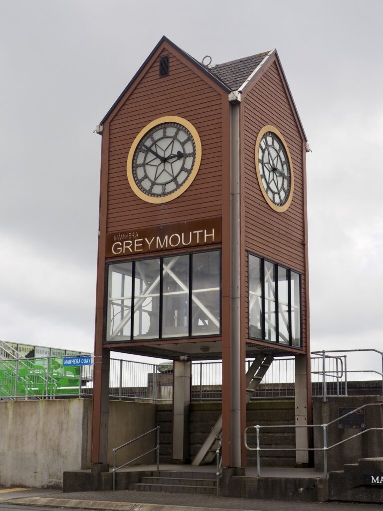
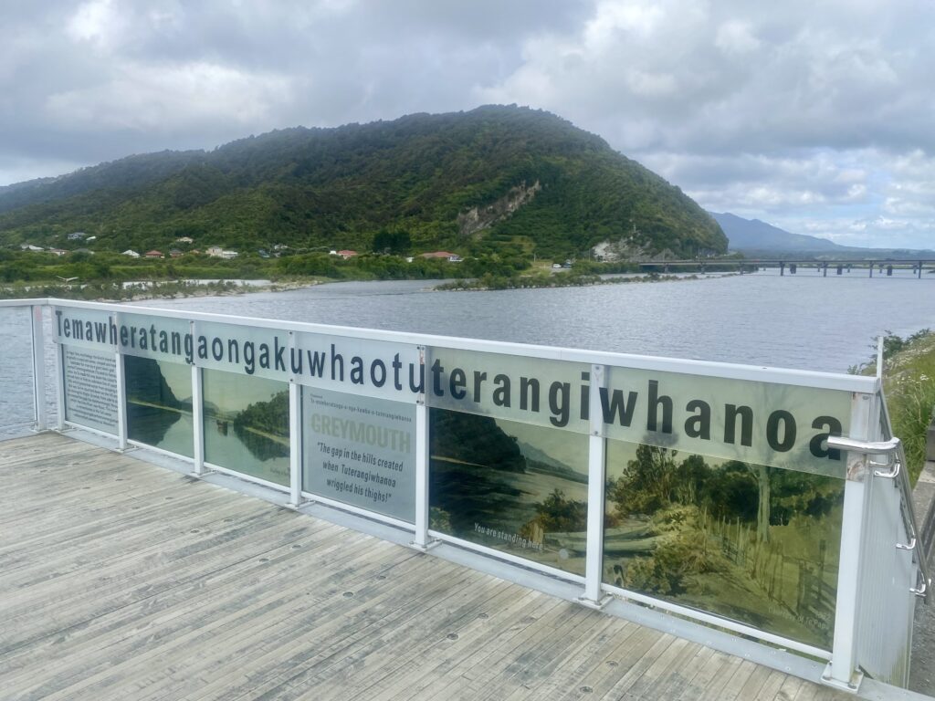
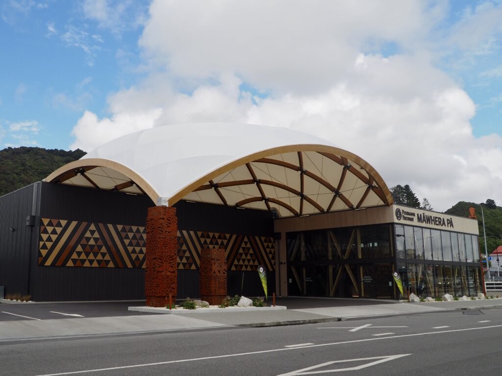
The town of Greymouth sits at the mouth of the Grey River – wonder where the name comes from? The Maōri name for it is epically long but is shortened to Māwhera usually. The full name translates as “the gap in the hills created when Tuterangiwhanoa wriggled his thighs”, from the legend of how the river’s path was formed. A far more exciting name in my opinion! The West Coast has the smallest population of New Zealand’s regions, so all of the towns here are pretty small. Greymouth is one of the largest, I assume due to its proximity to Arthur’s Pass. Other towns have a much longer drive to cross the mountains! I had opted to spend my first week in Hokitika, for its beachfront location, but spent a night in Greymouth first (due to a rather tight train to bus connection).
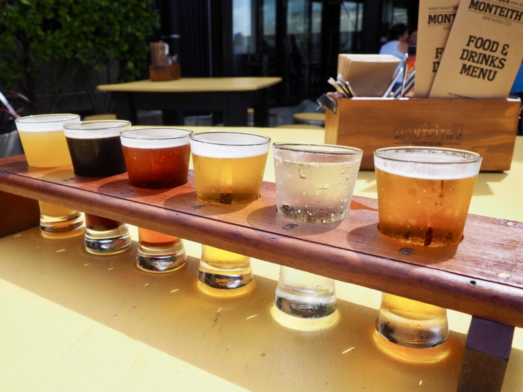
After dropping off my luggage, I took a wander around the town, browsing some of the shops and sheltering in a cafe from the rain. I strolled along the river’s edge, checking out the clock tower and the large piece of pounamu stone set beside it. Then I paid a visit to the Monteith’s Brewery. New Zealand has lots of craft breweries all throughout the country. I quite like trying to buy packs of beer at the supermarket local to wherever I am. But of course, when the brewery is in town, that’s even better! I skipped the tour (most breweries all function pretty similarly!) and instead grabbed a tasting paddle. It was sunny enough to enjoy this on their outdoor terrace, relaxing with a book in hand.
Pounamu Pathway
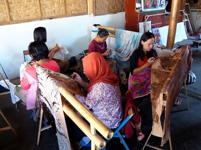
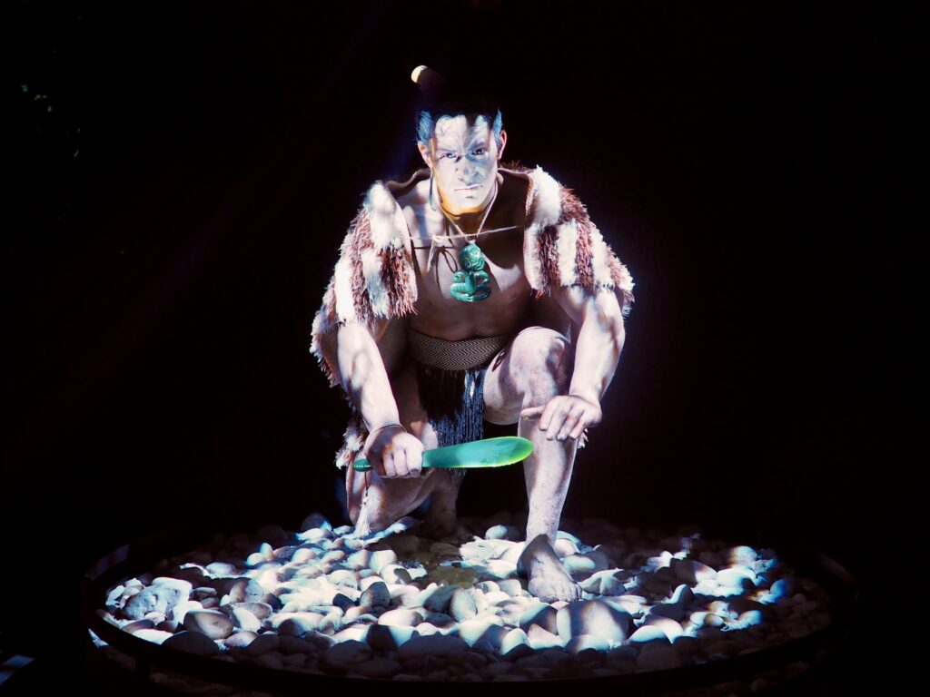
A large portion of Southwest New Zealand, including several national parks, is collectively a UNESCO World Heritage Site. Partly due to its stunning natural scenery! But also due to its cultural significance, as the only place in the world you can find pounamu or greenstone. This jade-like mineral is highly prized by the Maōri, who used it to craft tools and weapons. It’s now popular for jewellery as well and one of the highlights of the West Coast. The Maōri are also legally the only people allowed to collect it. You’ll find many greenstone shops all the way down the West Coast.
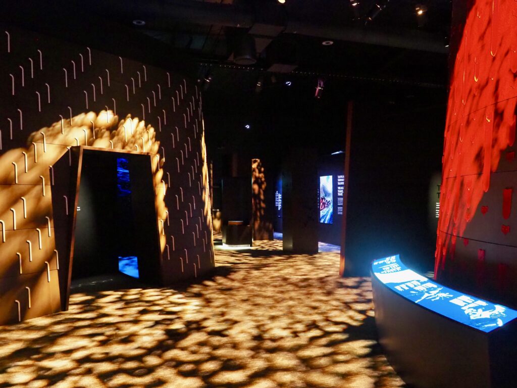
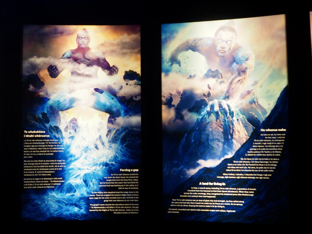
The Pounamu Pathway is a new project, a series of four immersive museums in four different towns down the West Coast. At the time of writing, only two are complete (Greymouth and Westport which I wasn’t passing through), with two more still to come in Hokitika and Franz Josef. Created by the local iwi (Maōri tribe), they have been designed in connection with Wētā Workshop, which I visited back in Wellington. The centre takes you through incredible displays, teaching you about the Maōri history and legends of the West Coast and the significance and uses of the pounamu. It was really interesting and beautifully crafted. An excellent choice for a rainy day (very common in this region!) and definitely a highlight of the West Coast.

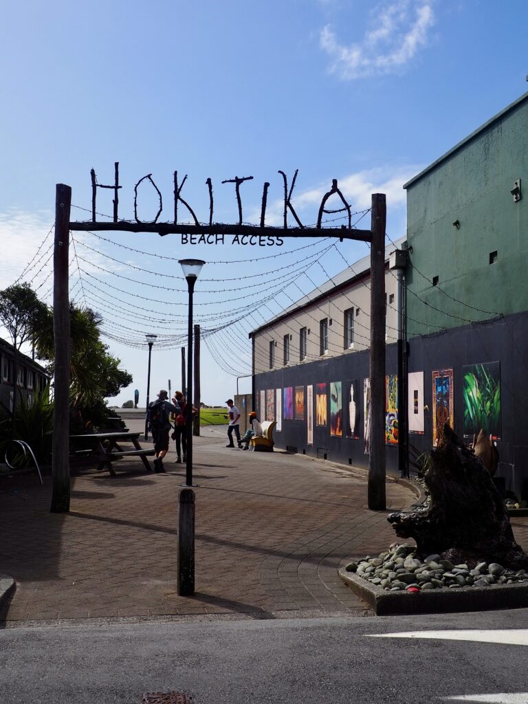
Hokitika
About an hour south by bus, I arrived in Hokitika for the rest of the week. With hindsight, maybe I could have split the week more evenly between Greymouth and Hokitika. The latter is very small and lacks the amount of sightseeing options other towns have. I’d chosen it for the beach, but that’s weather-contingent. I even had a few days where I didn’t go out after work at all – the heaviest, most relentless rain I’ve seen in New Zealand! The upshot was that I had a private room instead of a shared dorm. And with months of travelling this year, it’s good to have some relaxation time.
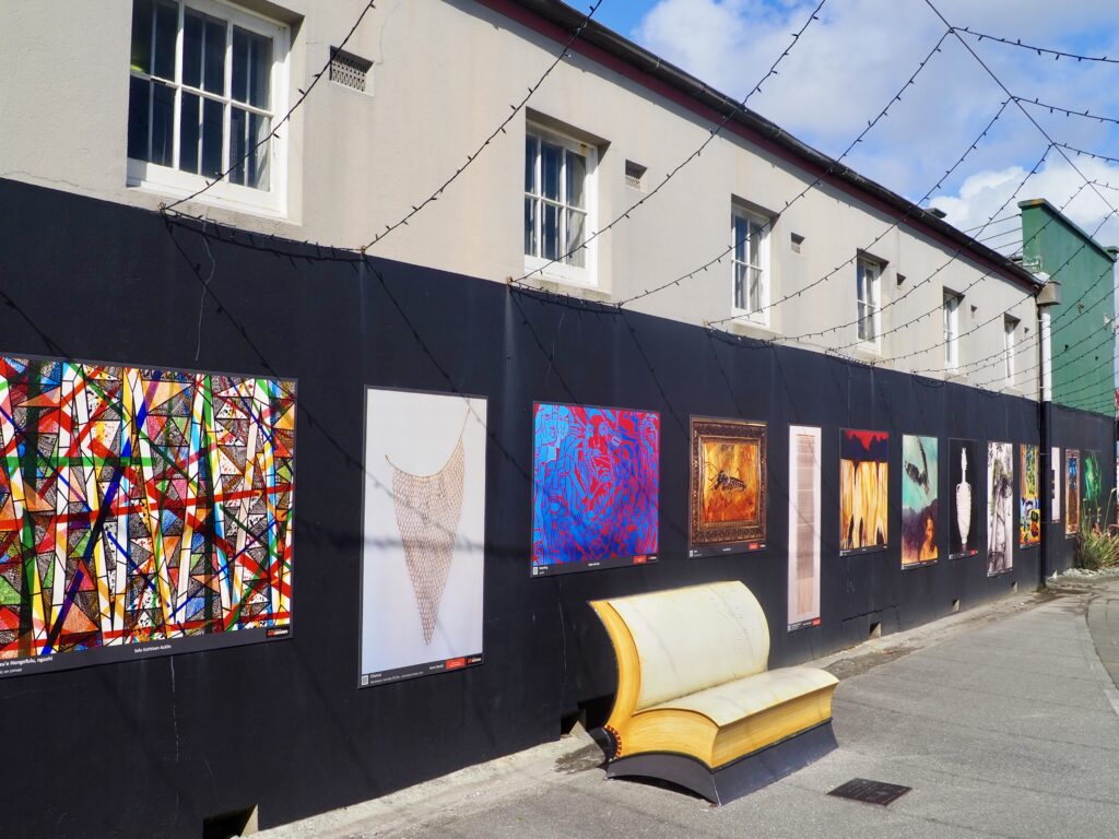
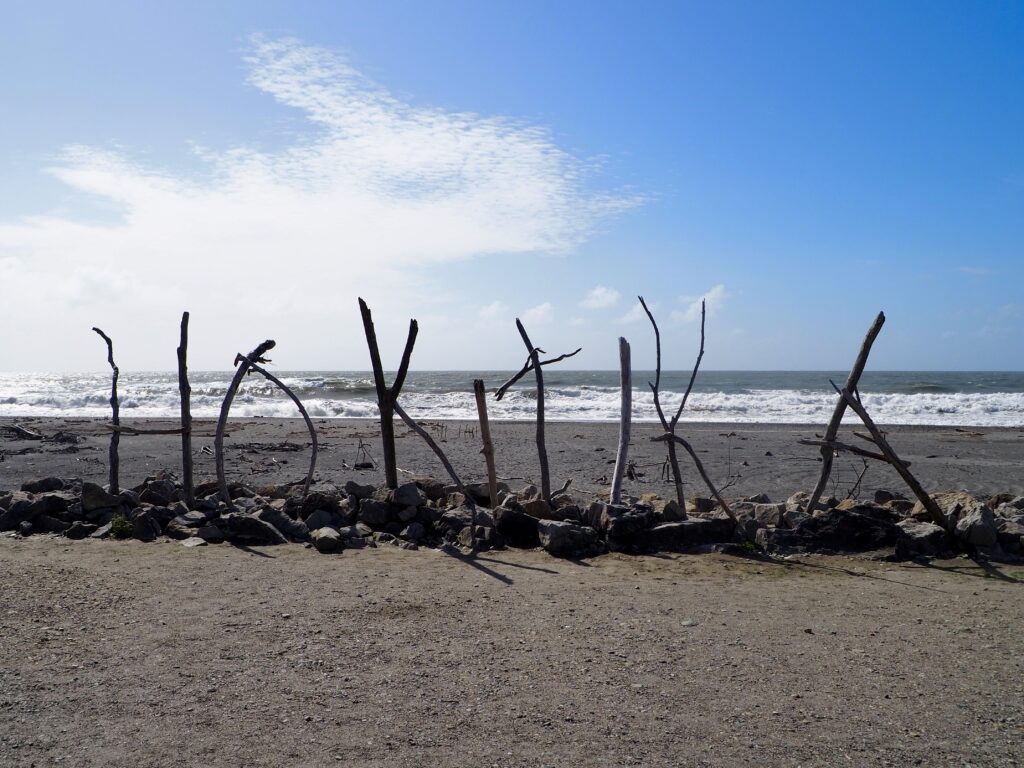
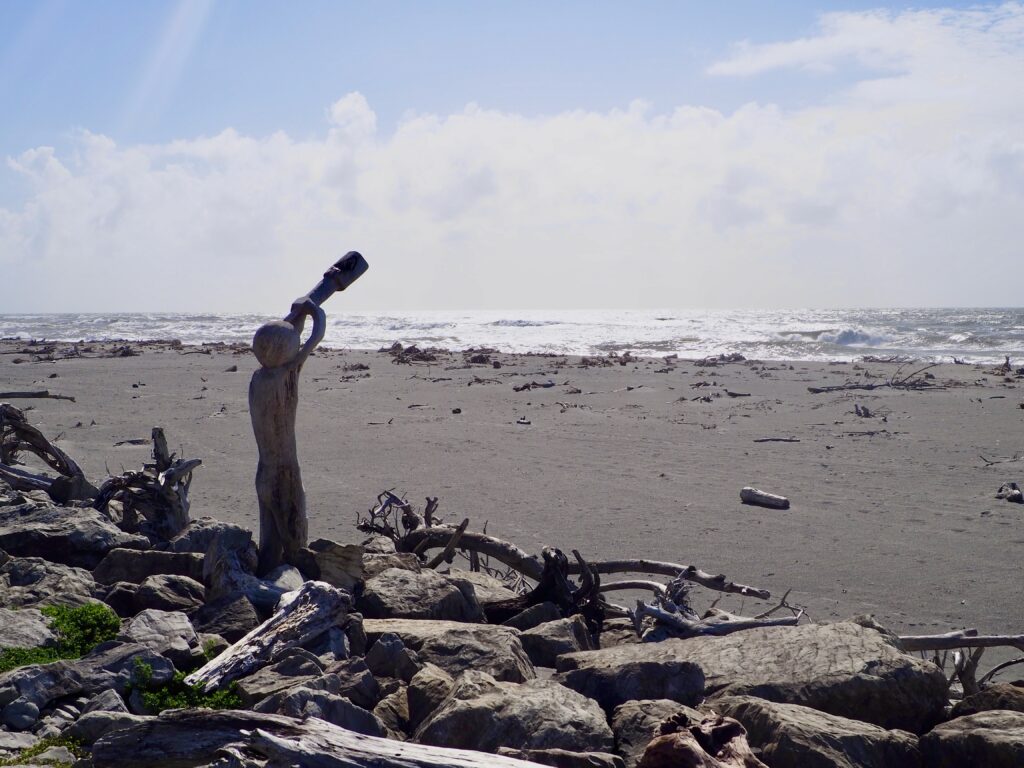
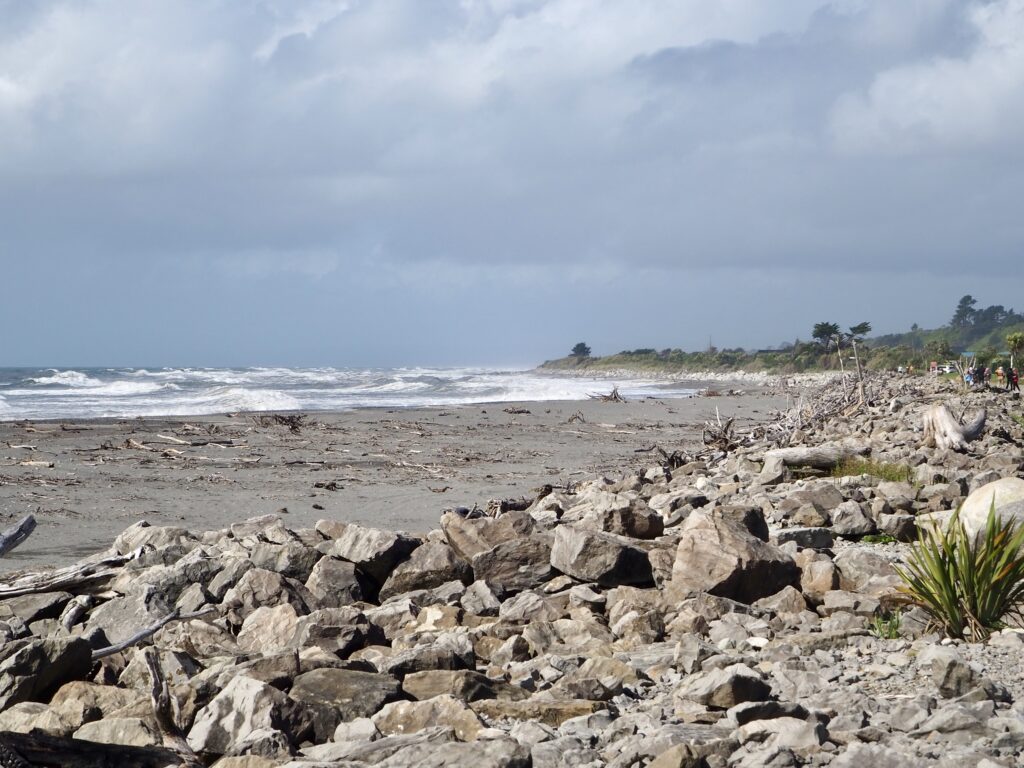
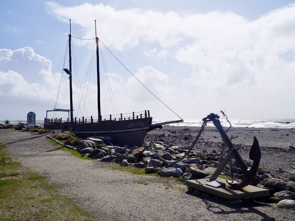
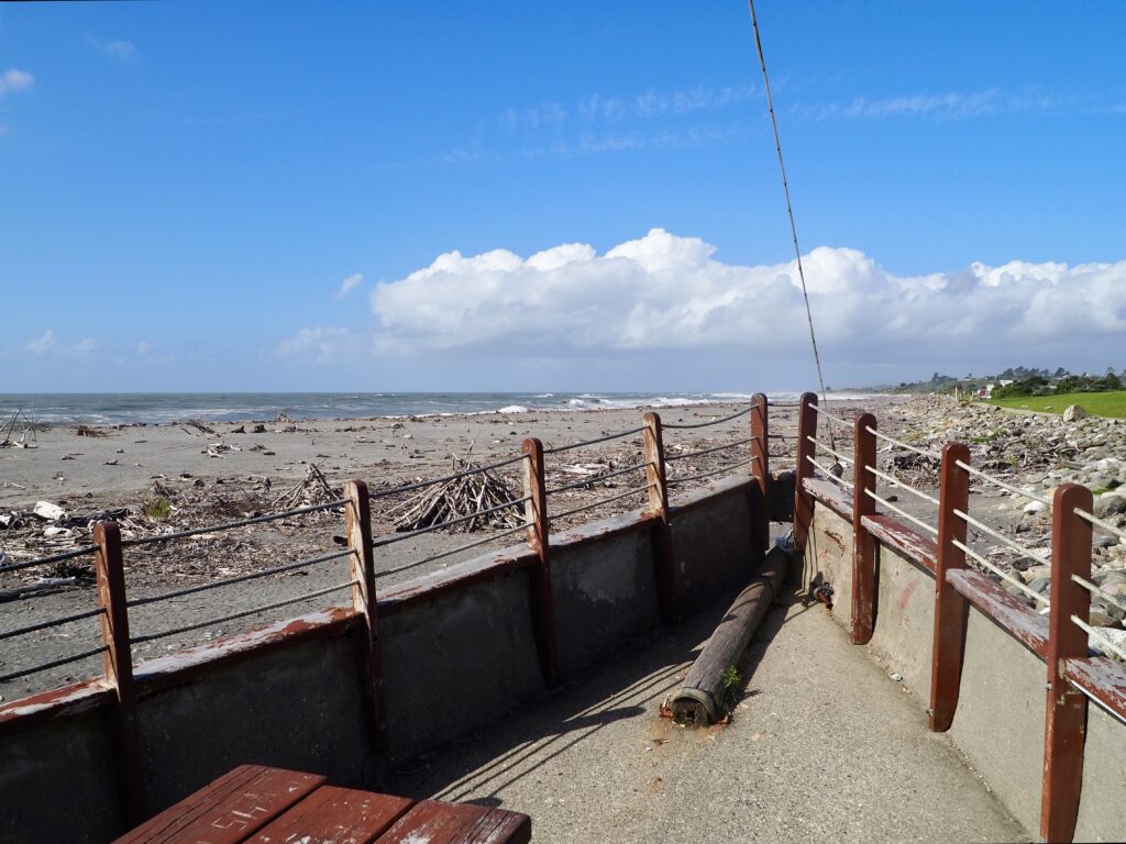
The town has plenty of pounamu shops, as well as art and other souvenirs, so I spent an afternoon browsing. And when it’s dry, the beach is lovely for a stroll. The waves are perhaps a bit strong for a swim! It felt so remote and isolated, as so much of the sparsely populated West Coast does. I think it’s perhaps being next to the wild waves of the Tasman Sea that really enhances this feeling. A lot of driftwood washes ashore and gets used for artwork, including the famous Hokitika sign. There’s also an old shipwreck at the end of the beach, kept as a monument to the many wrecks and lives lost.
The other big highlight of the West Coast in this area is Hokitika Gorge. If you’re driving yourself, then this is a must-do. Especially if you get sunshine, to see the dazzling green water at its brightest flowing through the gorge surrounded by lush rainforest. Unfortunately, I had tried to sign up for the one tour offered from town, but there were no other bookings so it cancelled. The weather wasn’t really on my side anyways!
The National Kiwi Centre
On my final day in Hokitika, I had quite a bit of time to kill between check-out and my onward bus journey. After a walk across the bridge that spans the Hokitika River, the mountains shrouded in mist, I sheltered in a cafe when the rain poured down yet again. Then I ducked across to the National Kiwi Centre, for an indoor activity!
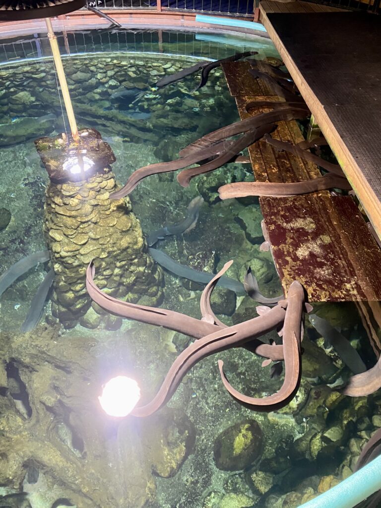
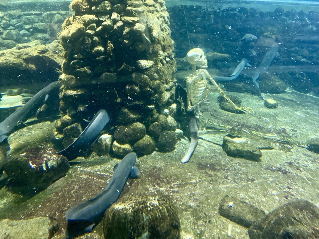
As the name suggests, you’re able to see kiwis here, New Zealand’s most famous flightless, nocturnal little bird. I’d been lucky enough to see one in the Zealandia sanctuary in Wellington, where they roam free outdoors. Here, they’re kept in an enclosure that’s dark by day, so visitors can see them awake and active. Then the lights are turned on at night for them to sleep, being nocturnal as they are. Besides kiwis, there are various other animals kept here as well, mainly at-risk species kept here for conservation. Lots of tanks of fish, along with turtles, crayfish, and other sea creatures. And a tuatara, the lizard-looking endemic species that is the last of a largely-extinct order of reptiles.
Perhaps the biggest highlight, aside from the kiwis, is the huge tank of endemic Longfin eels. I happened to arrive just before feeding time, which you can watch and participate in from the viewing platform around the top of the tank. These eels undertake a massive journey in their lifetimes, born way off in the Tongan Trench, they instinctively swim to New Zealand’s freshwater rivers where they spend most of their lives. Then they return to the trench to breed and after spawning their young, they die there. The tank here contains all females which were rescued (I can’t remember the full story from where now) and are aged 80-110 years old!

Franz Josef
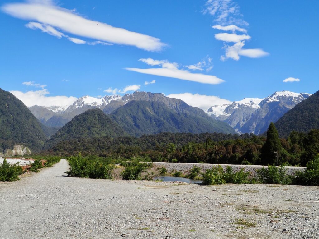
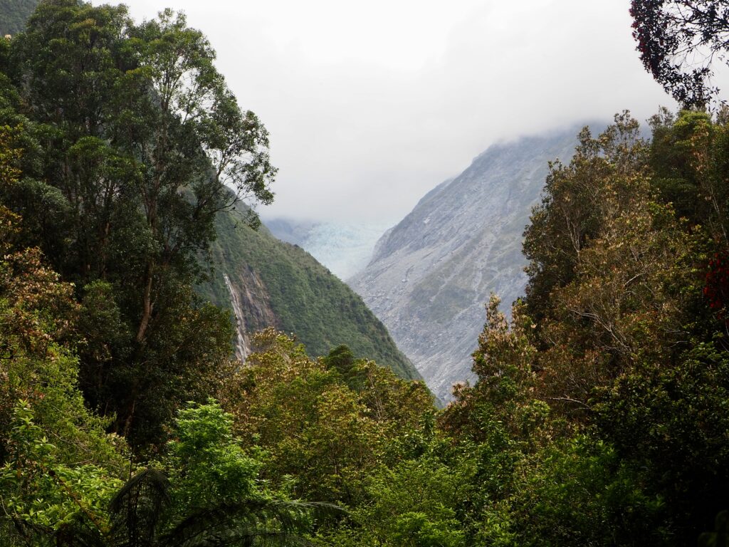
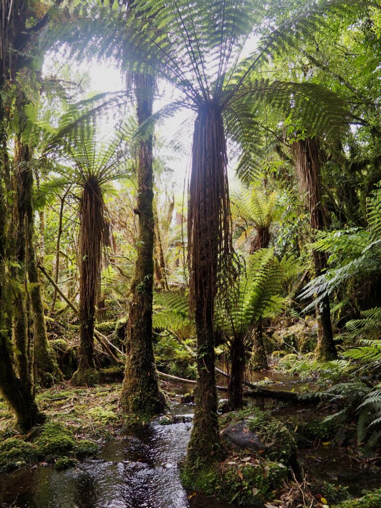
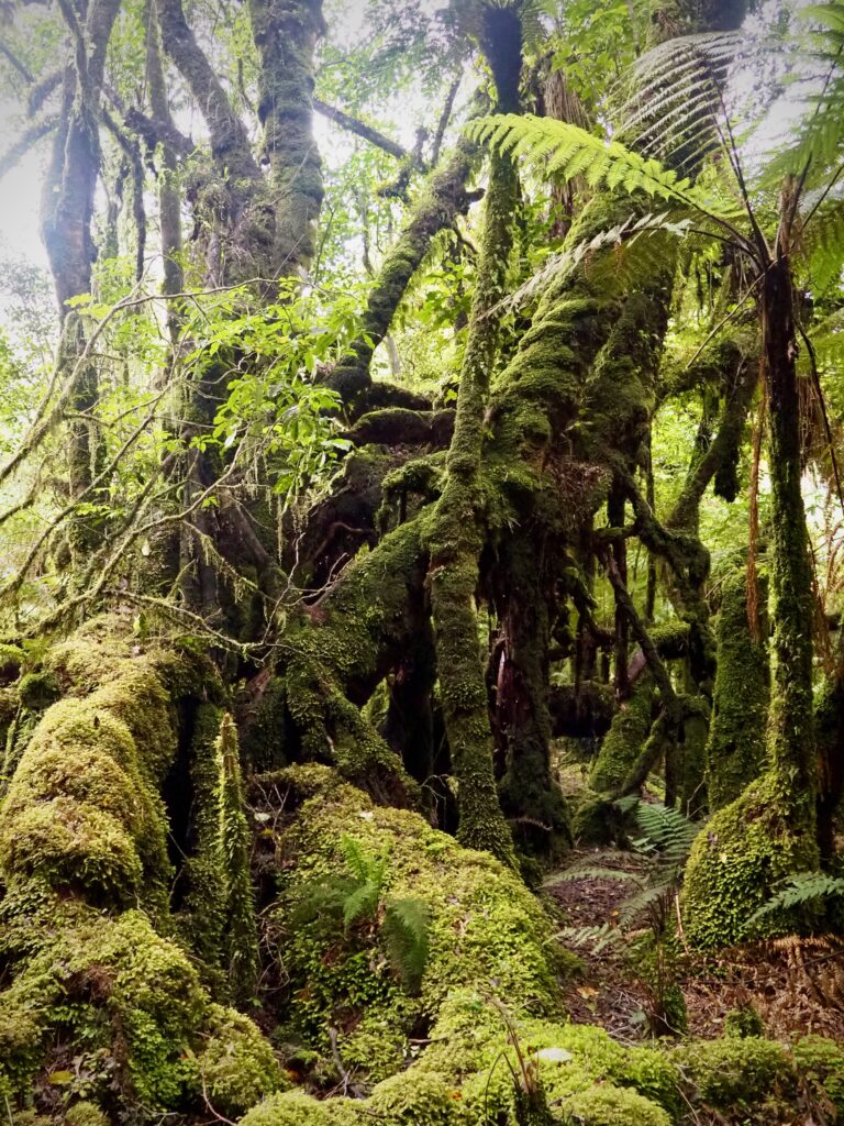
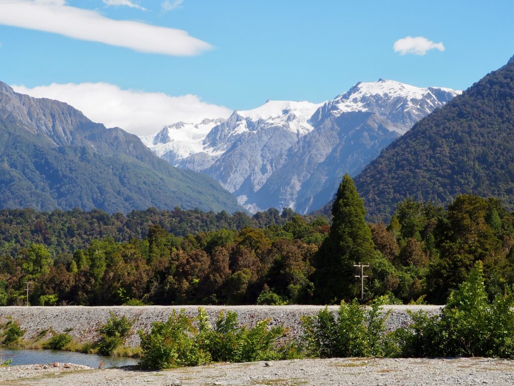
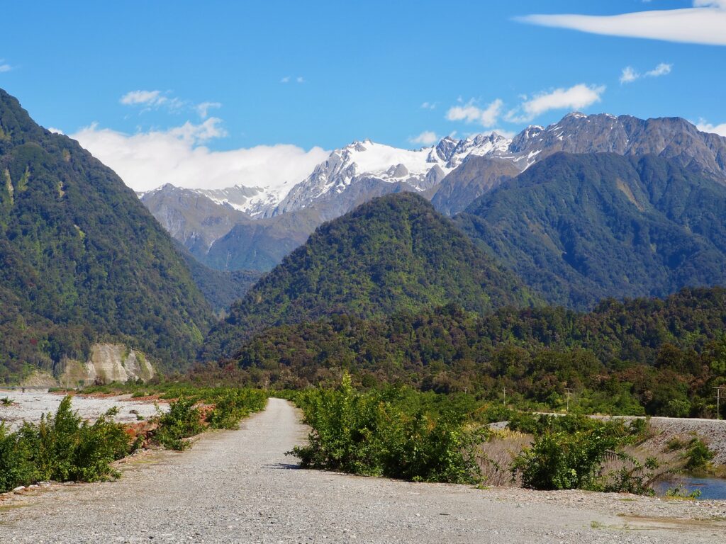
After Hokitika, I continued south to one of the biggest highlights of the West Coast, Franz Josef, where I spent another week. This is glacier country, where vast ice sheets have carved their way down the slopes of the Southern Alps. Fortunately, save for a couple of rainstorms, I had better weather overall this week, so I could actually see the mountains! Being the wettest part of New Zealand, much of the West Coast is covered in dense rainforest, coating the western slopes. Quite different to the other side of the mountains that I’d seen in Lake Tekapo! While snow caps the mountain peaks even now in the summer months.
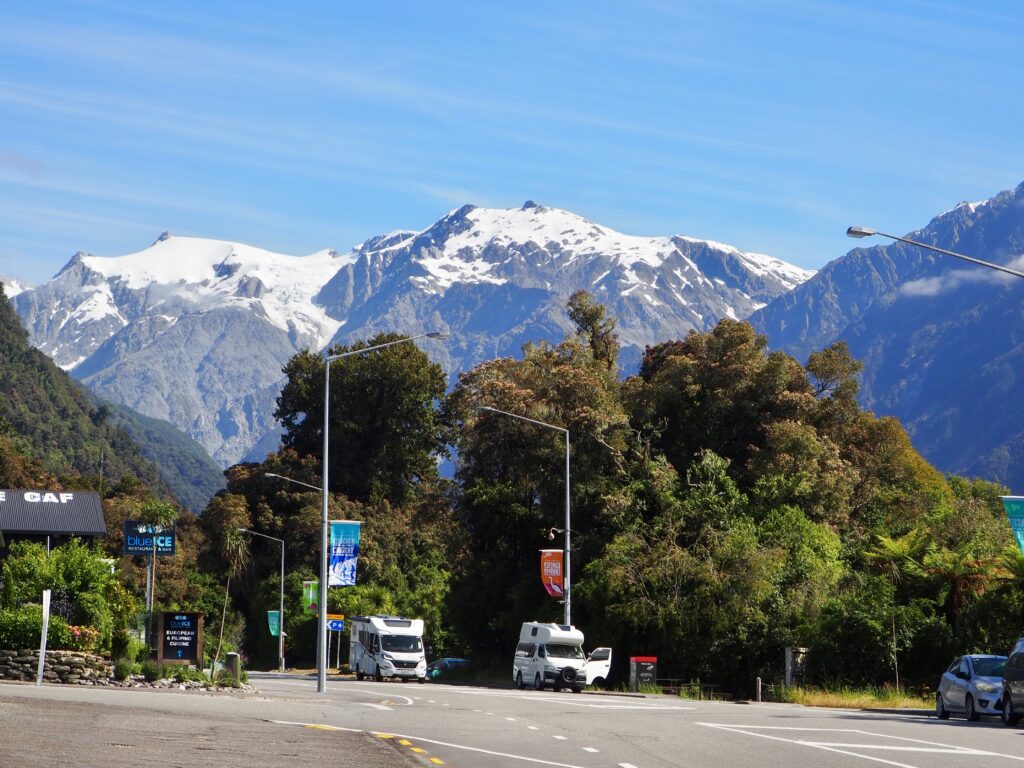
The township of Franz Josef caters mainly to tourists, with plenty of accommodation, a couple of gift shops and countless tour operators down the main street. A lot of them offer heli-hiking tours, where you travel by helicopter into the mountains, before landing on the glacier itself to walk across it. You can hear the hum of the helicopters constantly in the area! And drones are banned because of them. I don’t have any huge desire to walk on a glacier and could have done so in Jasper, Canada last year if I did. Plus I’m scared of heights and helicopters, and they’re very expensive tours! I was mainly going to be hiking this week instead. There’s also the West Coast Wildlife Centre in town, but I didn’t feel the need to go after visiting the Hokitika one already.
Franz Josef Glacier
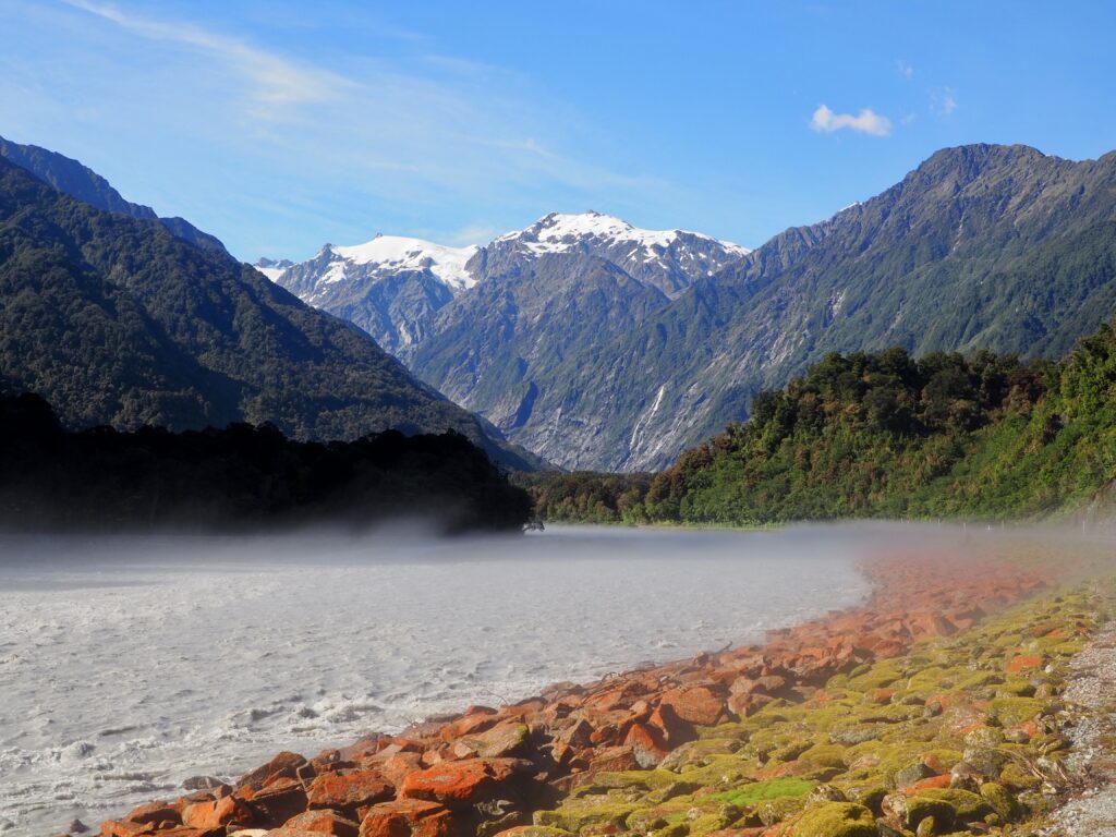
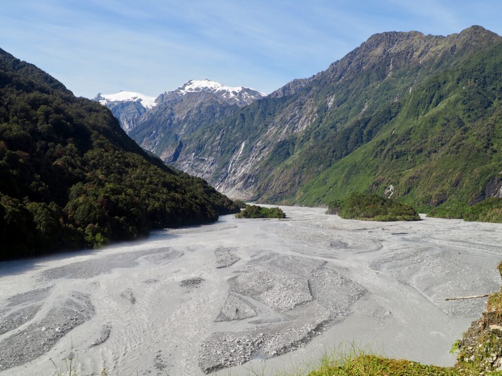
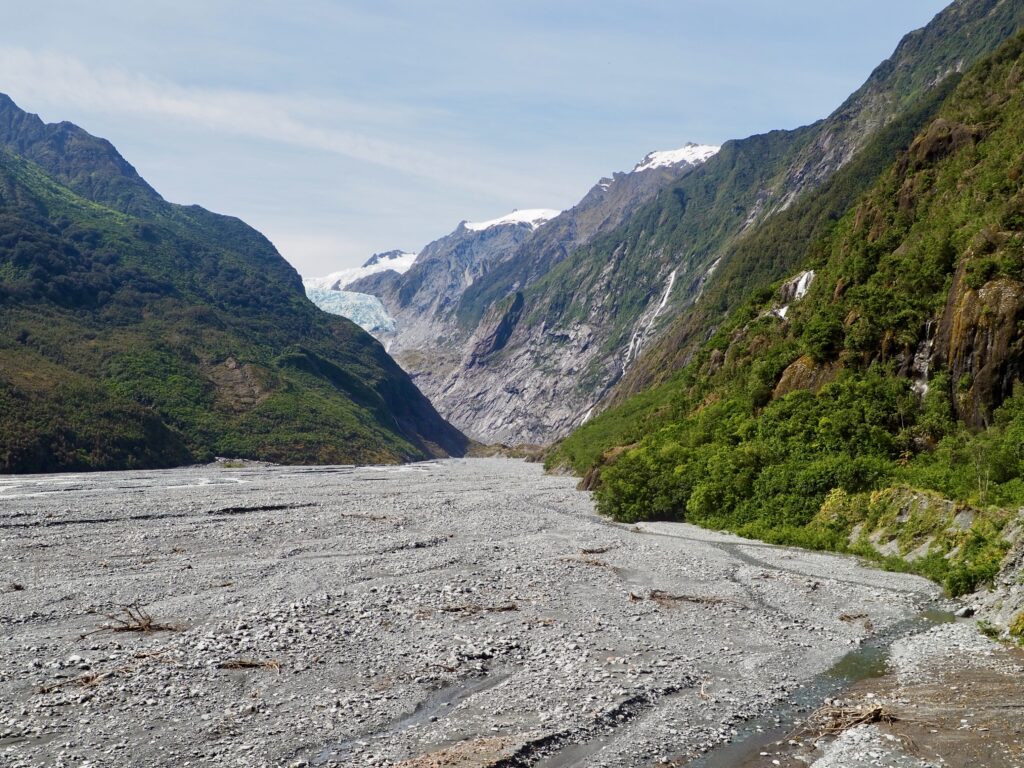
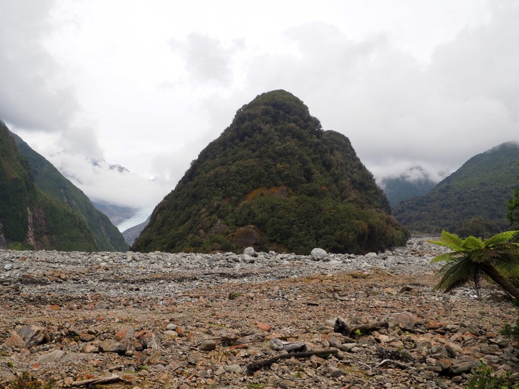
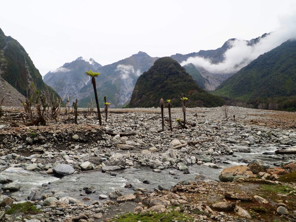
On my first and only full weekend day in town, I set off to see the Franz Josef Glacier. A lot of people drive to the glacier car park and just walk the short trail to the viewpoint. Or, you can do a big full-day hike to get even closer, not that I had enough time for that. I chose a half-day hike, setting off from town on foot and following the Waiho River. I was lucky enough to see its natural phenomenon, a layer of steam hovering above the water. This is caused by cold glacial water meeting warmer air. And could be the reason for the river’s name, which loosely translates to “smokey water”.
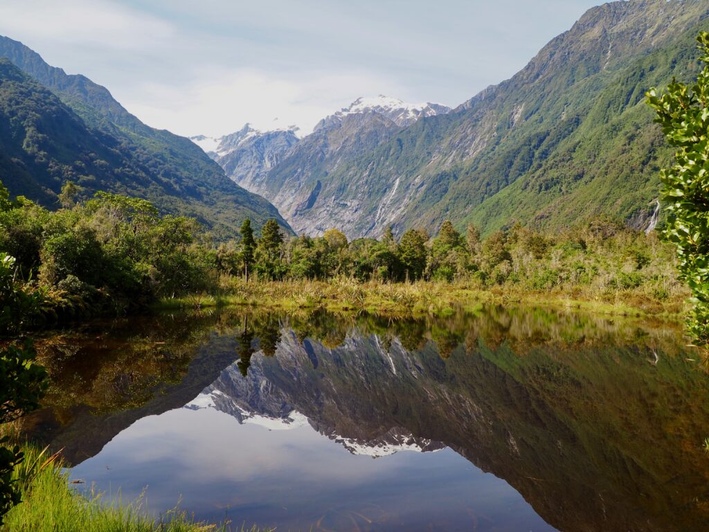
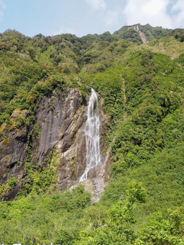
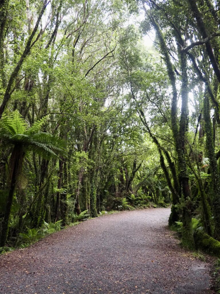
The walking trail then moves away from the road’s edge and into the forest. It also branches off into a few different trails, of which I was taking the Douglas Walk. Under the shade of the trees, it curves gently away from the road and uphill. The highlight is Peter’s Pool, a small reflective tarn, perfectly situated to reflect the mountain views beyond it. There are also several waterfalls in the area, tumbling down through the trees on the sheer mountain faces.
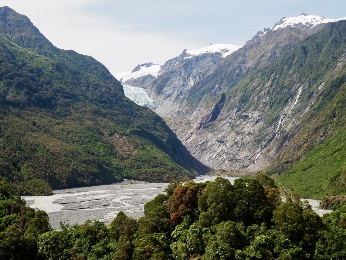
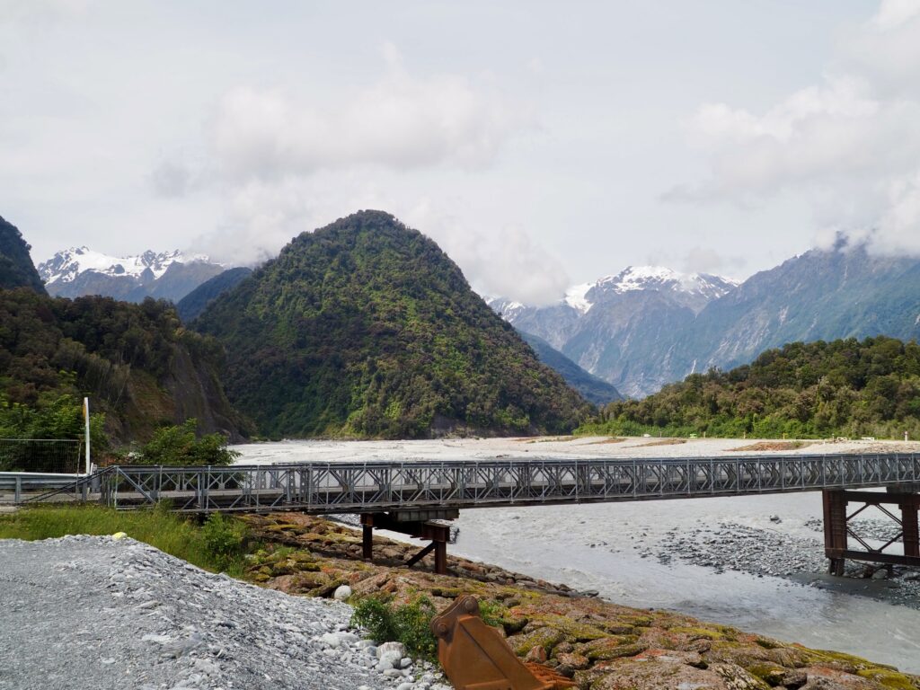
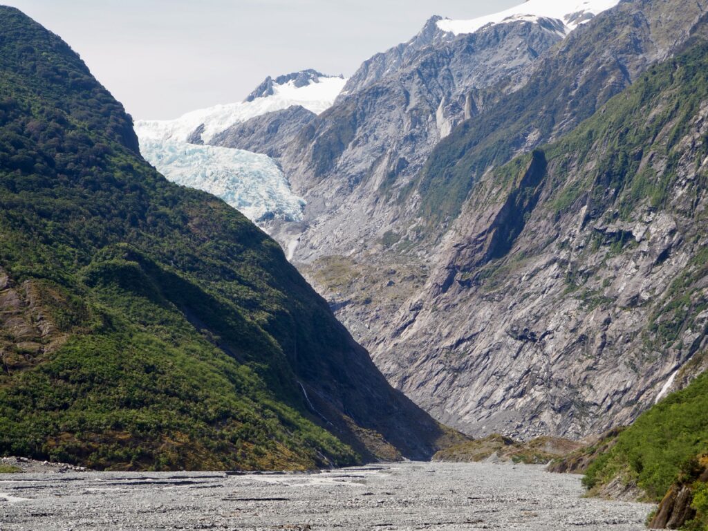
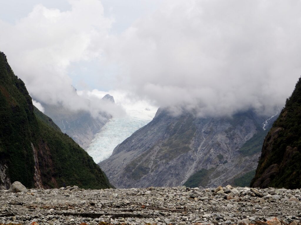
The trail then took me to the main car park, where I headed up the Sentinel Rock Walk. A short but steep trail, this leads to an excellent viewpoint overlooking the Waiho River and my first proper look at the Franz Josef Glacier. While it’s still an impressive slab of ice inching its way down the mountain, the information board showed photos from the last century. It’s alarming how much it has receded! There is then another flat trail leading to the main viewpoint, lower to the river’s edge, which is as close as I could get.
Fox Glacier
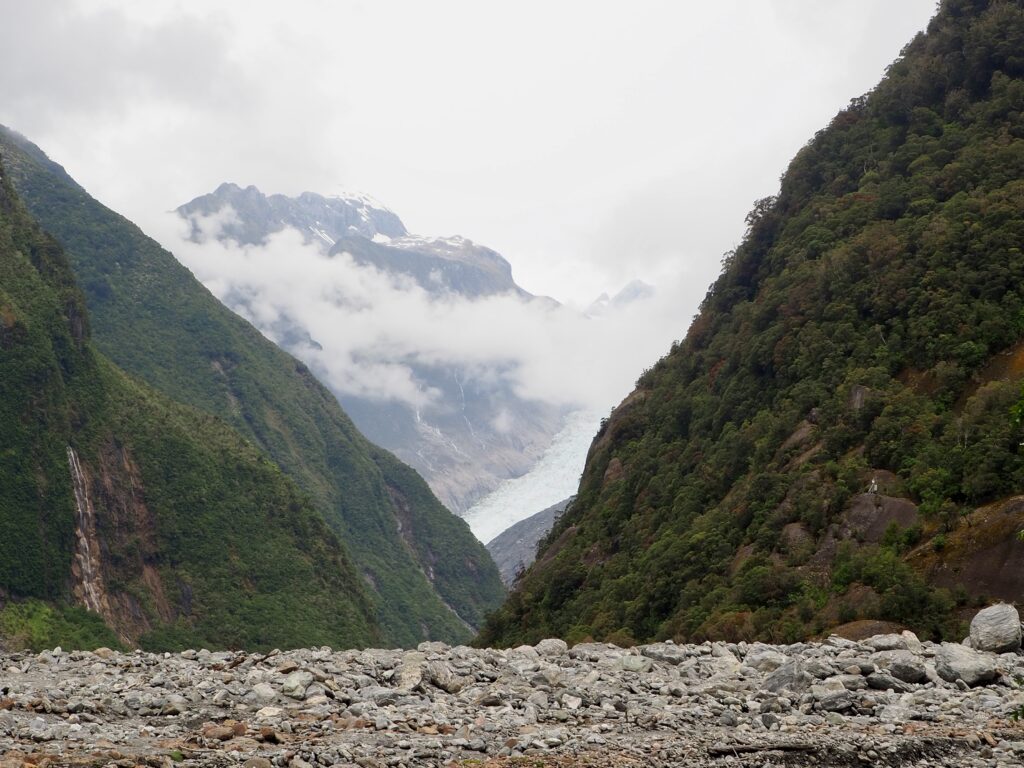
That same afternoon, I joined a small group hike with Glacier Valley Eco Tours to visit the other major glacier. The Fox Glacier and its township are about half an hour south, so the tour was a good way to get transport. Much of the trail was in the forest, following a wide path with a gentle ascent. It was great to have the guide for this, as he taught us lots about rainforest plants along the way. Our first viewpoint of the actual glacier was a window-like gap in the canopy. However, the clouds were low so we couldn’t see very much yet.
Our guide led us downhill to the dry riverbed for the best view. We went a bit off-piste here, leaving the path to walk into the channel itself, carefully walking over the stones. There was a landslide a few years ago, hence why there’s such a wide channel. The clouds lifted enough to see some more of Fox Glacier. Like its sister at Franz Josef, it has massively receded over the years. And from this distance, as it peeks through a mountainous valley, it’s harder to gauge its true size.
We continued down the riverbed, noting the plant life starting to emerge. Then we veered back into the forest, taking an adventurous route across a stream and through the dense undergrowth. It was certainly not a route I would have found on my own! Eventually we rejoined the main path to retrace our steps. But not before one final detour through a patch of forest that tells the botanical history of how the rainforest grows and develops over time. Overall, while I picked the tour to see Fox Glacier, I felt I got a much deeper understanding of the West Coast rainforest as well.
Callery Gorge
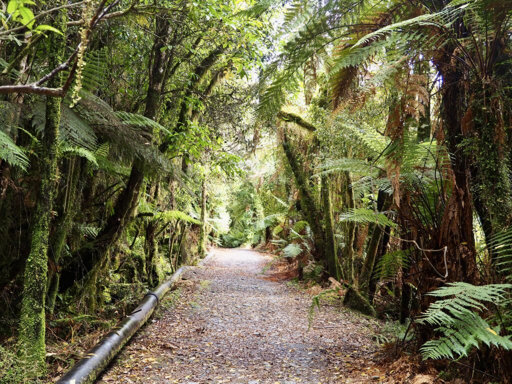
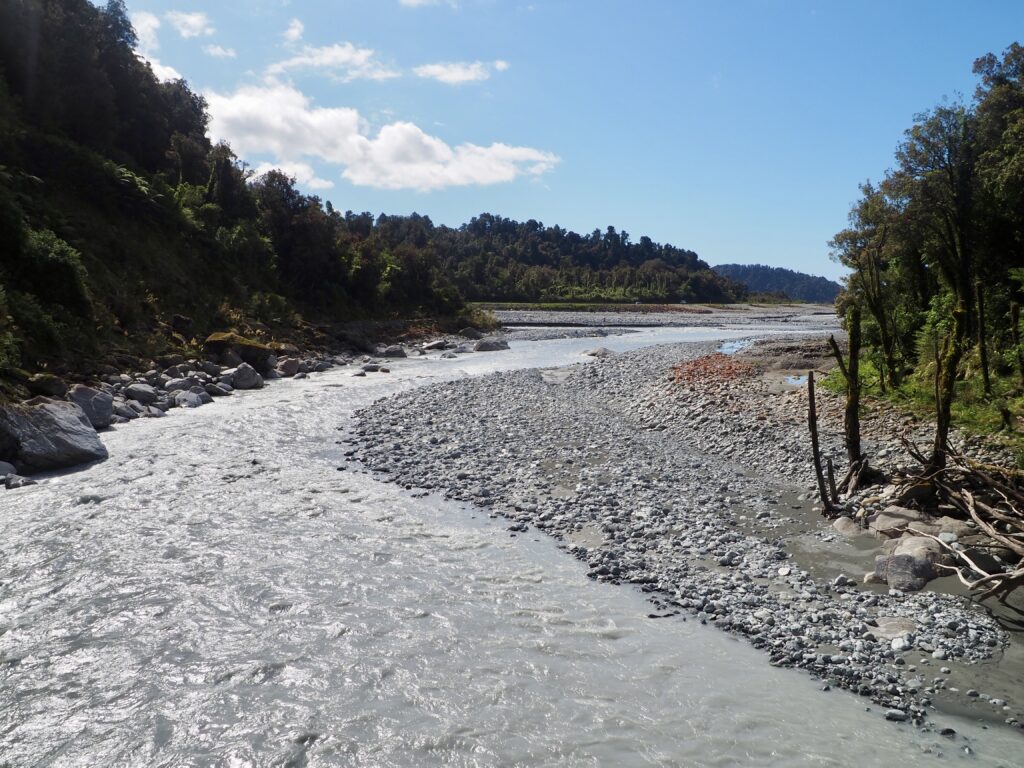
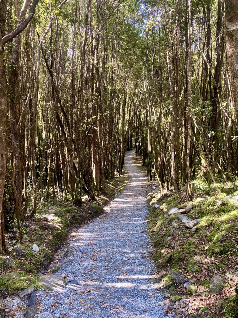
Throughout my working week, I explored a few smaller trails around the Franz Josef township in the evenings. The Callery Gorge trail is a pretty gentle forest walk, along a wide, fairly flat path. It leads you along the back of the town, but slightly higher in elevation, heading south towards the Waiho River again. I crossed a couple of small streams, and had to watch my feet on wet rocks sometimes, but overall it was a relatively easy walk.
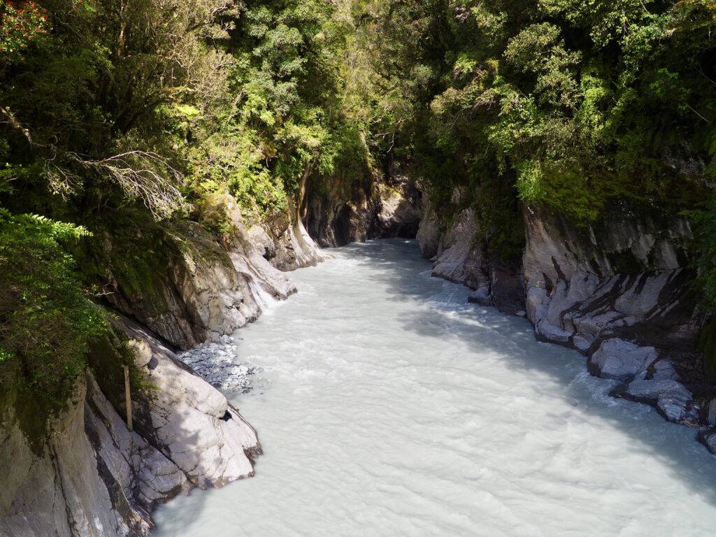
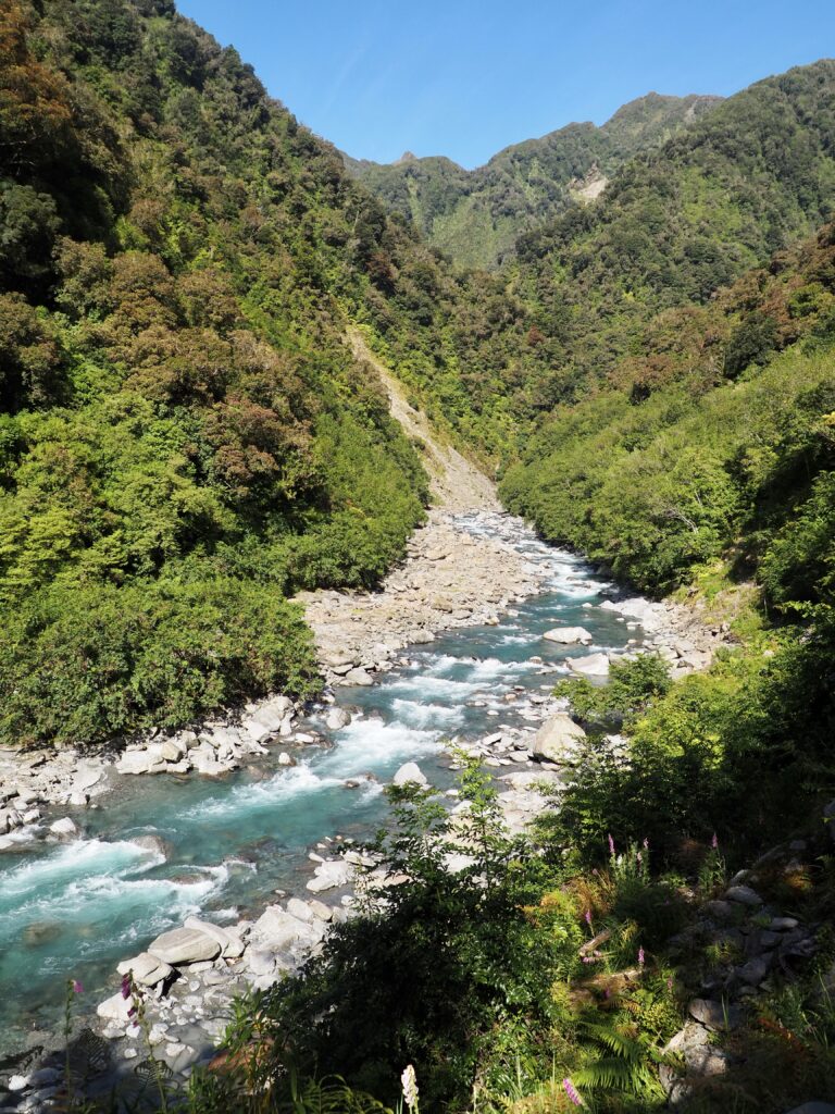
It culminates at the Callery Gorge, through which a tributary river flows down to join the Waiho. The end of the trail is actually the suspension bridge that crosses the gorge, with a dead end on the far side. Standing on the bridge, the water rushes beneath your feet, a murky blue colour from the rock flour swirling through its turbulent currents. The gorge is has steep white walls, which then give way to the rainforest all around, making it somewhat of hidden surprise! The trail is the only way to see or access it.
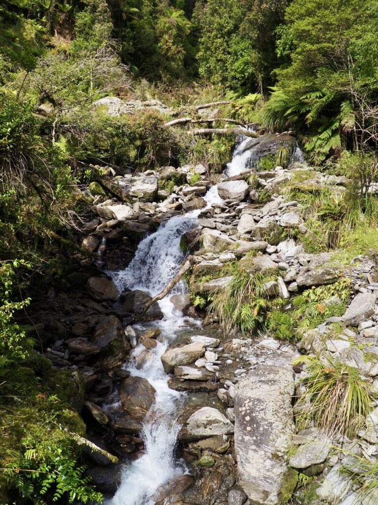
There is also a fork near the start of the Callery Gorge trail, heading the other direction, which takes you to the Tatare Tunnels. I ventured partway along it one day, another fairly flat and wide trail through the forest. I went as far as this pretty blue river tumbling down the mountain slopes. The trail looked a bit narrow and slippery from an earlier rainstorm after that, so I was unsure about tackling it solo. I was also a bit tired and not that fussed on tunnels!
Terrace Walk
Another popular choice for a short hike is the Terrace Walk. It starts near the southern end of town, next to the church and before crossing the bridge over the Waiho. Again, this is a forest walk. While the glaciers may be the main highlight, the lush, native rainforest is definitely a big part of the West Coast! This was probably the shortest walk of all of them, and doesn’t lead to a significant viewpoint or such. The end of is a little waterfall stream running through the trees. It’s really a walk for enjoying the journey and the ambience of the forest, rather than the destination.
I also looked at the Canavans Knob walk, which takes you down the far bank of the river, heading downstream, then up a small hill. I ended up missing a very slight fork and came to a dead end beside the river, with a tributary blocking me from the hill. It was quite a long way back to correct myself, so I didn’t bother with the whole thing. And I’d read it’s not the best of the trails on offer in the area, so hopefully I wasn’t missing much. I got a pretty decent view of the mountains from downstream anyway!
Highlights of the West Coast
Despite its small population and small towns, the West Coast is an area of New Zealand well worth exploring. Much of the South Island feels quite remote, but this narrow spit of land sandwiched between mountains and ocean felt the most wild and rugged of all. Ancient glaciers, lush rainforest, windswept beaches and brilliant blue rivers make up a breathtaking landscape. Just be sure to come prepared for wet weather! I also felt like I learned a good amount about the culture too, from uses of the rainforest plants to the significance of pounamu. As I mentioned at the start, I probably spent longer in the region that I needed to, but a few days of rest wasn’t a bad thing. And maybe it’s good to factor in extra days in case of bad weather – that rain really was no joke sometimes!
The next leg of my journey would take me south again, journeying by bus down the remainder of the West Coast to the Haast pass. This is the southernmost of the three passes across the Southern Alps. I managed to get a glimpse of Aoraki/Mt Cook along the way, too. This was a good perk, since I wouldn’t be travelling any closer to it than here. Crossing back to the eastern side of the mountains, I arrived into the stunning Southern Lakes region and my first destination here, Wānaka.